Page contents
About
Gallery
Parking
Poo bins?
Self-guided walk
About
Happy Valley near Coulsdon makes up part of the Farthing Downs. It was purchased under the Green Belt Scheme in 1937 by Surrey County Council, the Urban District Council of Coulsdon and the London County Council.
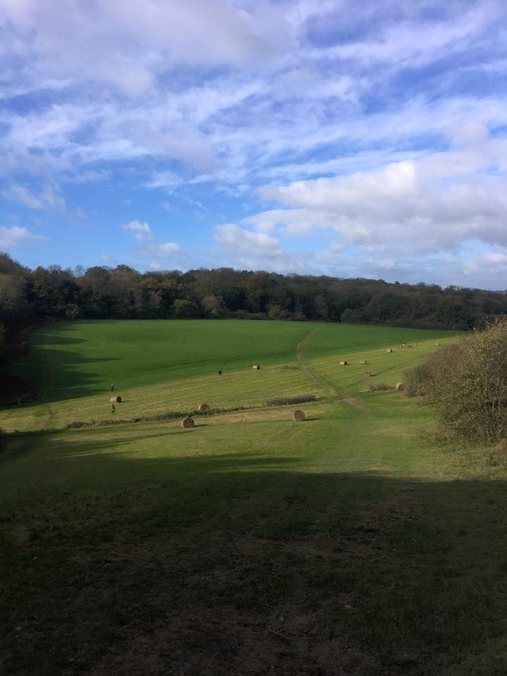
It is an area of managed open countryside of just over 250 acres of downland grass and ancient woodland slopes (Devil’s Den Wood), dominated by a steep‐sided dry valley at the centre and considered an important reserve for all kinds of animal and plant life. It is both a Site of Special Scientific Interest (SSSI) and a Site of Metropolitan Importance for Nature (SMNI). The valley slopes are rich in wild flowers, attracting a wide variety of insects and other invertebrates and over 25 species of butterfly have been recorded here.
Bird life in the valley includes skylark, kestrel, cuckoo, nightingale, green and great spotted woodpecker, yellowhammer and several varieties of warbler. Among the mammals found in the valley are roe deer, badgers, foxes, stoats, weasels and the nationally rare and elusive dormouse, which breeds in the woodland.
The diverse ancient woodland contains a wide variety of trees, including oak, beech, ash, cherry, sweet chestnut, field maple and hazel. Throughout the site there are a number of large ancient yew trees which were planted in lines many years ago to define the property and parish boundaries.
Today, Coulsdon is technically within the London Borough of Croydon, it was part of the administrative county of Surrey prior to the creation of Greater London in 1965.
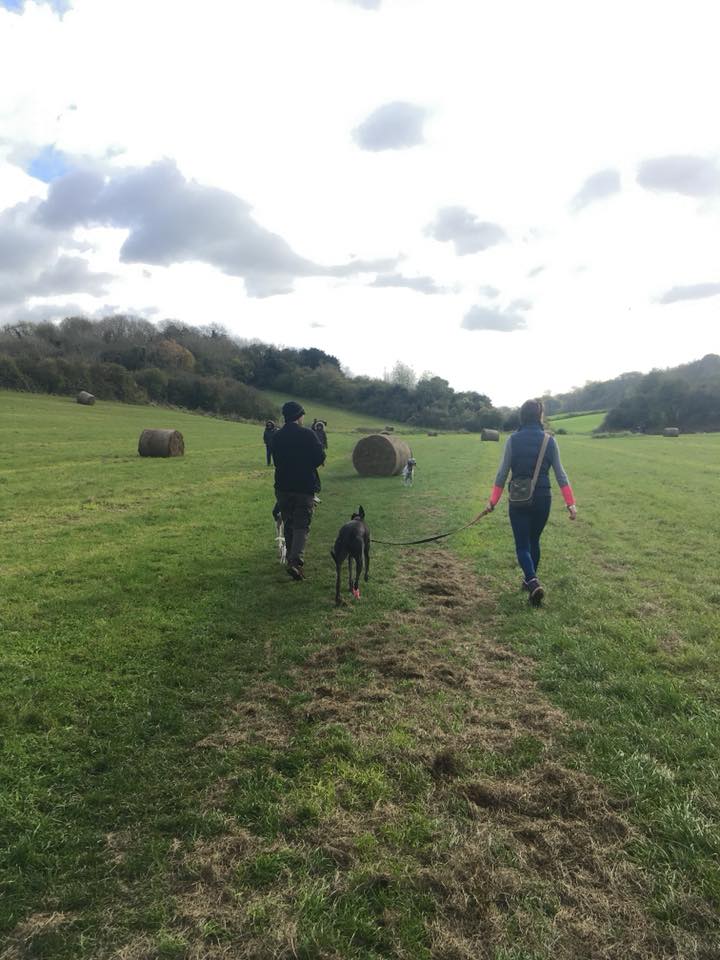
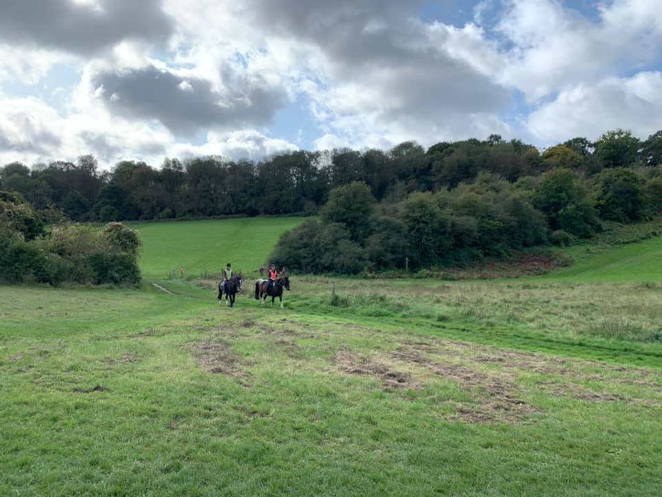
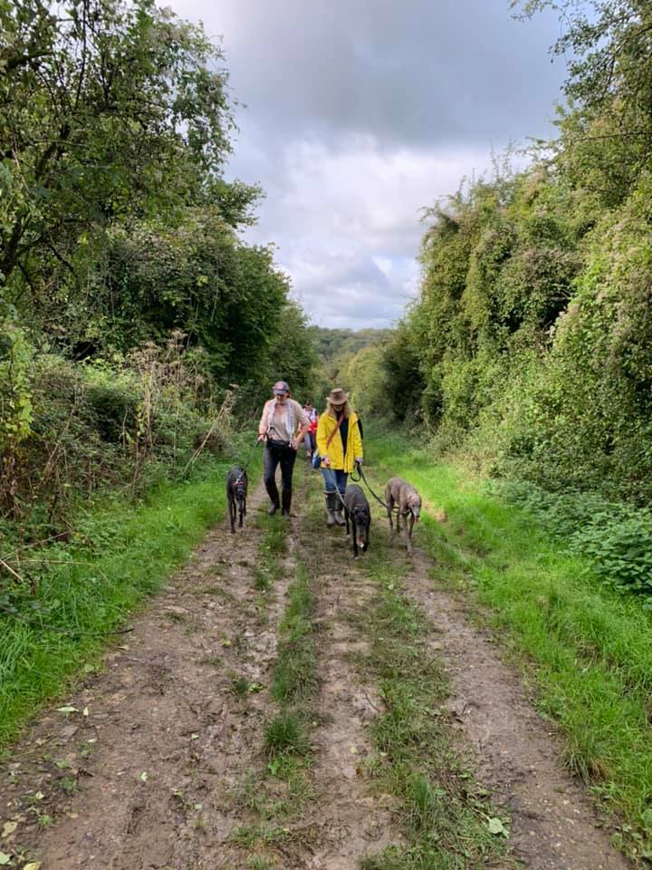
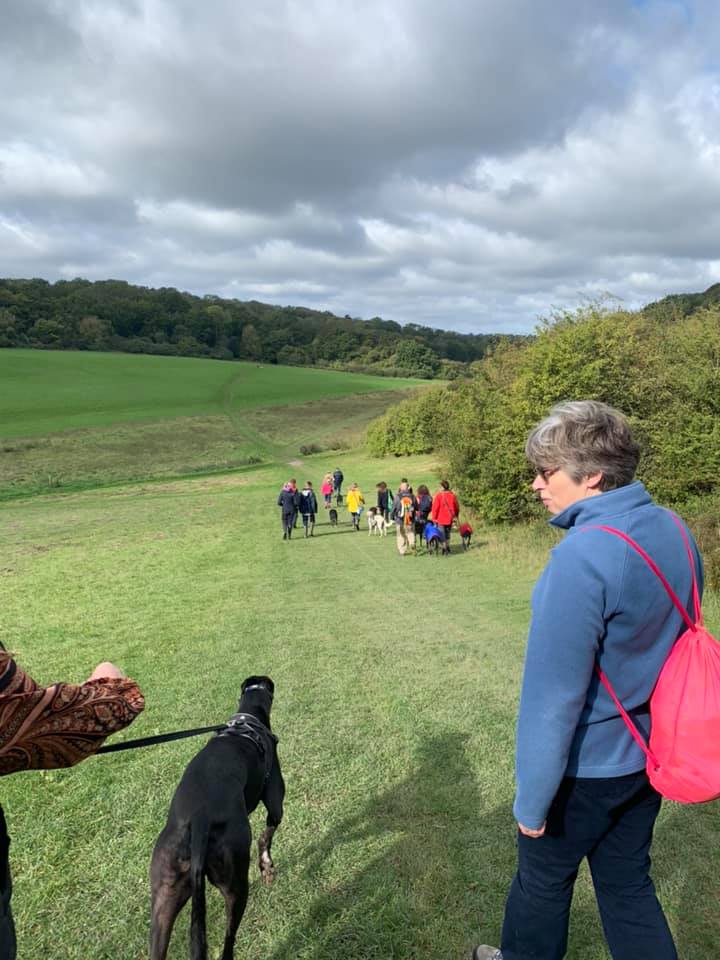
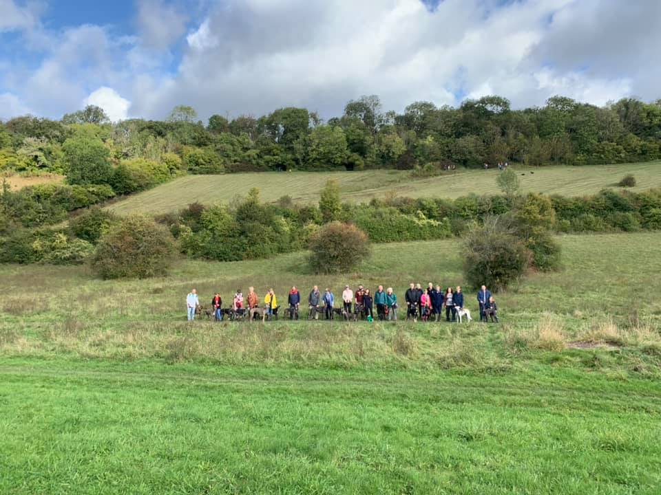
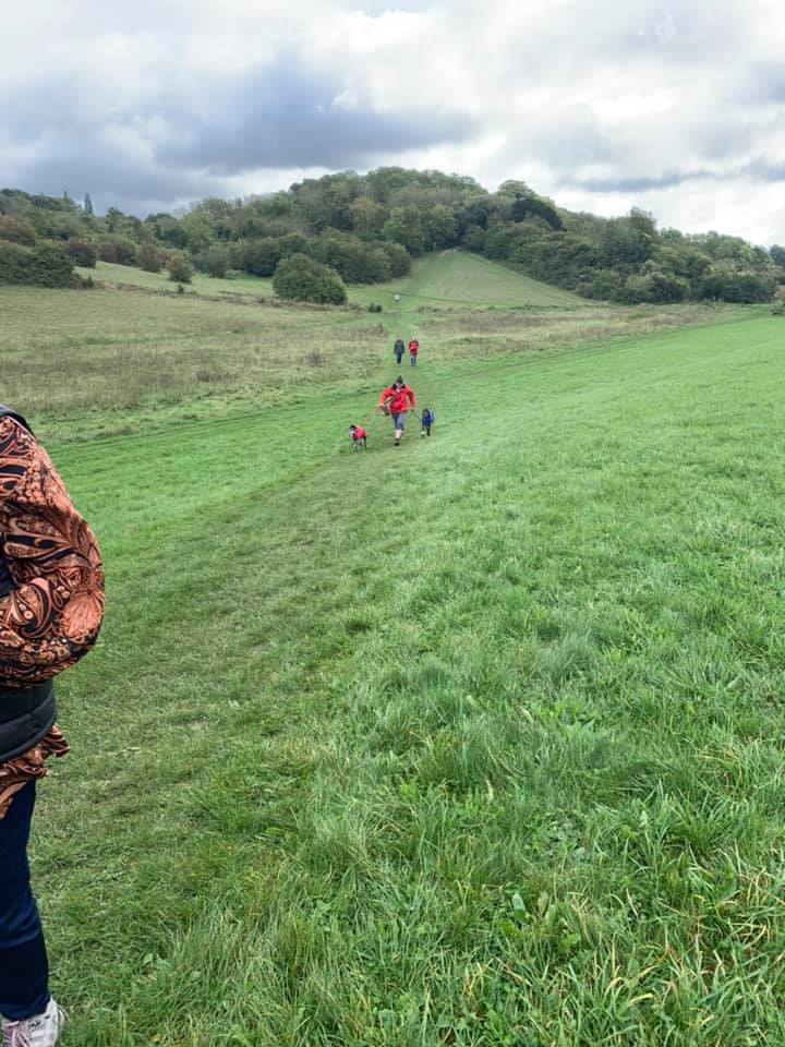
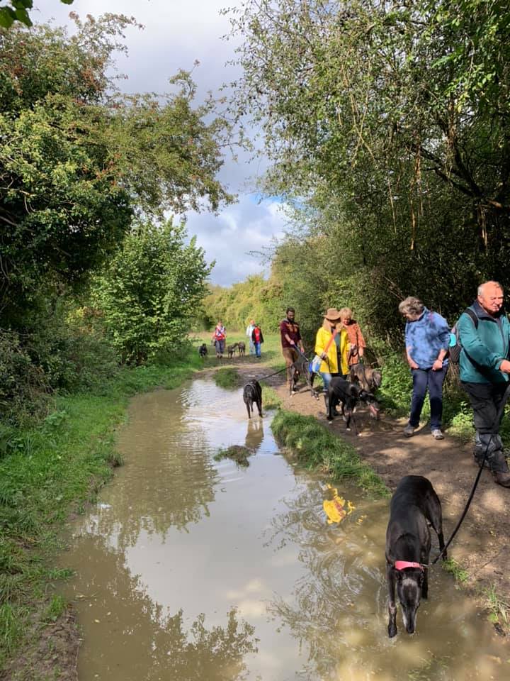
Gallery: What’s it like here?

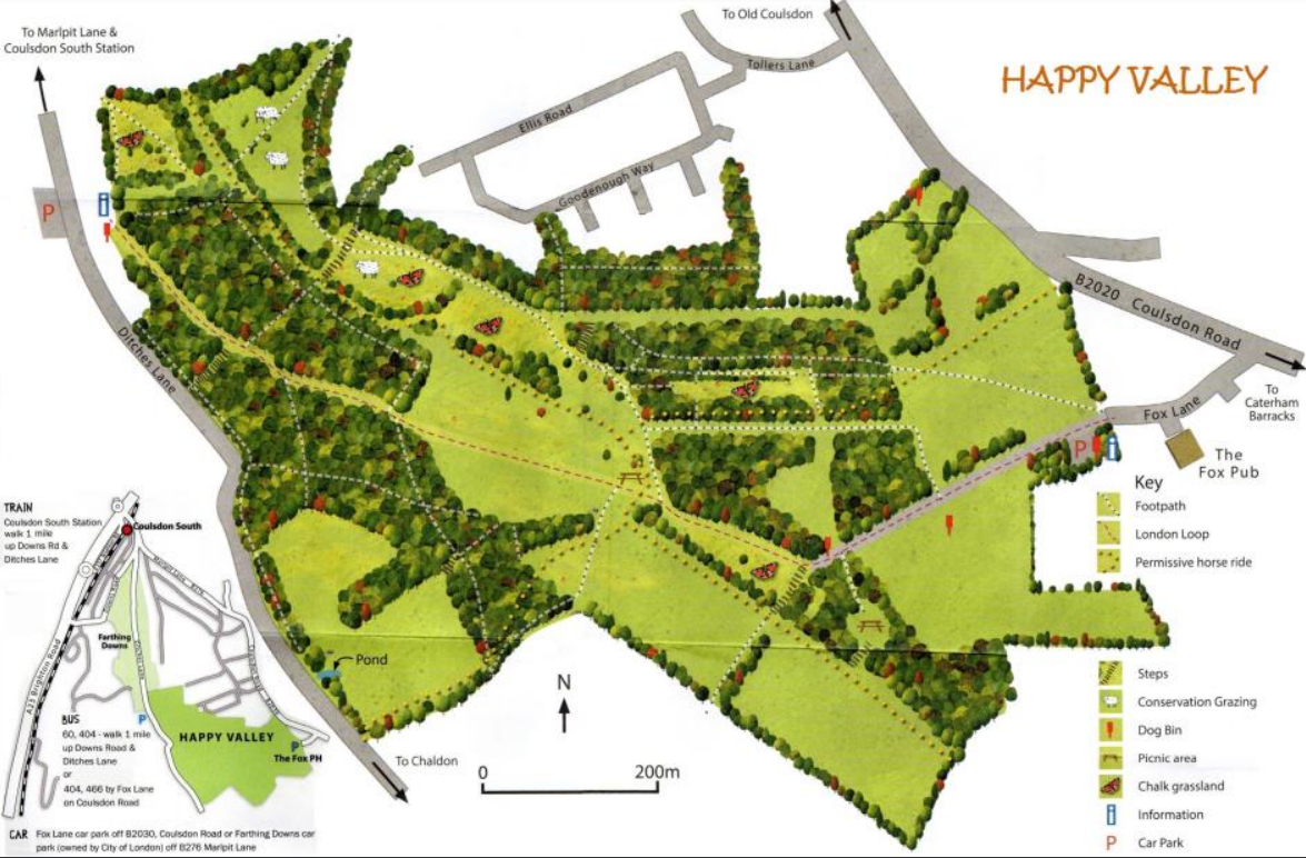
Parking
Park in the free Happy Valley car park at the end of Fox Lane just past The Fox pub, which welcomes dogs.
GOOGLEMAPS LINK: https://goo.gl/maps/xS7MgTv1iMaYm5pn7
WHAT3WORDS: images.state.hang
NEAREST POSTCODE: CR3 5QS
Poo bins?
There are poo bins at the car park and a few along the self-guided route suggested below (these are noted in the directions).
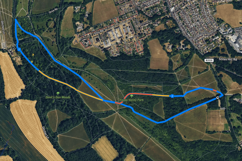
Self-guided walk
Here is a Footpath app route for Happy Valley starting at the car park at the end of Fox Lane just along from the The Fox pub. Also on AllTrails. You’ll start on one side of the valley and head down its fairly steep slope to the bottom, then over and up the other side through Devil’s Den Woods. It’s not that steep going up but there is another steep incline to contend with going back down again. Then along the valley floor and up out to the car park again – by the shallowest route out, which is gentler than really steep one you came in by.
Terrain: As the name suggests, this is a valley so expect slopes! Rena and I hate hills so rest assured nothing on this walk is particularly steep. There’s an even mix of open land and shaded woods but the valley bottom can be very exposed so take care during warm weather. The ground is uneven so wear decent walking shoes.
Length: approximately 2.3 miles/3.6km
Stiles/kissing gates? No stiles, no kissing gates
From the car park, head through the vehicle barrier and take the tarmac path past the information board and poo bin. Go along the side of the meadow, pass another poo bin (on the left) and descend into woodland (note – there is another poo bin on the right as you get to wood edge).
The tarmac surface gives way to gravel and the path curves to the right before bringing you out onto the open hillside. Stay on the main path (ignoring a smaller, steep slope to the left) and head on down the gentler slope. You’ll pass through some trees and it’ll become steeper then open out again. There’ll be a bench to the left of the path at a fingerpost and ahead you can see the dip of Happy Valley.
Stay on the main path straight down the hill into the valley and head over the cross paths where you should notice there is a patch of gravel* on the ground. Continue on this path up the gentle slope on the other side of the valley and into the woods. The path once again becomes gravelly underfoot.
Pass a tall tree with a “horse riding prohibited” sign nailed to it and then a bench (on the right). Stay on this wide path as it ascends through the trees, passing a chopped tree trunk (on the right) and then a fingerpost at wooden steps going up to the left.
Continue in the direction of Downs Road, passing a bench on the left at a way marker post numbered 28. You’ll eventually come to way marker post 29 and, just before a couple of poo bins and a green vehicle barrier, fork right and take the small path. A little way along this path, you’ll come to another way marker post, this one unnumbered – just keep straight ahead here, along the edge of the hillside that slopes down to your right.
This will bring you to a “danger of death” pylon (very cheerful) and a little bench. Turn right and head downhill past way marker 11. If you feel like you’re going back on yourself, that’s because you are – this is the only half sensible route down from here. (Out of interest, just after you pass way marker 13, look up to your right and consider the alternative path down!)
Anyway, the path downhill brings you out at a wide grassy bridleway, bear right here along it. Keep going ahead past a bench dedicated to Malcolm Guille (on your right) and when you come to a large fork in the path (just by a gate set into the shrubs on the left), bear right. Sometimes there is a big old puddle here – bad luck!

You’ll come out into the open space of Happy Valley, walking along the centre of the valley bottom.

Shortly, you’ll pass a bench in front of a sizeable shrub (on the left). As you keep going, you will notice that the hill ahead is the one you first came down with the bench. When you reach the bottom of this hill, cross the same patch of gravel* mentioned earlier in the walk, and very soon after, bear round to the left (as opposed to heading up the steep slope by the bench – you may be relieved to know that, while an ascent back up to the car park is inevitable, this next section is the gentlest way up out of the valley.)
Pass a bench on the left and follow the path ahead. It becomes stony underfoot and curves around to the right. As it straightens out again, you’ll see a sheltered path off to the left. Take this – it runs parallel with that main path but is shady, which is welcome after the openness of the valley, especially in warmer weather. As you climb the slope, keep on straight at the way marker. This is the steepest part but it’s only a short stretch!
The trees become less dense and at the gravelly cross paths, turn right into an open meadow. Of the two paths presented to you, take that which bears to the left and crosses the field on its diagonal. Go straight across this and straight over a grassy cross paths.
A little further on, the path forks. Bear right. This path comes out at the car park by the vehicle barrier.

Leave a comment