Page contents
About
Gallery
Parking
Poo bins?
Self-guided walk
About
Reigate Hill, at a height of 771m above sea level, is described by the National Trust as “a spectacular escarpment with sweeping views across the Weald” and that sums it up perfectly. This stretch of the North Downs hill top boasts a rich history, home to Reigate Fort, the Wing Tips memorial sculpture and the Inglis Memorial, all of which are visited on the walk described below.
Gallery: What’s it like here?


Parking
Park at at the free National Trust Reigate Hill and Gatton Park car park on Wray Lane. It’s quite a large car park but does get busy. There’s a cafe in the grounds and a picnic area.
GOOGLEMAPS LINK: https://goo.gl/maps/RyqejZbBG2iN1mWN6
WHAT3WORDS: trying.play.these
NEAREST POSTCODE: RH2 0PL
Poo bins?
Bins at the car park and just one on the long straight, not far beyond the footbridge and before the fort.
Self-guided walk
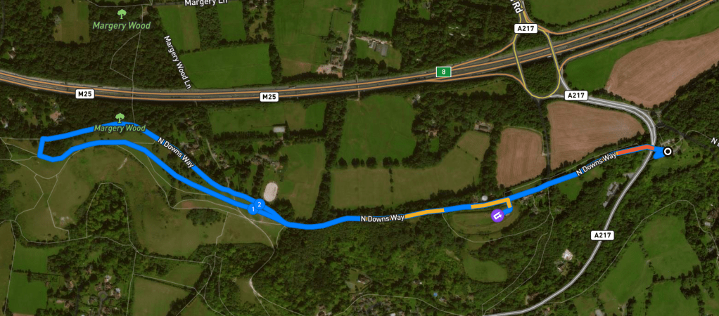
Here is a Footpath app route for Reigate Hill and Colley Hill. Also on AllTrails. Despite the word “hill” appearing twice, this is a flat route along the top of the hill. This is almost an out-and-back, but dropping down very slightly onto the grass when you get beyond the Inglis Memorial allows you to make more of a loop of it. While I generally find out-and-backs a bit dull as I hate retracing my steps, the stunning views from this hillside and the sites of historical interest that you’ll pass along the way – the National Trust-managed Reigate Fort, the Wing Tips memorial sculpture and the Inglis Memorial – make it a worthwhile trip.
Length: approximately 2.9 miles/4.6km
Terrain: Flat along the top of the hill via a wide, man-made path, and a largely flat grassy section
Stiles/kissing gates? No stiles, no kissing gates
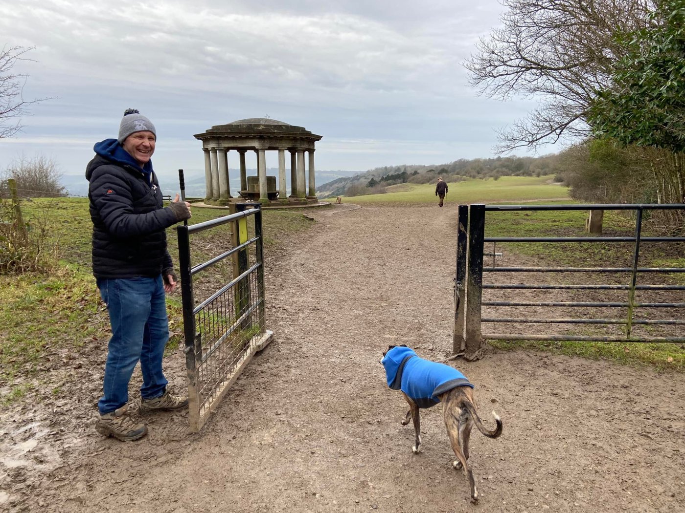
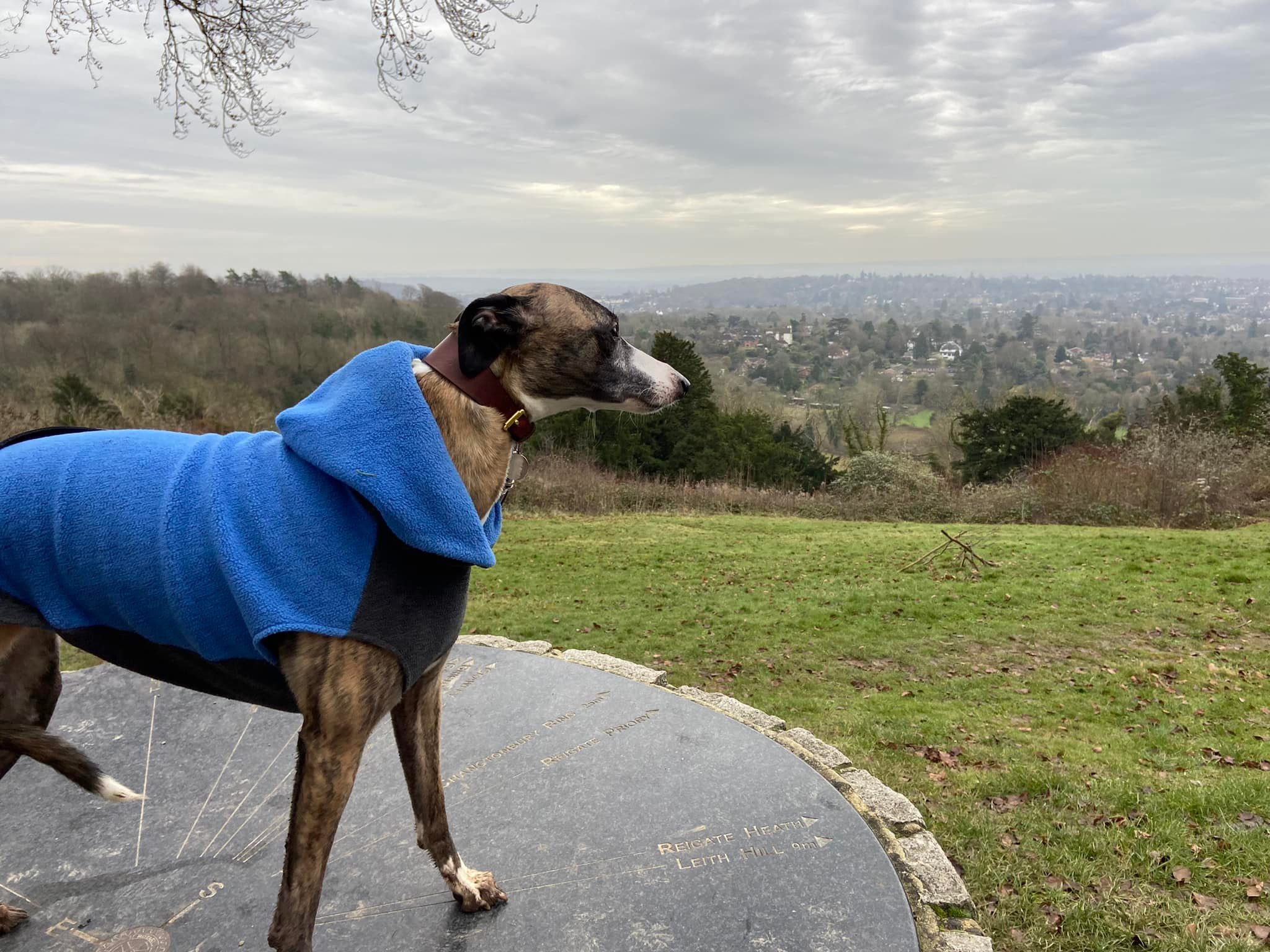
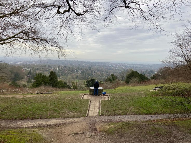
Before you leave the car park, visit the Reigate Hill viewpoint, which is below the cafe. The lines on the circle point to places of interest including Dover, Brighton and Leith Hill.

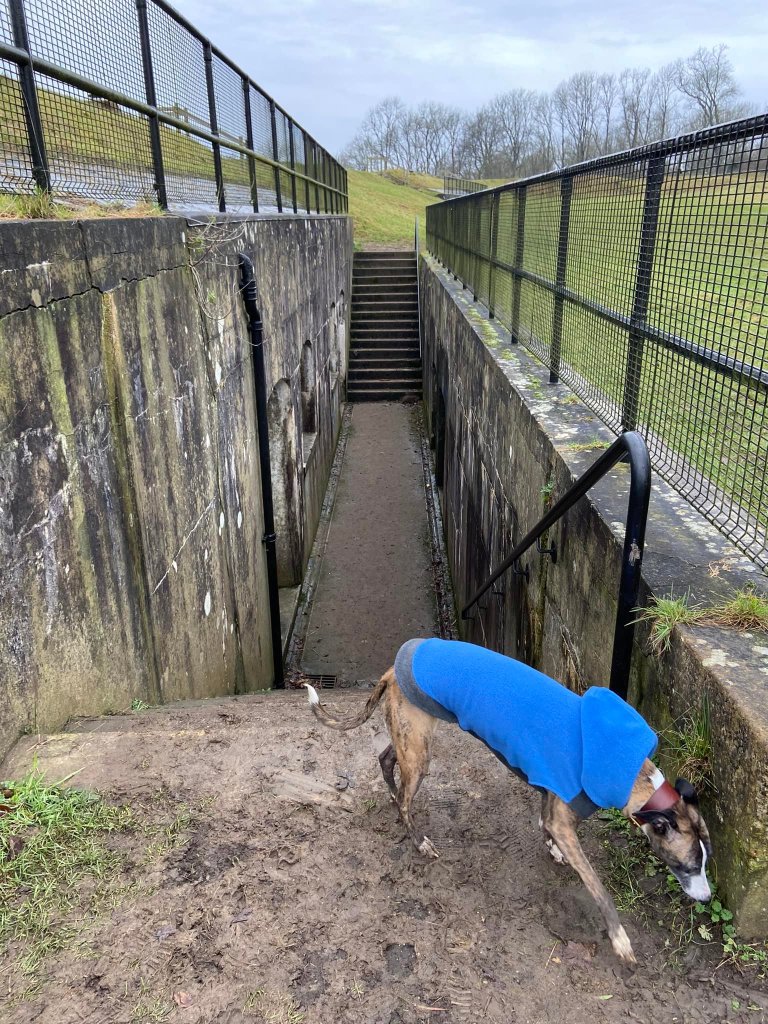
Then head back up towards the cafe and turn left just before you reach it to follow the path over the footbridge that crosses the A217 between the M25 and Redhill. Continue straight ahead for quite a distance – and note that you’ll shortly pass the only bin on the route (besides those in the car park) so if you have any litter or poop, please dispose of it here or carry it with you for the rest of your walk. Pass the first black bollard and continue straight, passing Hilltop Cattery (hold onto your hounds), and you’ll presently come to a National Trust sign for Reigate Hill next to two brown bollards and one black one.
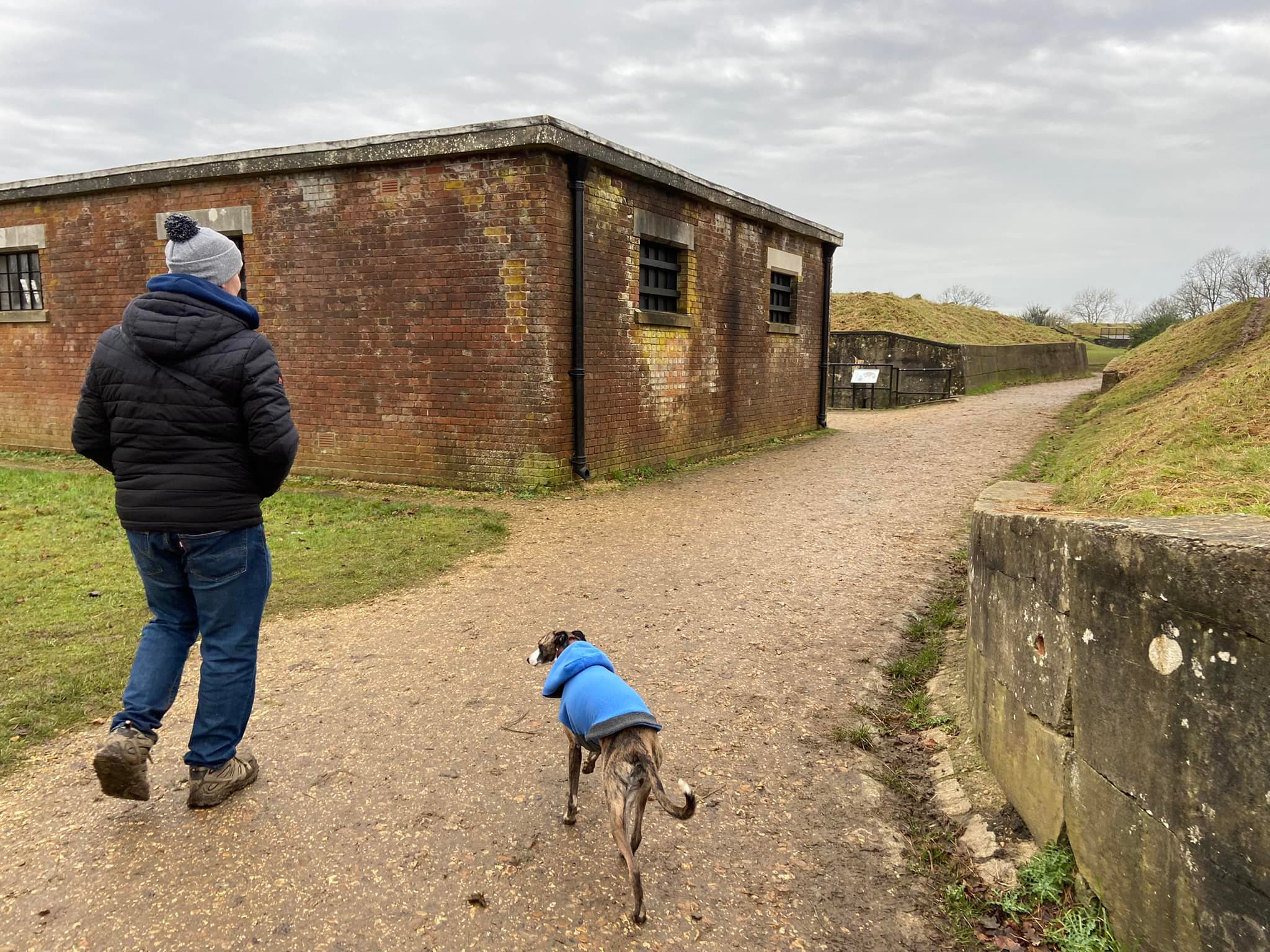
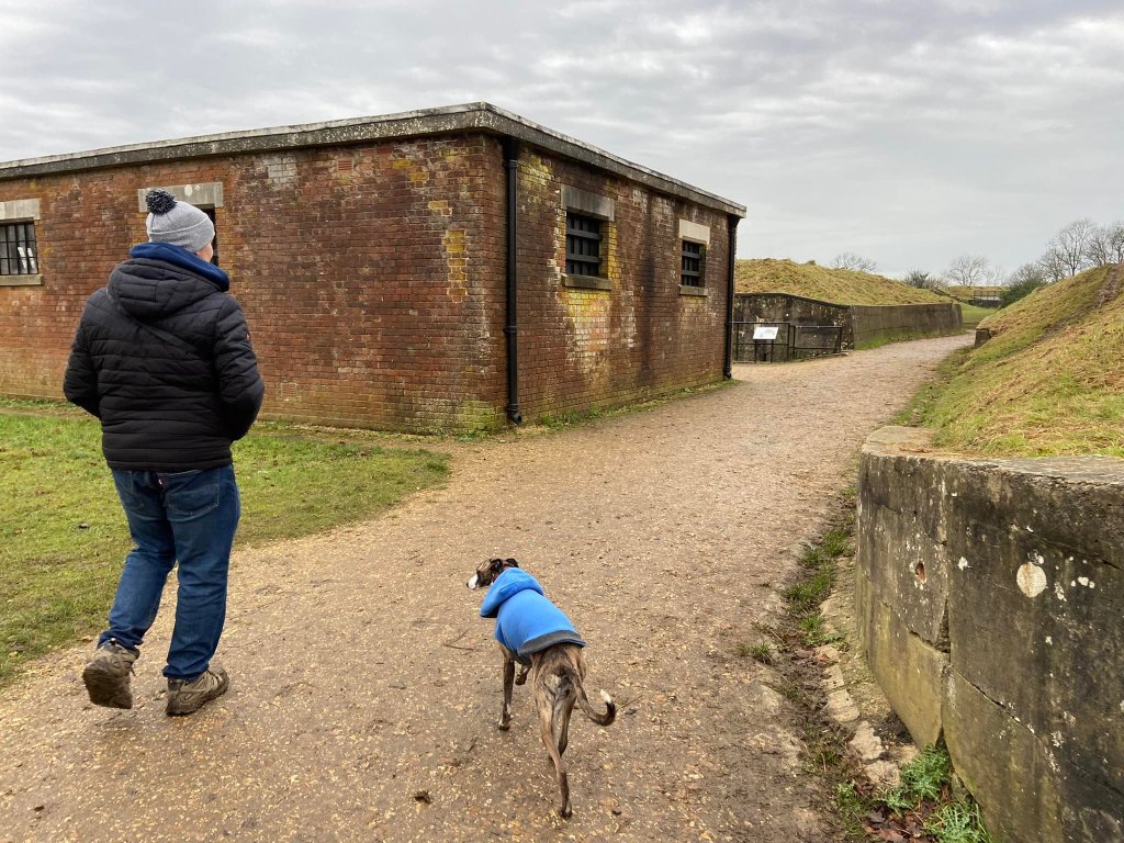
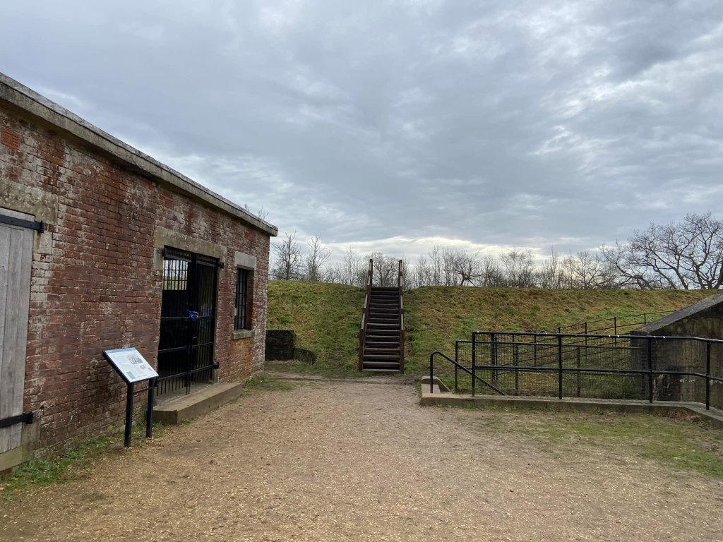
A little further on, you’ll reach Reigate Fort (on your left.) You may wish to head into this now – or do it on your return stretch. It’s free and you can take your dog(s) in.

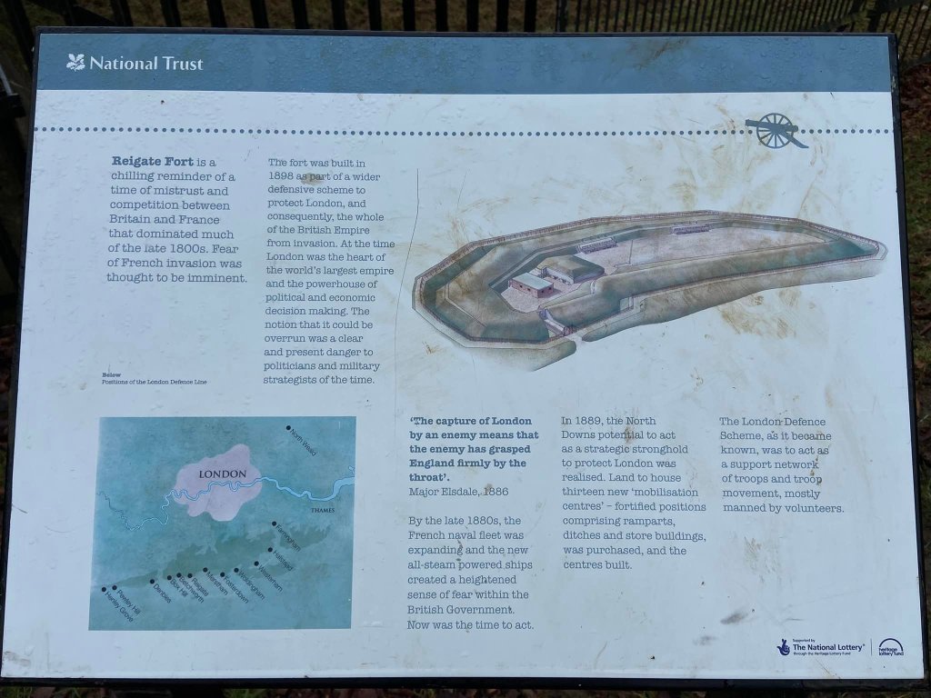
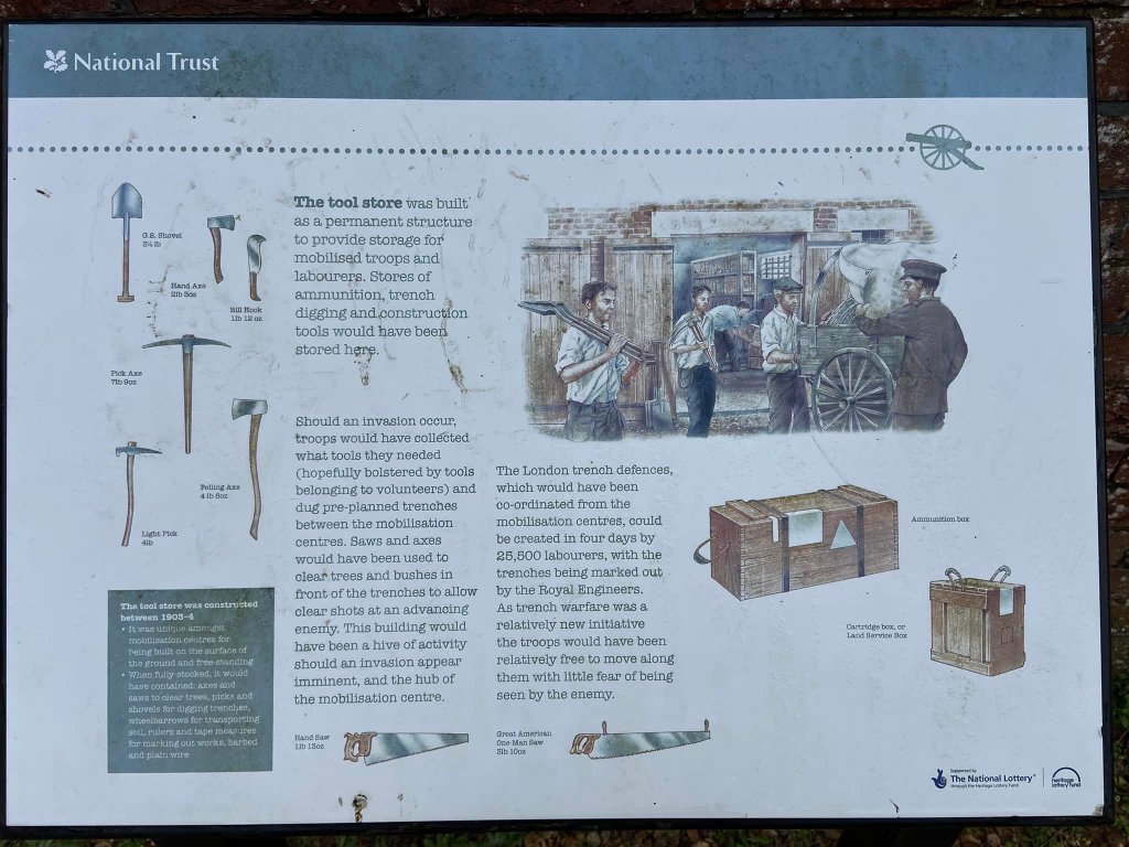
Dating back to 1898, Reigate Fort was one of 13 built along the North Downs as part of the 72-mile long London Defence Scheme – but it was decommissioned in 1906 when the Government decided the Navy provided a superior defence of the shoreline. During the First World War, it was used for storing ammunition. Recommissioned in the Second World War, it is believed to have played a part in wartime communications for the army’s South East Command, which was based in tunnels a few hundred metres away. In 1972, the fort was designated as a Scheduled Ancient Monument by English Heritage and restoration work was carried out from 2000. Now looked after by the National Trust, you can find out more about it in this leaflet (PDF). As you explore the site, there are a few information boards to tell you about how the fort and its buildings were used over the years.


When you’re done at the fort, continue back on the path you set out on. You’ll come to a green fence with gates and behind this you can see the big grey vat that is Margery Water Tower, which houses 1.2 million litres of drinking water to supply local towns – there is an information sign about it a little further on.
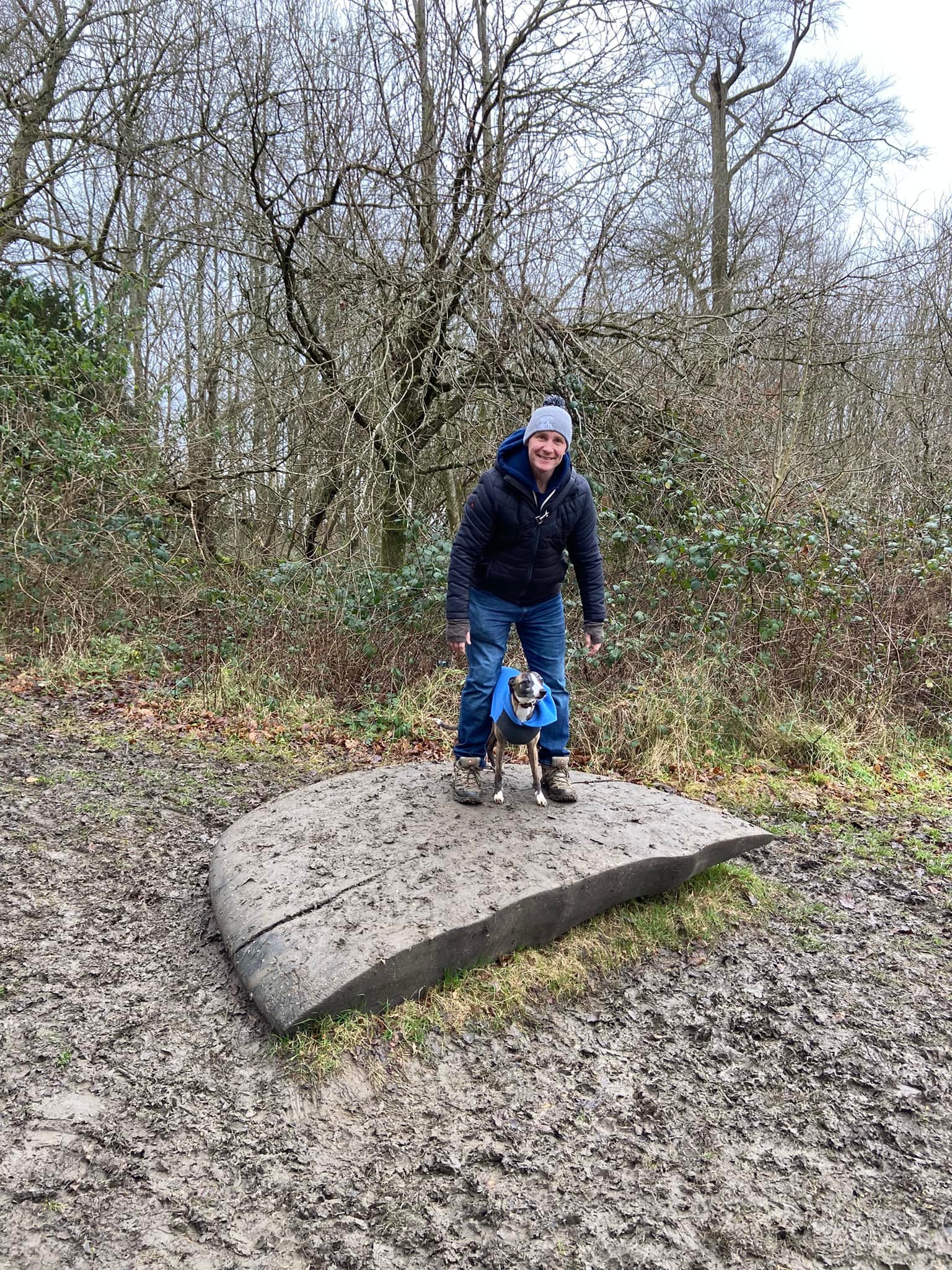
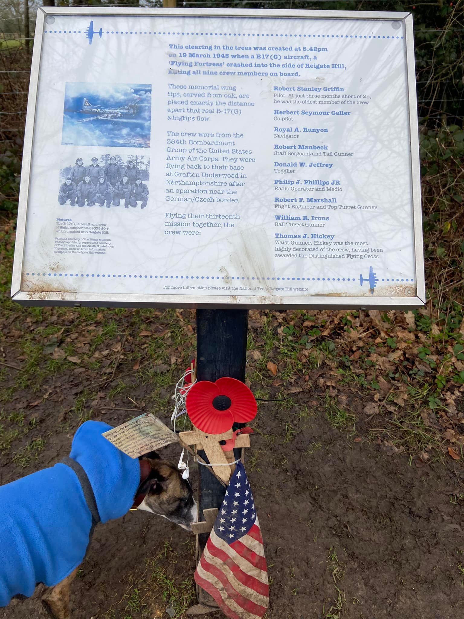
A bit further on from this, you’ll reach the Wing Tips memorial sculpture: two wooden plane tips, which mark the spot where a B-17 Plane crashed on 19 March 1945. All nine of the USAAF crew were tragically killed on their journey from Germany to Northamptonshire. The sculpture, by local artist Roger Day, was unveiled on the 70th anniversary of the crash. The two pieces of the memorial, which are made from ancient Surrey oak, are spaced the same distance apart as the stricken aircraft’s wing tips, and are made to the exact dimensions. Buried deep in the sculpture is molten metal, recovered from the crash site and now forming part of the memorial itself.
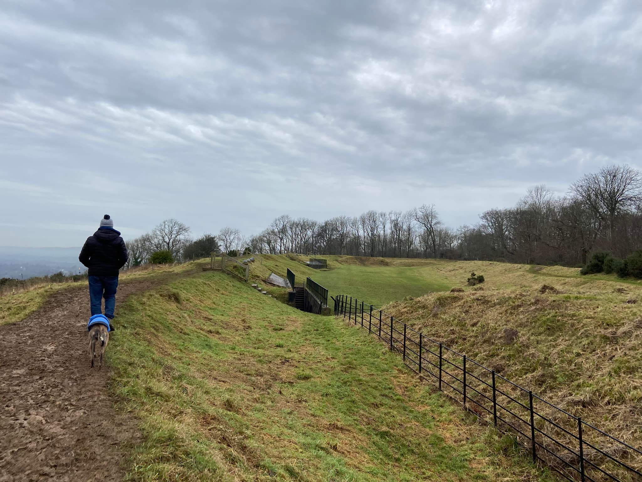
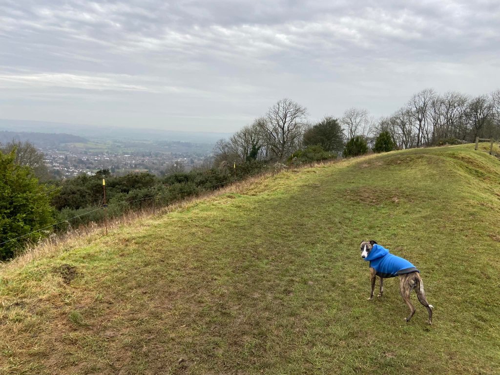
Continuing on past Wing Tips, the path will pass a substantial pill box on the left, which you can peer into (usually has litter in, sadly) and it’ll presently bring you to a gate, immediately beyond which, you’ll see the Inglis Memorial. You are now at Colley Hill, which is the ninth highest hill in Surrey. I’m not sure being the ninth is something to write home about but it’s a fact for you.

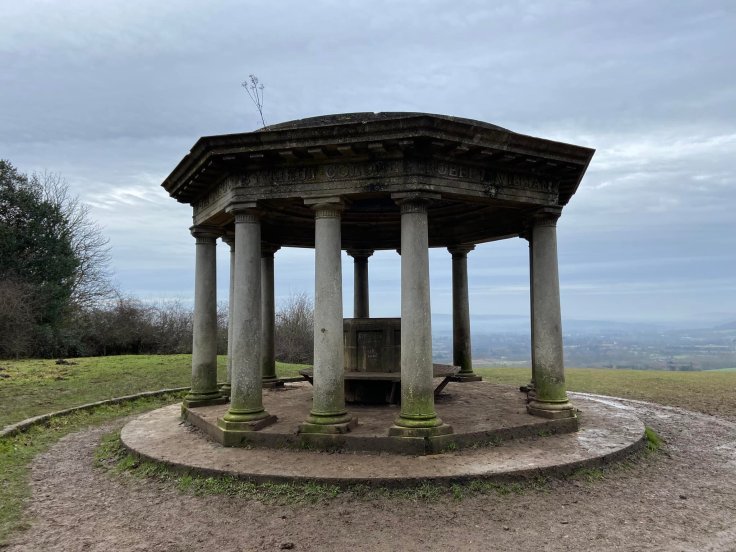

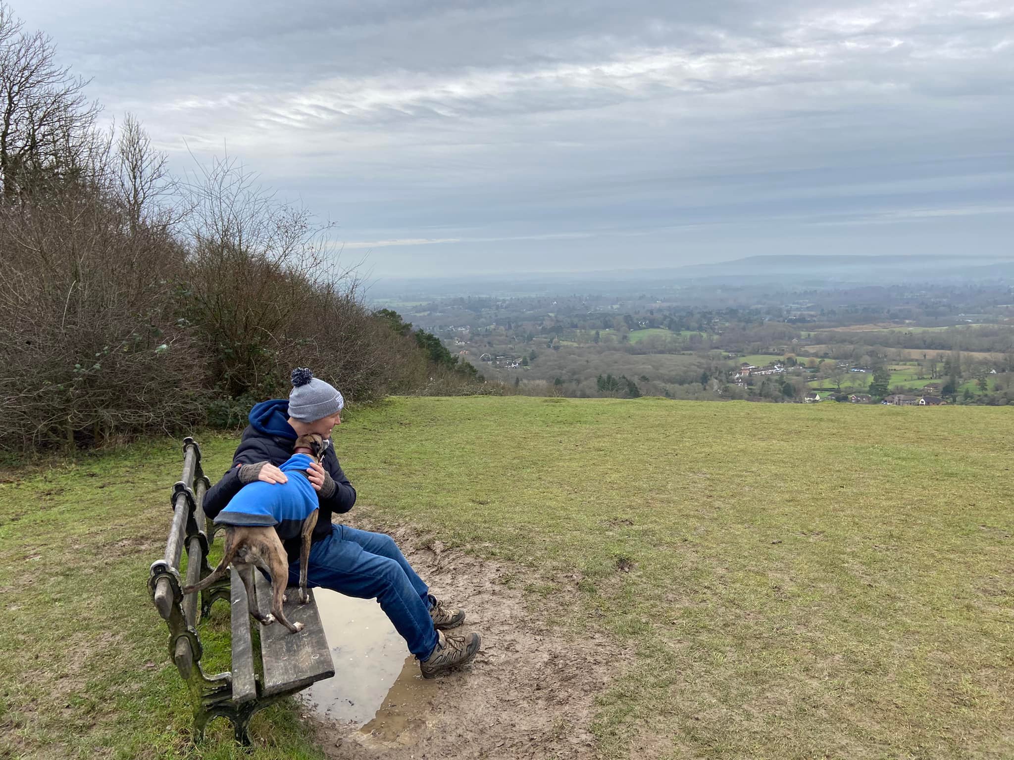
The Inglis Memorial was donated to the Borough of Reigate in 1909 by Lieutenant Colonel Sir Robert William Inglis. Originally a drinking fountain for horses at the top of the original main route over Reigate Hill, it’s now a scenic place to stop. The view here, as from the fort and the viewpoint at the car park, is pretty spectacular.
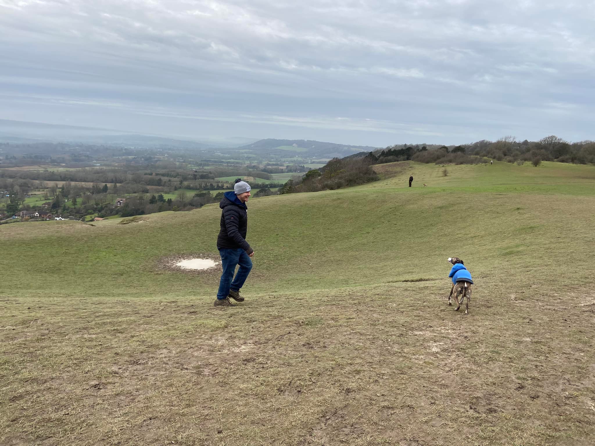
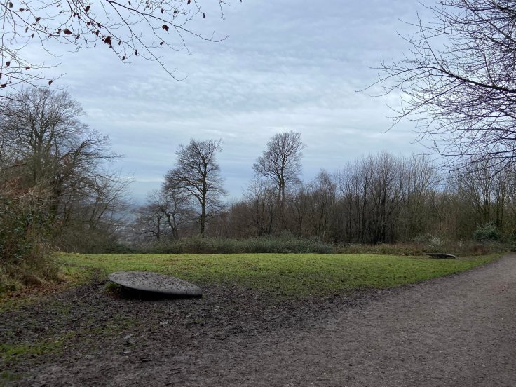
When you’re done looking at the memorial or sitting on the bench, continue ahead – but to make it a loop, I take the footpath that bears off the main path slightly to the left onto the grass and skirts the top of a big dip, which a lot of people think is an old bomb crater. Apparently this is not the case. Known as the ‘sugar bowl’ by some locals, it is actually a historic surface chalk quarry. There were several stone mines along the bottom of Colley Hill until the 1960s and there are pits at the bottom of the hill from mine collapses in derelict tunnels below.
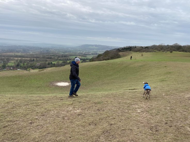
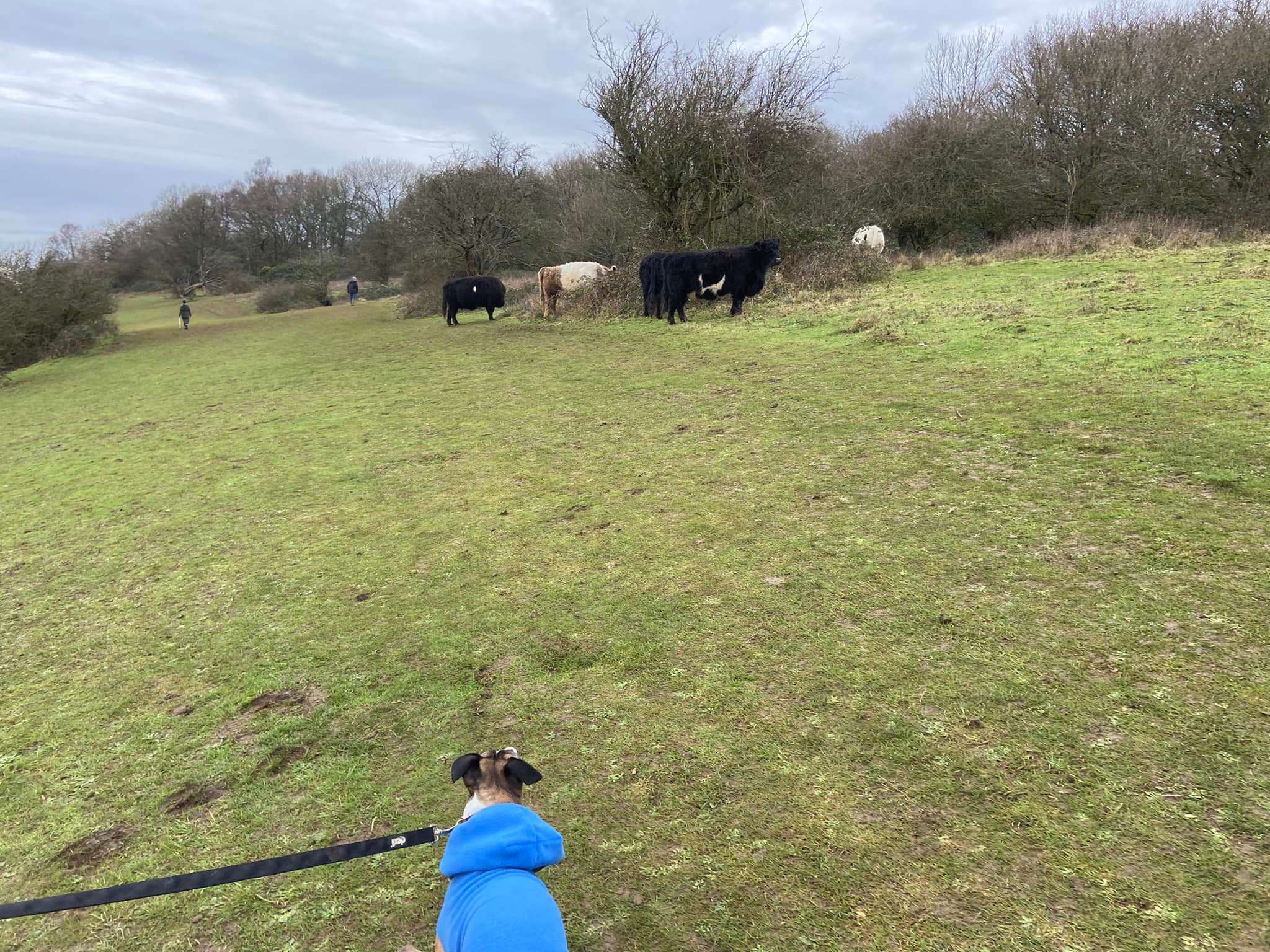
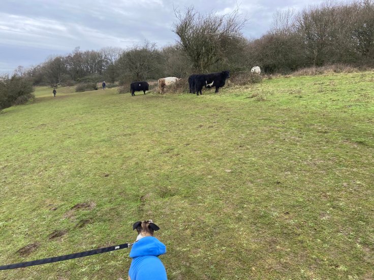
With the dip on your left, walk ahead on the grass and you’ll cross a footpath heading downhill – this is Reigate Hill path and not one I am keen to try any time soon. Continue ahead and you’ll head into some shrubbery/copse. Passing through this, you’ll be again out on the open hillside. Keep going, admiring the view. There are sometimes cattle up here – so if your dog is off lead, you may wish to put it on – and the area also attracts gliders and drone operators.
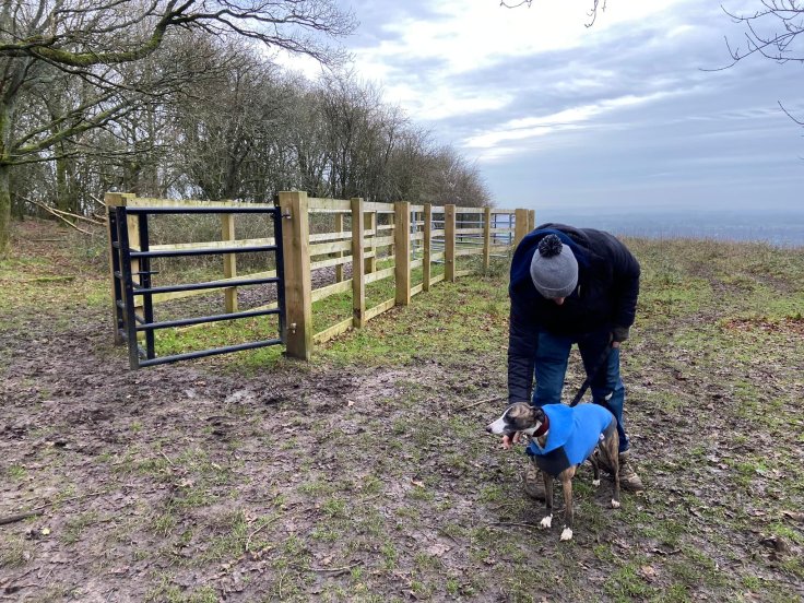
Follow the contour of the hill onwards and after a fair stretch, the path will come alongside some trees. Use these trees as a “roundabout” of sorts, skirting along the side of them and round to the right at their end. You’ll see ahead a large wooden pen, used for holding and checking over cattle. Walk down the side of this (either side is fine) to the main path and turn right.
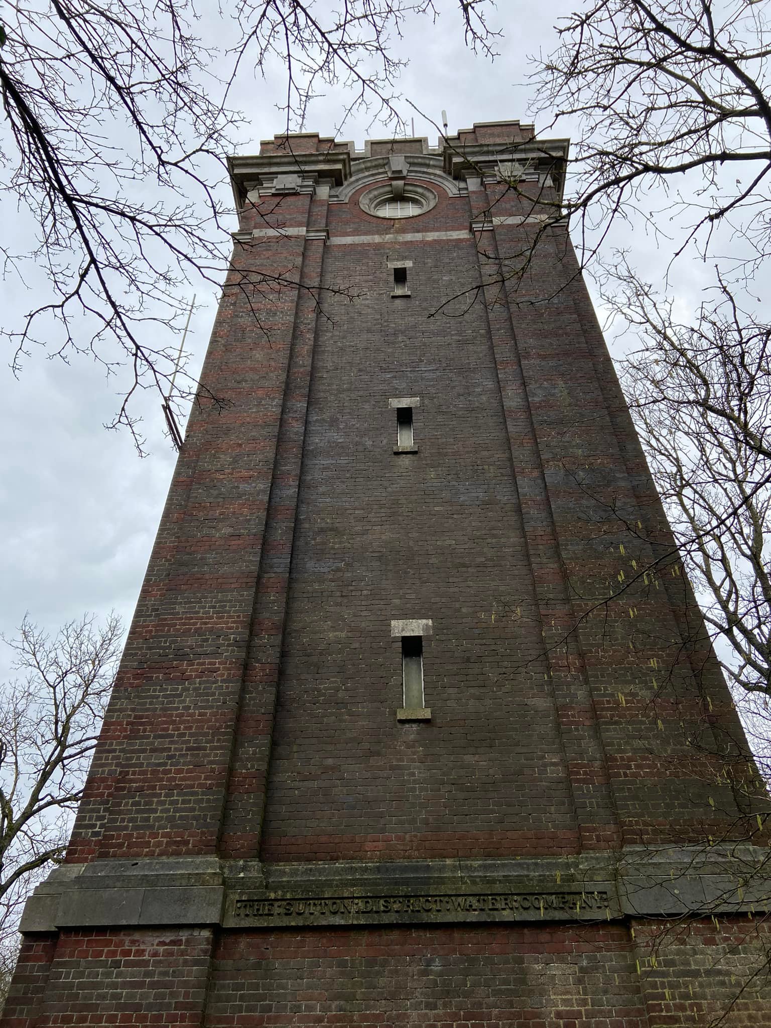
Then follow this main path all the way back to the car park, perhaps pausing as you pass an ornate old water tower on your left, which was built by the Sutton and District Water Company. There’s not much to be found about it online aside from the observation that it was likely built in the 1930s.

And finally, if you didn’t explore the fort on your outward leg, make sure you pop in on this return journey.

Leave a comment