Page contents
About
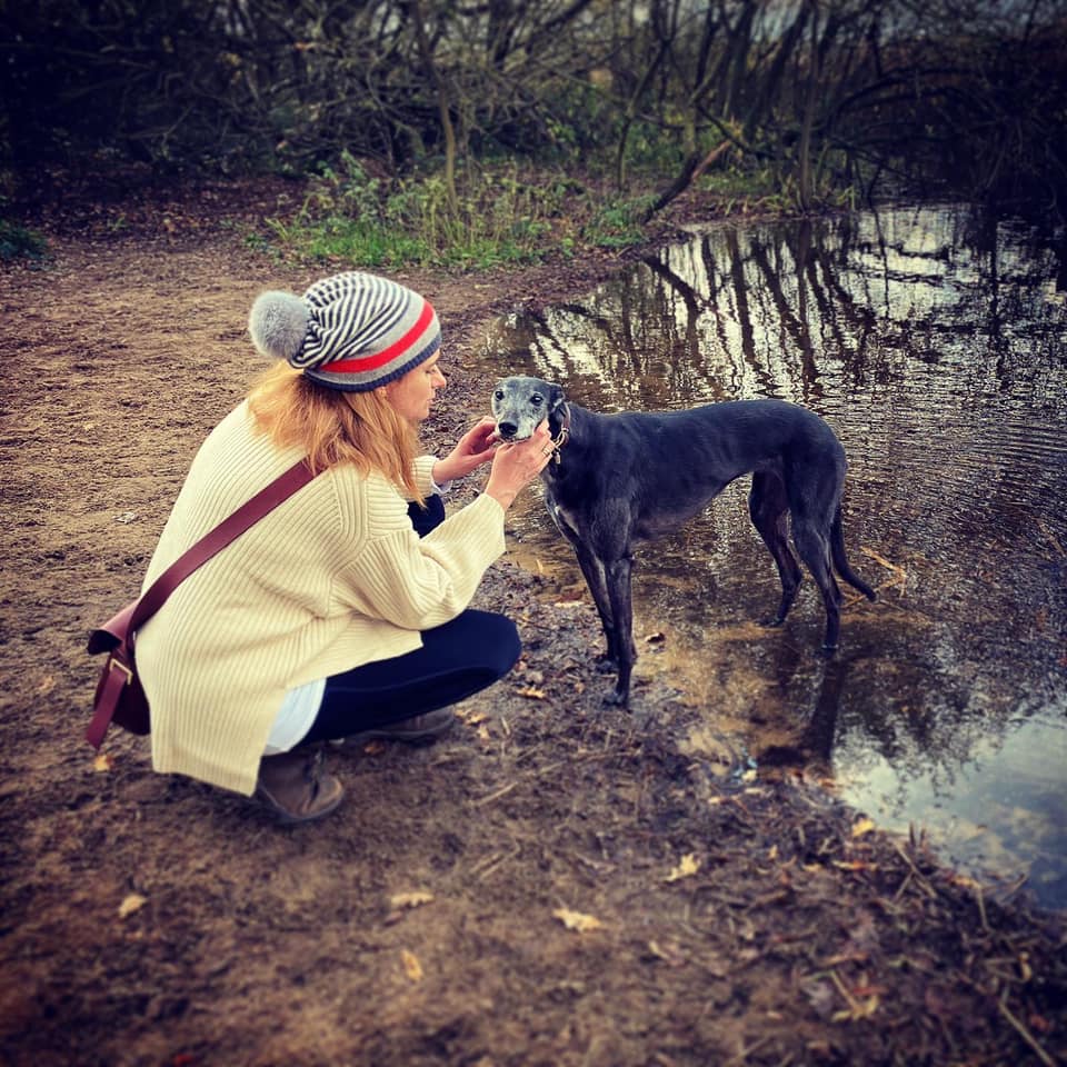
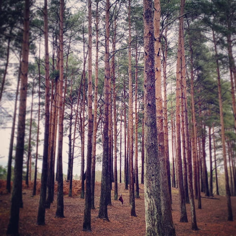
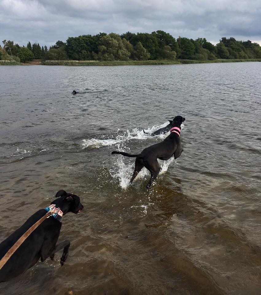
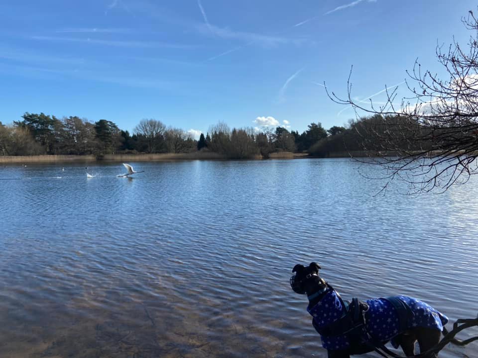
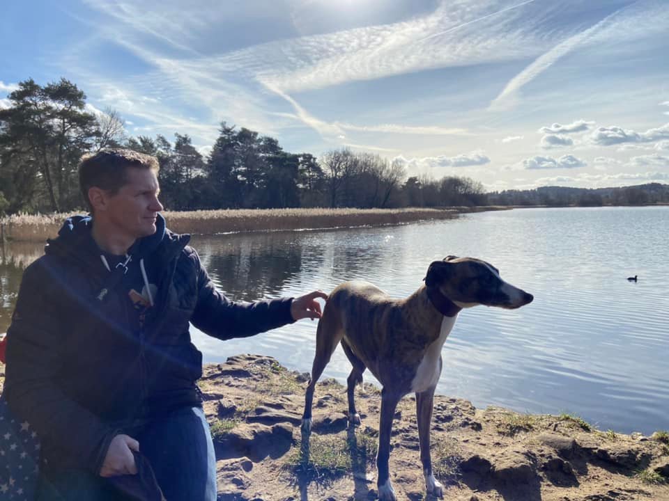
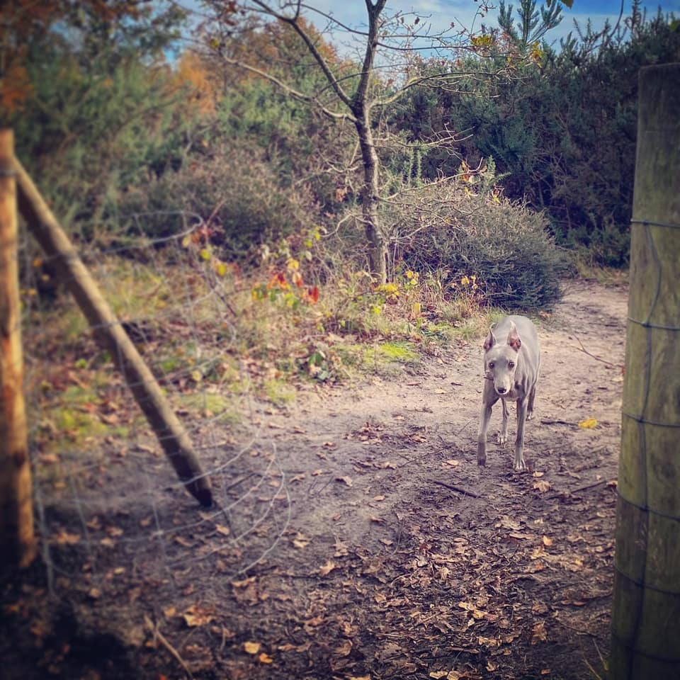
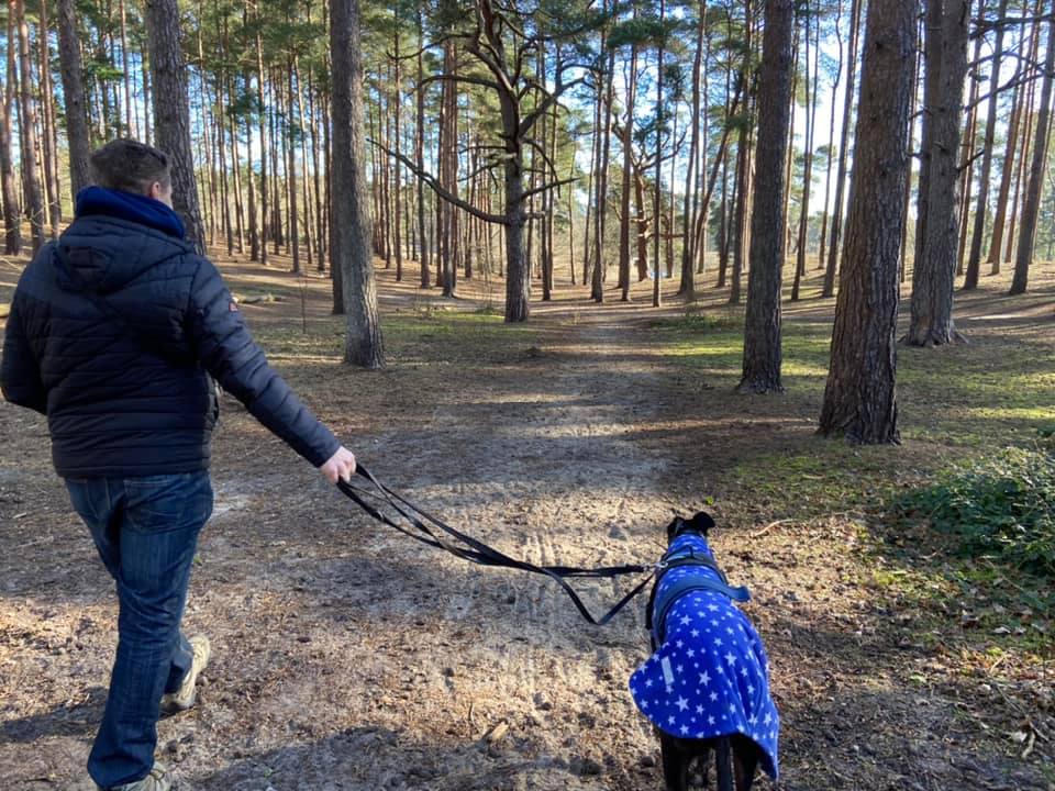
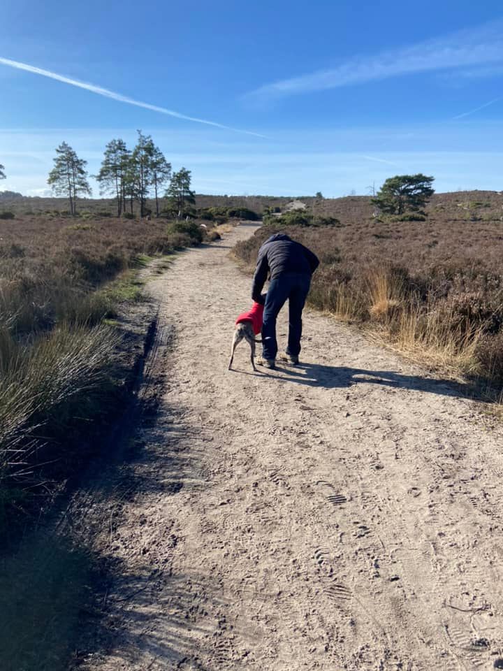
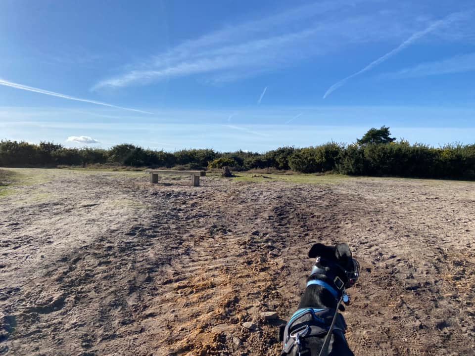
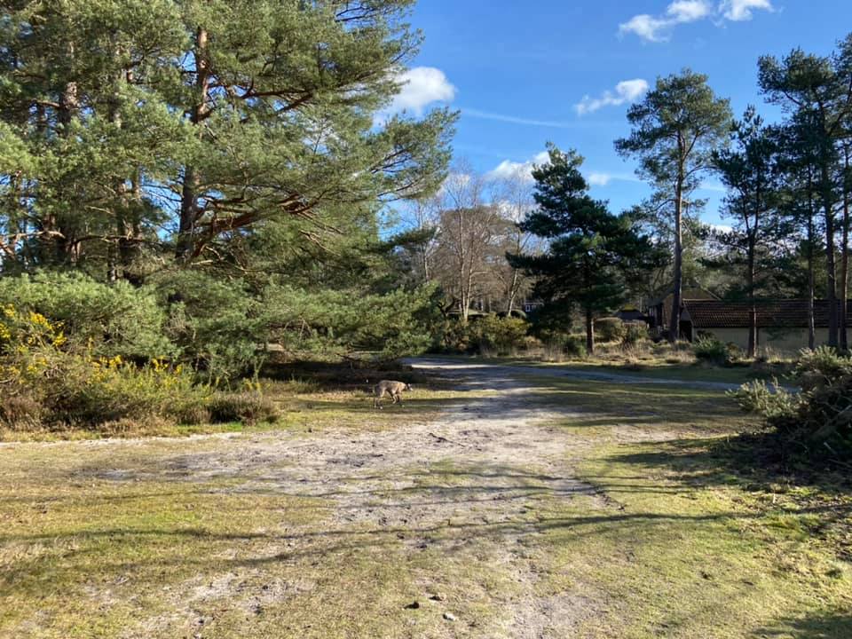
Gallery
Instagram reels showing here
Parking
Poo bins?
Self-guided walks
About
The village of Frensham and its Little and Great ponds can be found near the town of Farnham. The name Frensham comes from “Frena’s ham”.
Frena was the name of either a Danish Earl who was killed in the battle of Ashdown in the year 871, or a Saxon who was driven south from Northumberland by the Danes in 993. I’m not sure it matters which dude it was but I was unable to find out more anyway (sorry).
The second part, ”ham” is an olde English word for “settlement”, and is also from where the word ”home” originates, so Frensham means “Frena’s settlement”. I particularly like this because if you lose the F and go for the word “home” instead of “settlement”, you’ve got ”Rena’s home”.
Frensham Little Pond, once called Crowsfoot, was built in 1246 by order of the Bishop of Winchester, William de Raleigh, because he wanted a fish supply for when he visited nearby Farnham Castle. Back then, the majority of the people living in the area were bondsmen, bound to the Bishop’s land, which basically means he granted areas of land to them and they in return paid their rent in money, kind or services (stuff like ploughing, sowing, harrowing or harvesting crops…but not building ponds.)
If the Bishop claimed services ‘not warranted by custom’, the bondsmen could refuse to work, which is what happened when old Willie de Rally demanded the creation of a bloody massive pond to fulfil his whimsy for fancy fish suppers. This was possibly one of the first strikes in England.
After some wrangling, the bondsmen were paid for the extra work so well done to them for standing their ground. (PS – join a workplace union).
Anyway, with the dispute settled, the pond was formed by building an ironstone wall – some of the original stonework is apparently still visible near the sluice gate – across a shallow valley and damming a stream entering the southern end of the pond, which came from a spring in the grounds of Silverbeck, Churt.
The pond is also fed by springs which rise near the Devil’s Jumps, three conical shaped ironstone hills also near Churt. According to local folklore, the Devil used to amuse himself by leaping from the top of each hill to the next, which pissed off the god Thor who picked up a boulder and threw it at the Devil, causing him to flee. Firstly, local folk clearly smoked too much weed back whenever this story originated. Secondly, since when has jumping around hill tops been enjoyable? Thirdly, why would it bother the almighty Thor anyway? Fourthly, the Devil and Thor don’t exist – and here we come full circle as I refer you back to ”firstly”.
Today Frensham Little Pond is owned and cared for by the National Trust, while Frensham Common and the Great Pond are leased to and managed by Waverley Borough Council. The area is a Site of Special Scientific Interest, a Special Protection Area and a Special Area of Conservation.
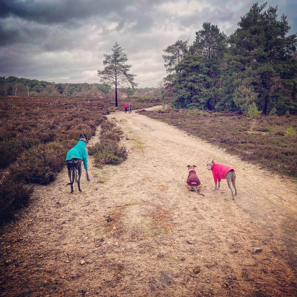
Around the pond you can spot many common and rare birds, such as reed bunting, sedge warbler and great crested grebe, as well as nightjars and woodlarks. There are damselflies and dragonflies darting over the glistening water in warmer months, and the banks of the pond are fringed with a multitude of yellow iris, purple loose-strife and common reeds. The heathland is a colourful mosaic of purple heathers, fragrant bright yellow gorse and rich green bracken.
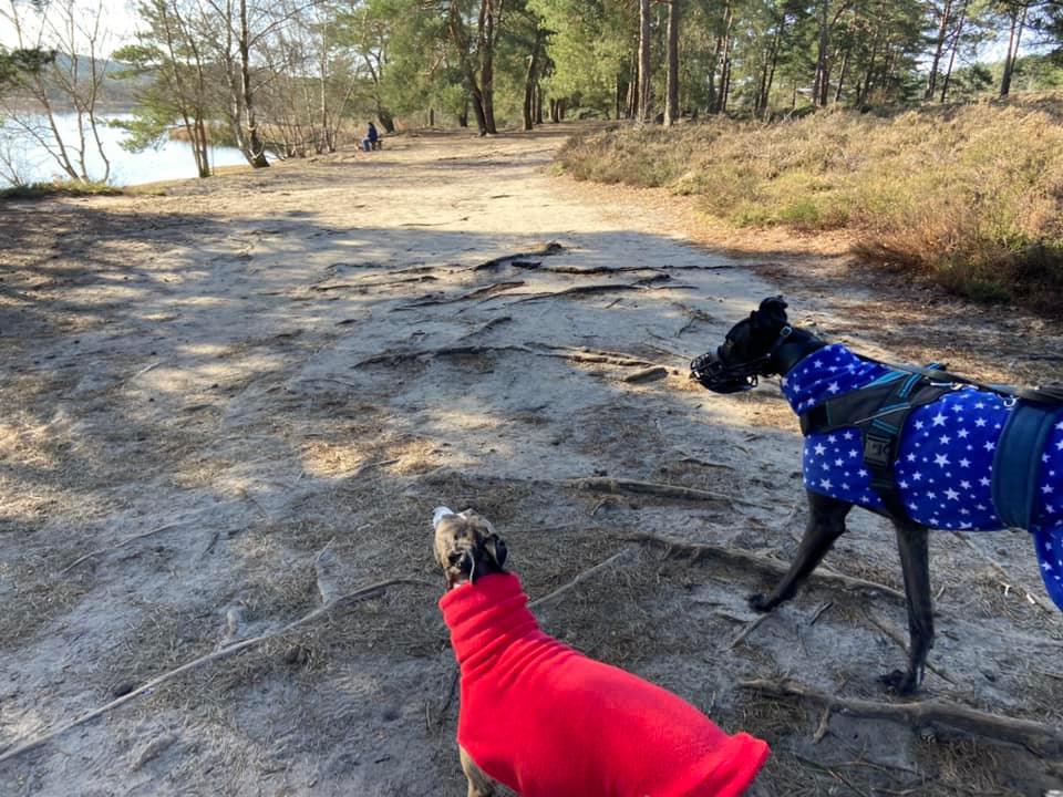
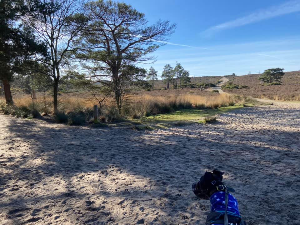
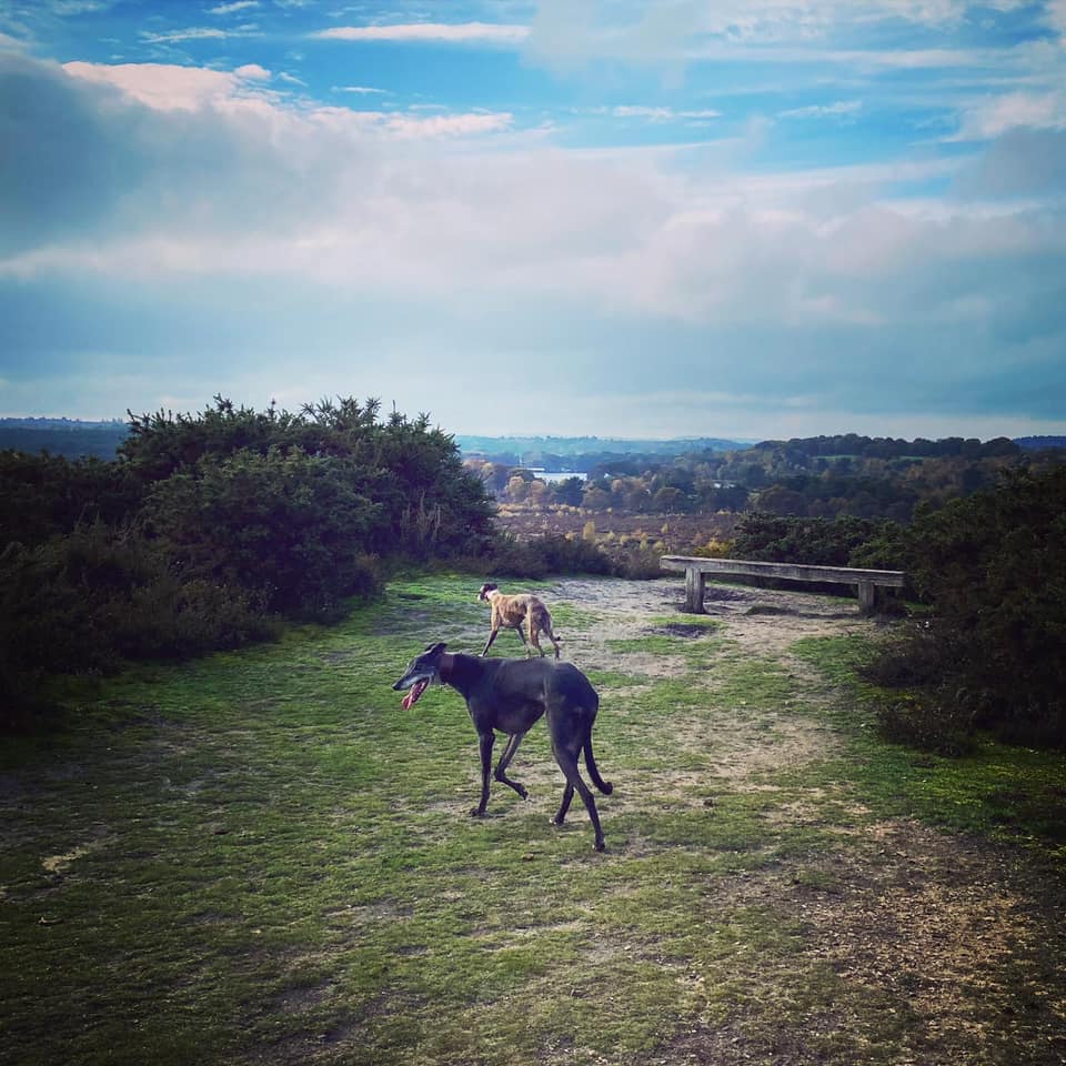
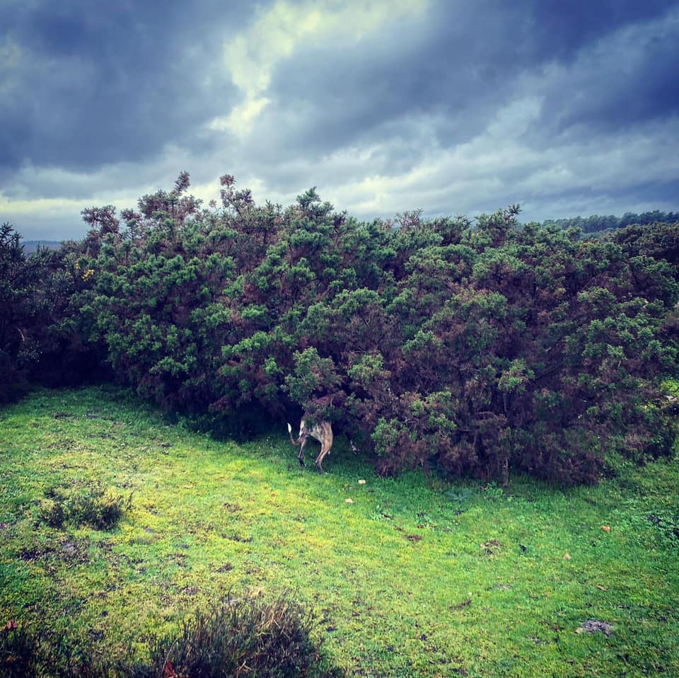
Gallery: What’s it like here?


Instagram reels showing here
Parking
There are two car parks on Priory Lane. The first, on the sharp corner, is free but it is often full.
If you follow the lane round the corner, you’ll come to another car park, which charges for parking unless you are a member of the National Trust, in which case it is free provided you scan your membership card at the pay machine.
NATIONAL TRUST CAR PARK
GOOGLEMAPS LINK: https://goo.gl/maps/bsr5rfbkJsa34nEC9
WHAT3WORDS: https://w3w.co/replayed.diary.fussed
NEAREST POSTCODE: GU10 3BT
FREE PRIORY LANE CAR PARK
GOOGLEMAPS LINK: https://goo.gl/maps/uEdwnWADGb3mnCC37
WHAT3WORDS: https://w3w.co/deputy.impeached.shells
NEAREST POSTCODE: GU10 3BT
Poo bins?
At the car parks, please use them
Self-guided walks
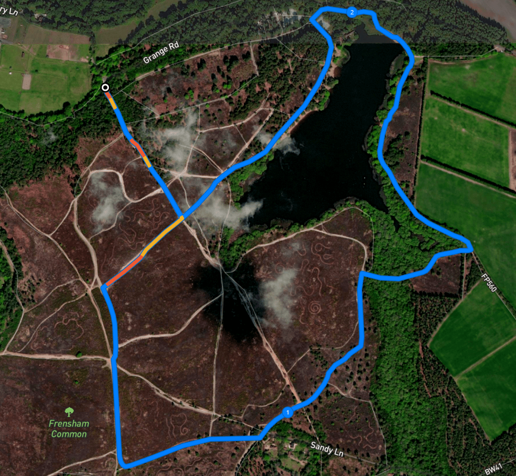
There are two self-guided walks on this page, the first is from the NT car park that is pay and display but free for members, otherwise you need to pay. Keep scrolling down the page to get to the second (or click here to jump down), which is from the free car park on the corner (but often very busy). The routes are largely the same.
Walk from National Trust car park
Here is a Footpath app route from the National Trust car park (free for members) on Priory Lane. Also on AllTrails. You’ll walk along the edge of the little pond, then up the slope (sorry) to the ridge, from which you have lovely views back over Frensham Little Pond and across to Frensham Great Pond. You’ll then head down again to walk around the other side of the pond and back to the car park (past the cafe, or not – the choice is yours).
Length: approximately 2.5 miles/4 km
Terrain: Sandy paths around the pond and through heath. There is one long, steady slope up to the ridge (just take it slow), and a slope down again a little later on, but the rest of it is flat. Plenty of water-side areas for paddling. Sometimes there is blue-green algae growing in the lake but the NT puts signs up when this is the case – don’t allow your dog into the water if the signs are up. The last few times I have been there, the lake has been algae-free though.
Stiles/kissing gates? No stiles, no kissing gates
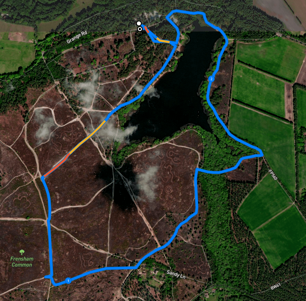
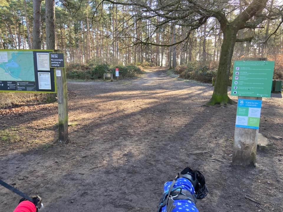
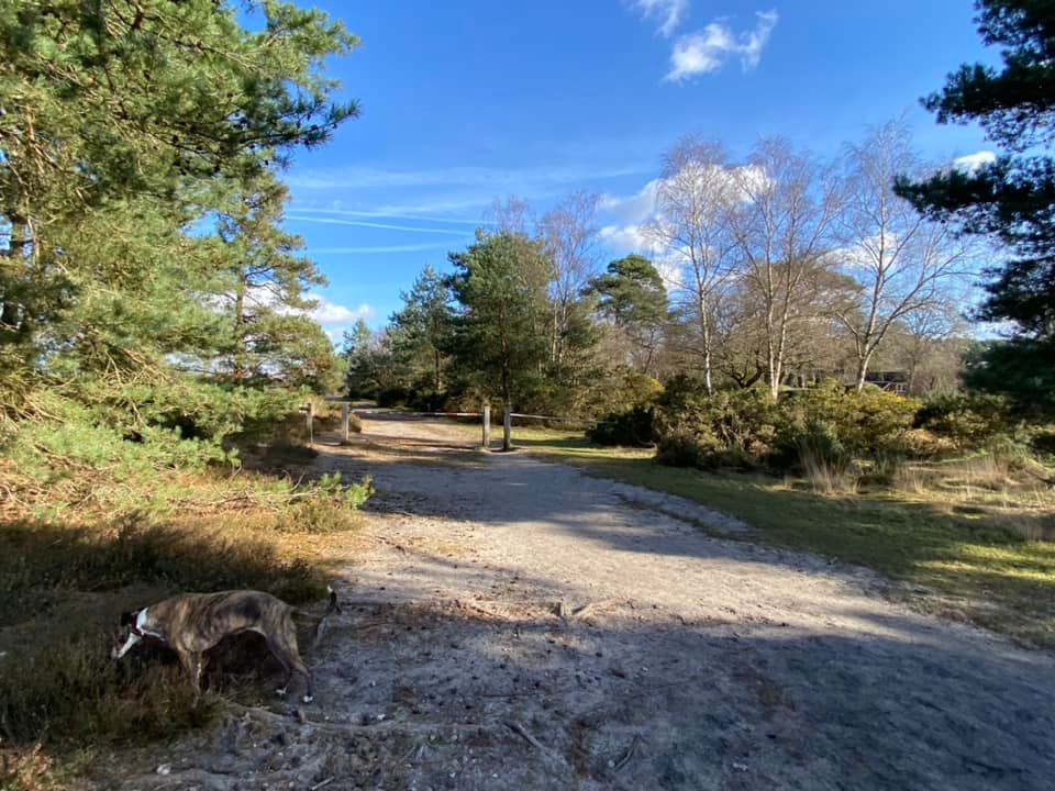
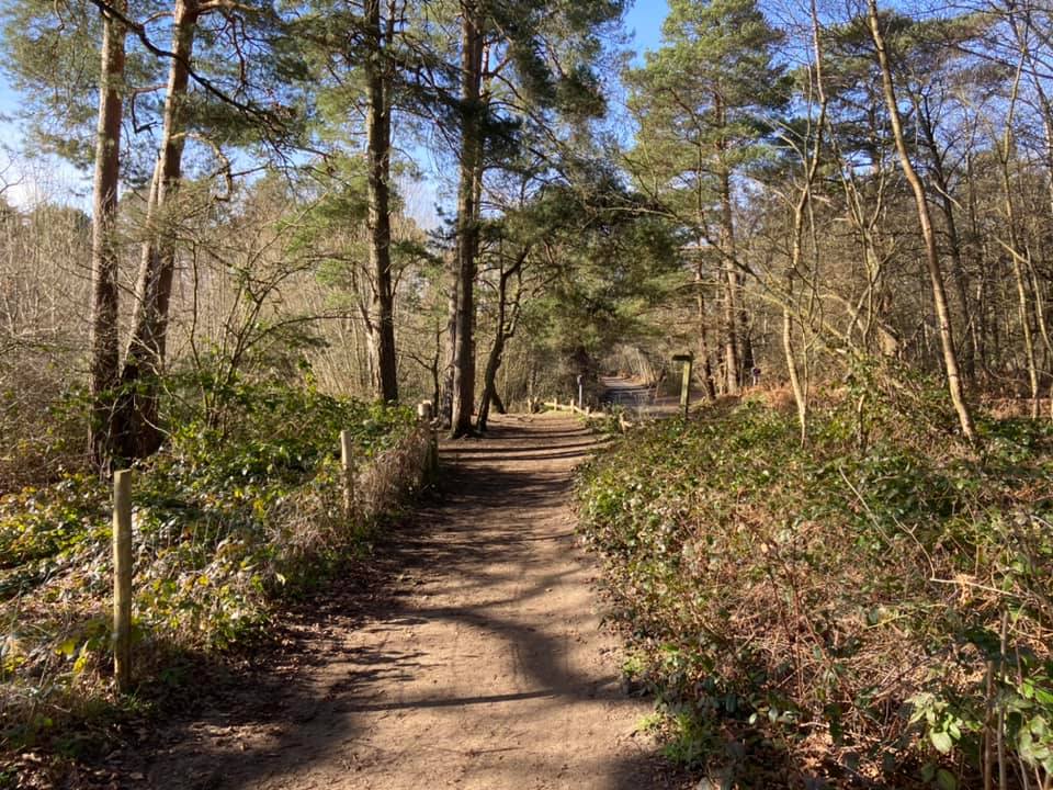
From the rear of the NT car park that you have to pay for/members free (i.e. not the small free car park on Priory Lane – it’s always chocker!), head to the back where the pay station and site information board is. Walk past these and continue straight ahead on the sandy path that heads up into tall, thin conifers. It’ll gently slope down again with a steep hill off up to the right. At the cross paths, turn left and walk down towards the pond, which you will see in the distance ahead of you.
When you reach the pond, turn right and walk along the sandy path running alongside it. The path will become softer/sandier underfoot and you’ll see a path off to the left that continues to follow the edge of the pond. Continue straight here towards the slope you can see ahead with a wide sandy path between heather.


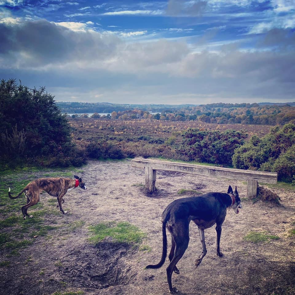
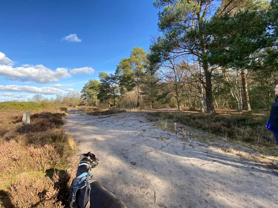
You want to head all the way up the slope, ignoring any side paths and going straight over the large cross paths where the wooden posts are. It’s a long slope, that doesn’t appear to be steep when you start it but as it goes on and on, I swear it gets steeper as you go. When you get to the top, there’s a well-placed bench for a sit down if you need one. Otherwise, turn left and walk along this top ridge. If you look over to the left, you have a lovely view of Frensham Common and Frensham Little Pond.
As you walk along this high path, you will notice on the right an area that has been fenced off – this is the first of three ancient “tumuli” along this ridge. They are bowl barrows, which are funerary monuments dating from the Late Neolithic period to the Late Bronze Age, with most examples belonging to the period 2400-1500 BC. They were constructed as earthen or rubble mounds, sometimes ditched, which covered single or multiple burials. They occur either in isolation or grouped as cemeteries and often acted as a focus for burials in later periods. Quite fitting as I am writing this particular page two days after Rena passed away and the day before I am due to collect her ashes. Anyway, there’s not much to actually see about them so continue onwards.

Just as you get to a second fenced off area (which encloses the two other bowl barrows), there’s a path off to the right. If you walk a few steps down it, you will be rewarded with a nice view of Frensham Great Pond.

When you’re done admiring the view, about turn and walk back to the main path and turn right to continue in the direction you were walking. The path splits here, and you want to take the one on the left, which curves round and heads down the slope.

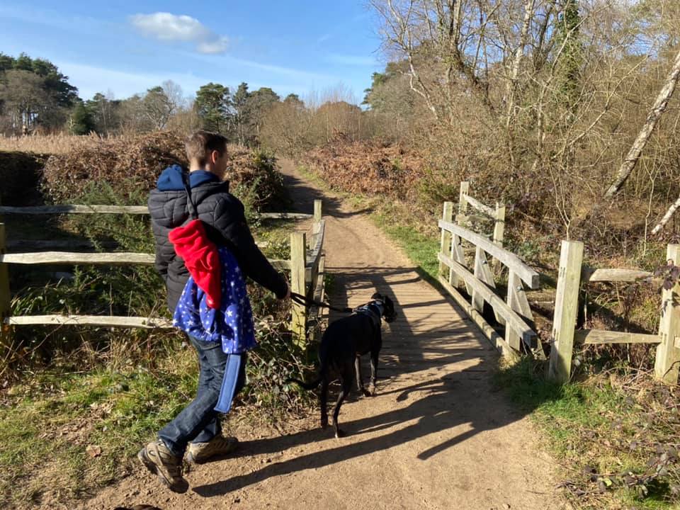
Follow this path down the slope, ignoring any paths off it and eventually, you’ll see a building/house ahead. When you get to the end of the path, with the house still visible, turn left and walk through the barriers.
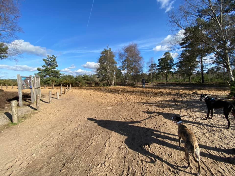
Now follow this path straight (well, it’s a bit wiggly in places, but you know what I mean). At the cross paths where the ground is really, really sandy and there are lots of small wooden posts lining the path by an information board, go straight over.
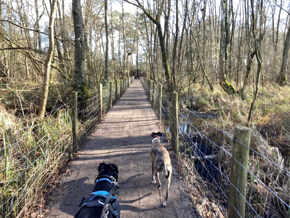
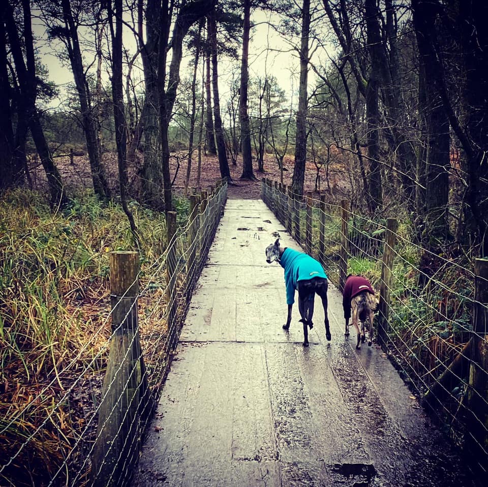
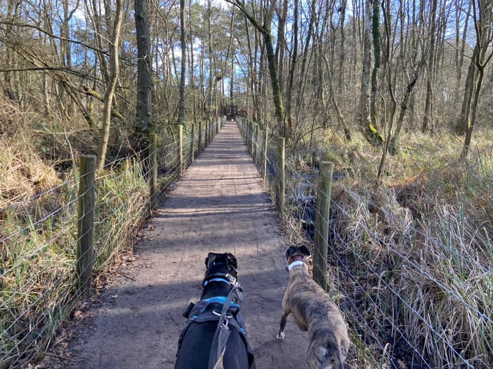
Ignore a couple of small paths on the right hand side as you walk along this bit, but keep your eyes peeled for a pair of wooden posts on your left. Turn right here, and take the path down over a long wooden boardwalk.
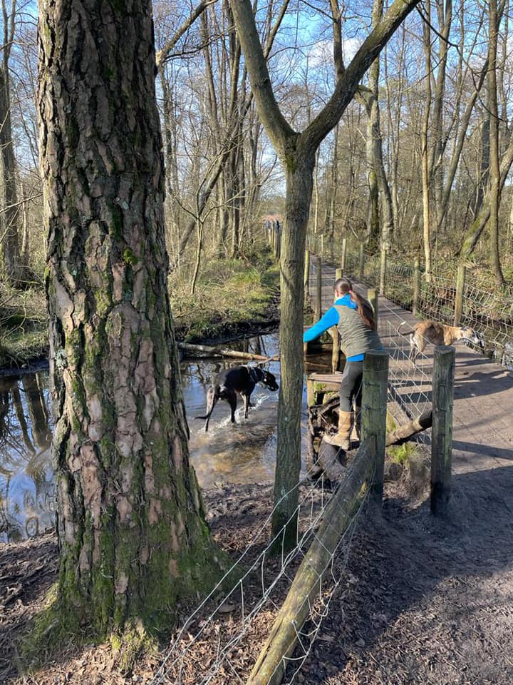
At the end of the boardwalk, follow the path as it bends to the left. Just stay on this path until you reach the end of it at a tall wire fence and a marker post. Turn left here and walk along with the fence on your right. After some distance, you will see a wooden bird hide on the left, through which you can view the birds doing their birdy things on the pond.
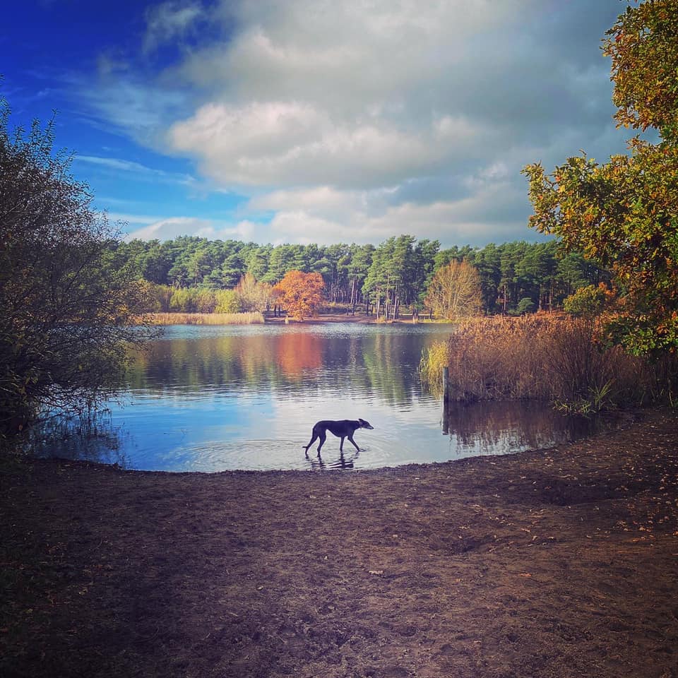
Keep going on the main path and a bit further on, there’ll be a bench on the right, which is opposite a clearing where you can go down the sand to the water’s edge again. This is another nice spot for a little paddle.
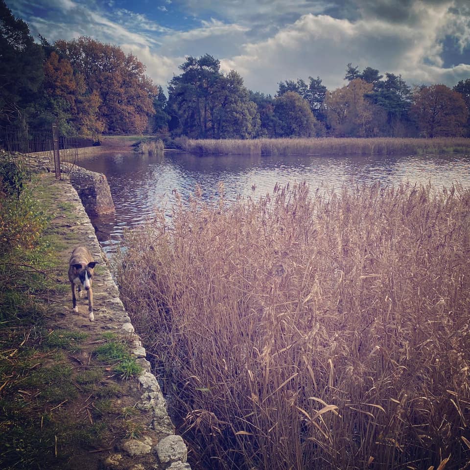
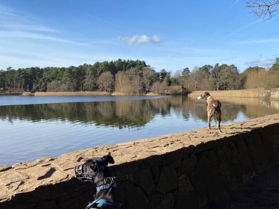
Again on the main path, keep going and when you get to the fork, opt for the left-hand path, which continues around the edge pond. There is a small wall along the pond here, and you can go down to the water again here if you want to, otherwise stick to the path that runs to the right of the wall (or if you’re a whippet, walk on the wall).

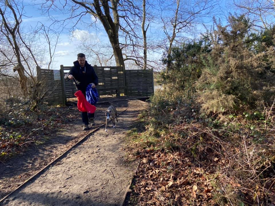
Go over the little wooden bridge by the sluice and, if your dog is off lead, putting them on is a good idea as the path will shortly skirt the edge of the lane with only little wooden posts between. It’s a very quiet lane but cars do use it so better safe than sorry.
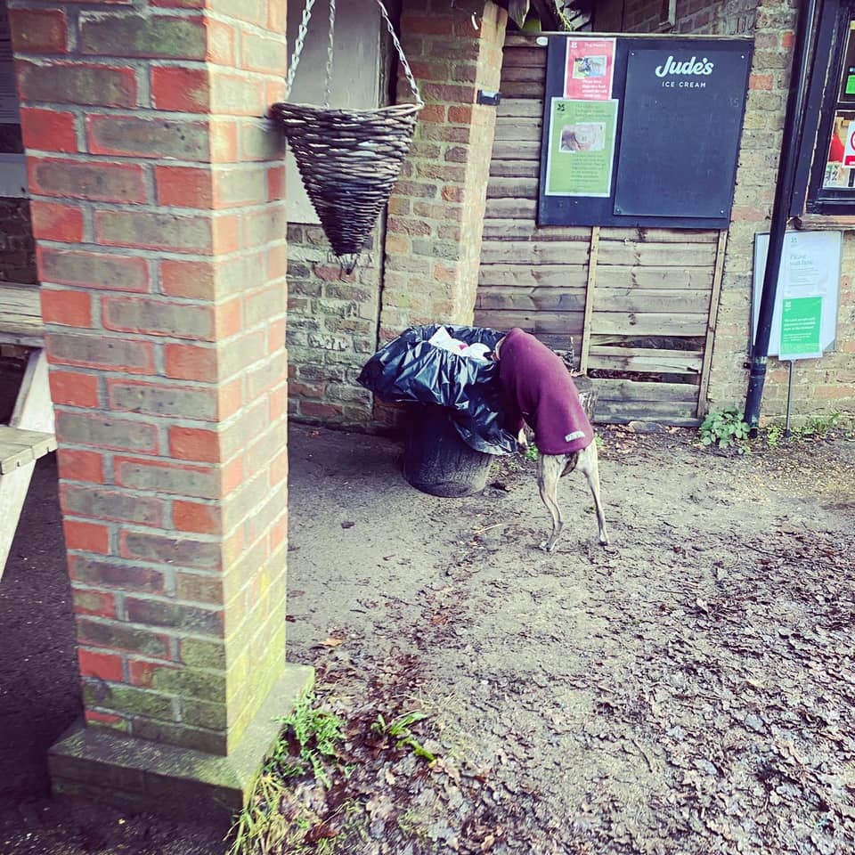
Just stay on the path with the lane on the right-hand side of you. At the marker post by the very low log fence, continue straight and you’ll come to a cross paths next to a big stone donation point and an information board. Here, you can either continue straight until you get back to the information board and pay machine where you started, or, if you fancy a coffee at the cafe or to visit the sandy beach-like areas at the beginning of the walk, turn left, passing the donation point and following the path down to the cafe (on the left).
When you’re done at the cafe/beachy bit, retrace your steps back through the trees, then turning right at the cross paths in the middle of the tree area to go back to the car park.
Walk from small free car park on corner of Priory Lane
Here is a Footpath app route from the little free car park on the sharp corner of Priory Lane. Also on AllTrails. You’ll walk through the conifers to the heath, then up the slope (sorry) to the ridge, from which you have lovely views over Frensham Little Pond and across to Frensham Great Pond. You’ll then head down again to walk around the pond (via cafe, or not – the choice is yours) and back to the car park.
Length: approximately 2.5 miles/4 km
Terrain: Sandy paths around the pond and through heath. There is one long, steady slope up to the ridge (just take it slow), and a slope down again a little later on, but the rest of it is flat. Plenty of water-side areas for paddling. Sometimes there is blue-green algae growing in the lake but the NT puts signs up when this is the case – don’t allow your dog into the water if the signs are up. The last few times I have been there, the lake has been algae-free though.
Stiles/kissing gates? No stiles, no kissing gates
Take the main path from the rear of the little free car park. Stay on this long, straight path and emerge from the trees into open heath and the ground is very sandy underfoot, ignoring paths to the left and right until you get to a sizeable junction of paths, where small wooden posts line the path you are on and go across the path cutting left to right. Turn right here and go up the long slope. This doesn’t appear to be steep when you start it but as it goes on and on, I swear it gets steeper as you go. When you get to the top, there’s a well-placed bench for a sit down if you need one. Otherwise, turn left and walk along this top ridge. If you look over to the left, you have a lovely view of Frensham Common and Frensham Little Pond.
As you walk along this high path, you will notice on the right an area that has been fenced off – this is the first of three ancient “tumuli” along this ridge. They are bowl barrows, which are funerary monuments dating from the Late Neolithic period to the Late Bronze Age, with most examples belonging to the period 2400-1500 BC. They were constructed as earthen or rubble mounds, sometimes ditched, which covered single or multiple burials. They occur either in isolation or grouped as cemeteries and often acted as a focus for burials in later periods. Quite fitting as I am writing this particular page two days after Rena passed away and the day before I am due to collect her ashes. Anyway, there’s not much to actually see about them so continue onwards.
Just as you get to a second fenced off area (which encloses the two other bowl barrows), there’s a path off to the right. If you walk a few steps down it, you will be rewarded with a nice view of Frensham Great Pond.
When you’re done admiring the view, about turn and walk back to the main path and turn right to continue in the direction you were walking. The path splits here, and you want to take the one on the left, which curves round and heads down the slope.
Follow this path down the slope, ignoring any paths off it and eventually, you’ll see a building/house ahead. When you get to the end of the path, with the house still visible, turn left and walk through the barriers.
Now follow this path straight (well, it’s a bit wiggly in places, but you know what I mean). At the cross paths where the ground is really, really sandy and there are lots of small wooden posts lining the path by an information board, go straight over.
Ignore a couple of small paths on the right hand side as you walk along this bit, but keep your eyes peeled for a pair of wooden posts on your left. Turn right here, and take the path down over a long wooden boardwalk.
At the end of the boardwalk, follow the path as it bends to the left. Just stay on this path until you reach the end of it at a tall wire fence and a marker post. Turn left here and walk along with the fence on your right. After some distance, you will see a wooden bird hide on the left, through which you can view the birds doing their birdy things on the pond.
Keep going on the main path and a bit further on, there’ll be a bench on the right, which is opposite a clearing where you can go down the sand to the water’s edge. This is a nice spot for a little paddle.
Again on the main path, keep going and when you get to the fork, opt for the left-hand path, which continues around the edge pond. There is a small wall along the pond here, and you can go down to the water again here if you want to, otherwise stick to the path that runs to the right of the wall (or if you’re a whippet, walk on the wall).
Go over the little wooden bridge by the sluice and, if your dog is off lead, putting them on is a good idea as the path will shortly skirt the edge of the lane with only little wooden posts between. It’s a very quiet lane but cars do use it so better safe than sorry.
Just stay on the path with the lane on the right-hand side of you. At the marker post by the very low log fence, continue straight and you’ll come to a cross paths next to a big stone donation point and an information board. Turn left, passing the donation point (it’ll be on your right as you pass it) and following the path down to the cafe (on the left). At the cafe, the path bends to the right and you’ll see a sandy beach-like area at the pond edge, which is great for dogs that like a bit of splash about fun.
Continue straight along the sandy path running alongside the pond. It will become softer/sandier underfoot and you’ll see a path off to the left that continues to follow the edge of the pond.
Continue straight here towards the slope and up to the cross paths/junction with the little wooden posts that you turned right at earlier to go up to the ridge.

At the little wooden posts, turn right and walk back to the little car park.
