Page contents
About
Gallery
Instagram reel showing this place
Parking
Poo bins?
Self-guided walk
About
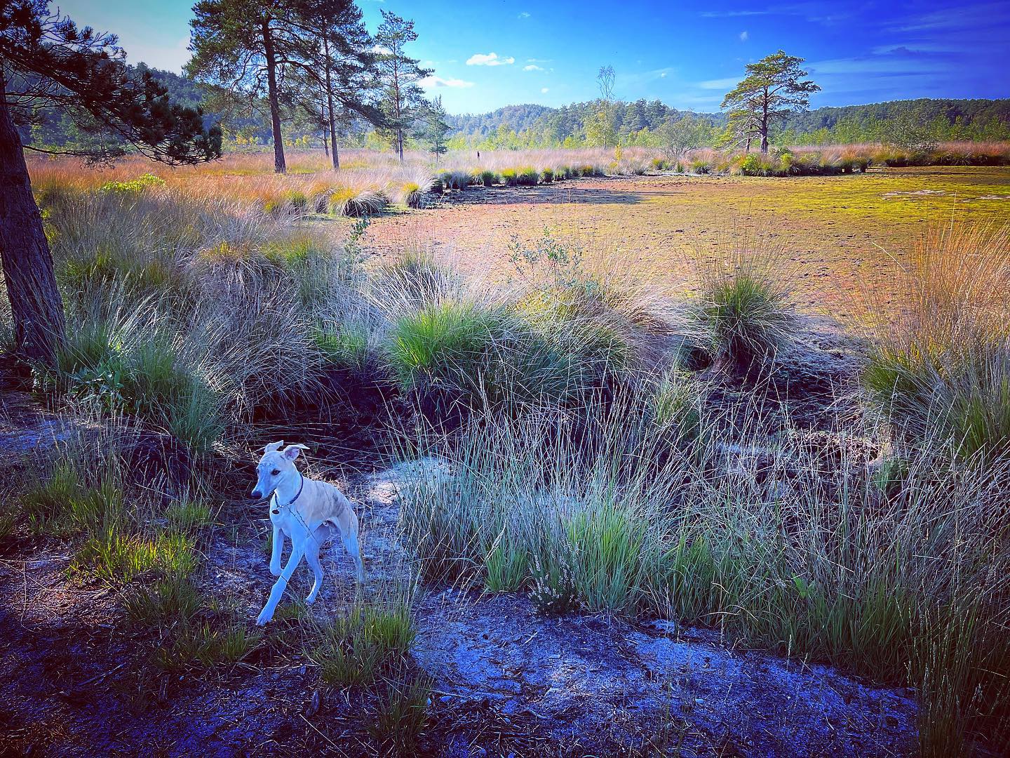
Churt Common, known locally as The Flashes, comprises 106 hectares of heathland and bog to the south-east of Frensham Common. Heathland is actually very rare, although you may not believe it given that the south of England is blessed with quite a lot, but globally, it covers less area than the area covered by tropical rainforests.
Most heathland is found on dry, sandy soils so the wet heathland areas/boggy parts of Churt Common are particularly rare. Consequently, Churt Common/The Flashes is designated a Site of Special Scientific Interest (SSSI), a Special Protection Area (SPA), a Special Area of Conservation (SAC) and and Local Nature Reserve (LNR).
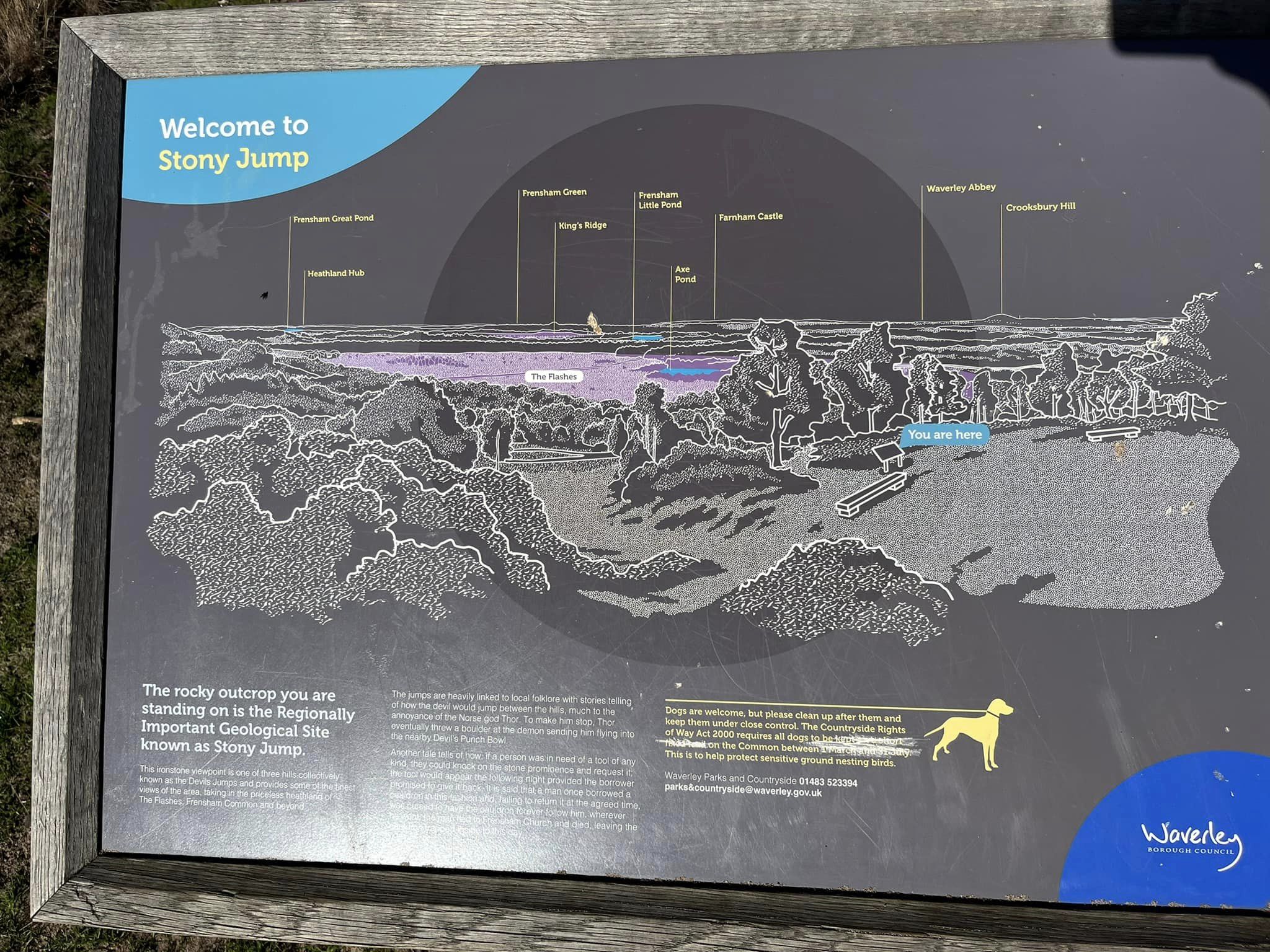
Stony Jump is one of three conical shaped ironstone hills collectively known as The Devil’s Jumps. As noted on my Frensham Little Pond post, according to local folklore, the Devil used to amuse himself by leaping from the top of each hill to the next, which pissed off the god Thor who picked up a boulder and threw it at the Devil, causing him to flee. Firstly, local folk clearly smoked too much weed back whenever this story originated. Secondly, since when has jumping around hill tops been enjoyable? Thirdly, why would it bother the almighty Thor anyway? Fourthly, the Devil and Thor don’t exist – and here we come full circle as I refer you back to ”firstly”.
Another tale says that Mother Ludlam (a local witch) had her cauldron stolen by the Devil and he took off in great leaps and bounds. The witch chased after him on her broomstick and every time the Devil took a great leap he kicked up a hill, creating the Devil’s Jumps. (So he only made three super big leaps, not that impressive really, is it?) Anyway, apparently he left the cauldron on Hankley Common’s Kettlebury Hill (a walk that includes this hill is described here), from where it was recovered and put in Frensham church for safekeeping. When the Devil disappeared after yet another barney with Thor, he scooped up a handful of earth to fling at him and created the Devil’s Punch Bowl (this website has a walk for that location too.)
Note – I have quite a few other walks for this area, including:
– Elstead Common from Moat Pond
– Royal Common, Forked Pond and Thursley Nature Reserve fringes
– Thursley Common National Nature Reserve
– from the village of Thursley (to be added)
– Hankley Common – Atlantic Wall
– Hankley Common – route following the Greensand Way through Hankley golf course and via Stockbridge Pond (to be added)
– Hankley Common south side from Pitch Place
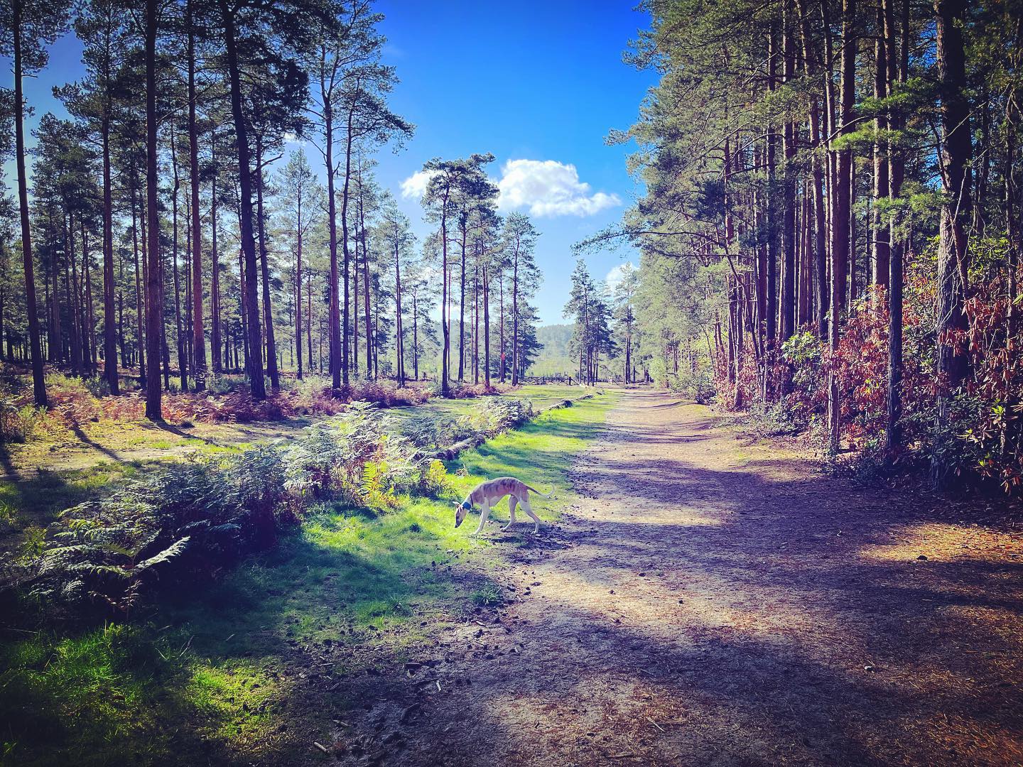
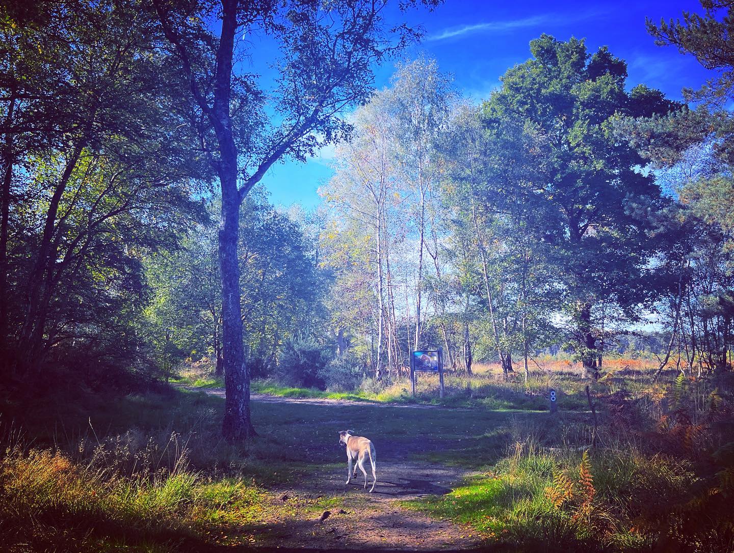
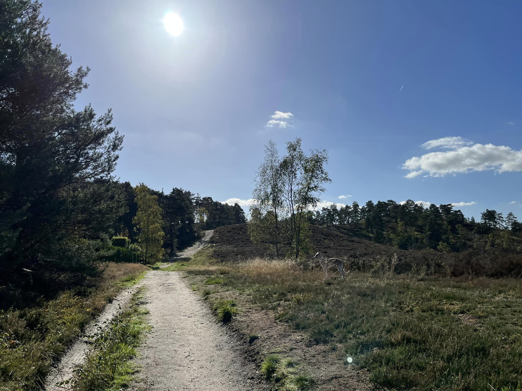
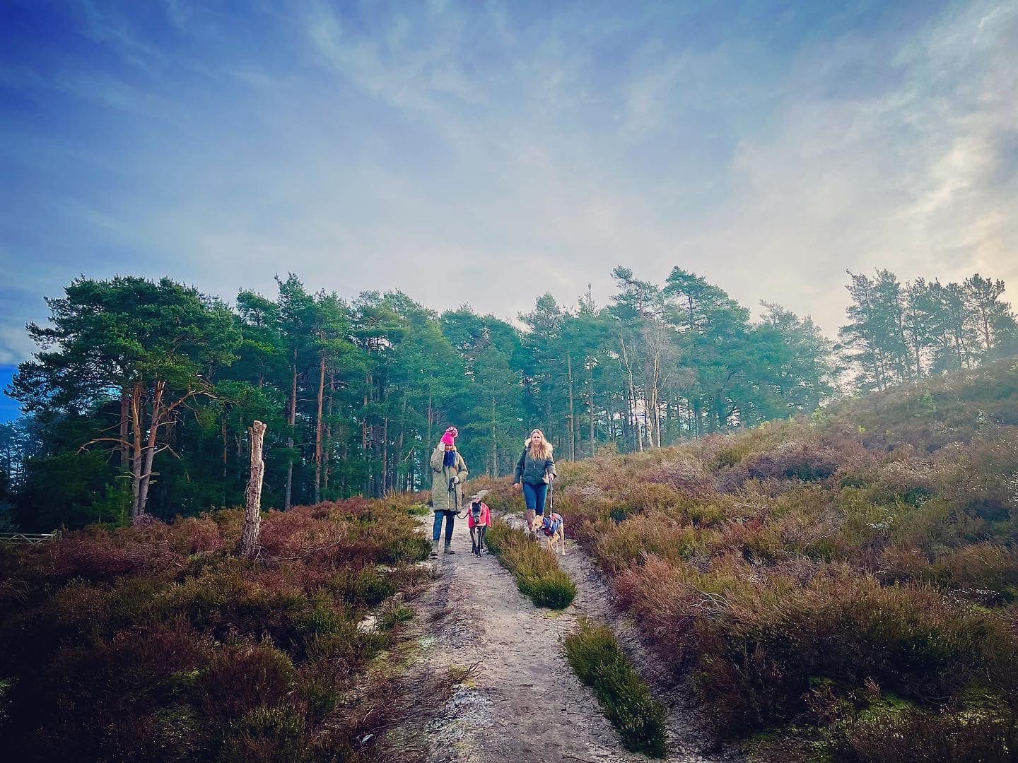
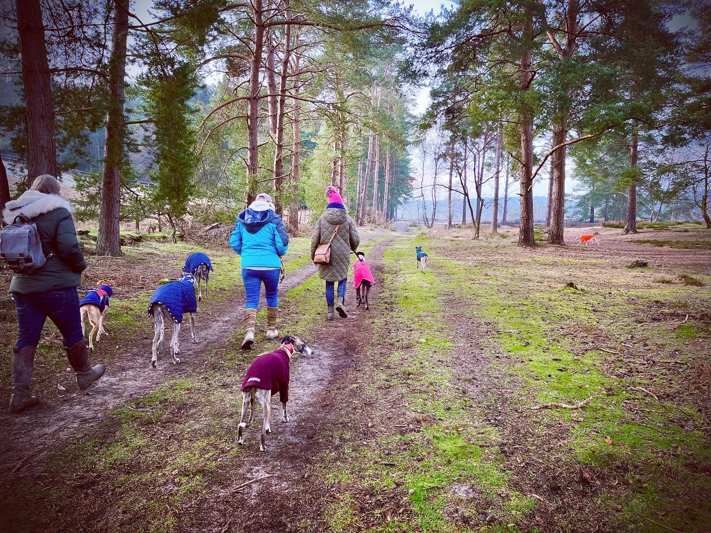
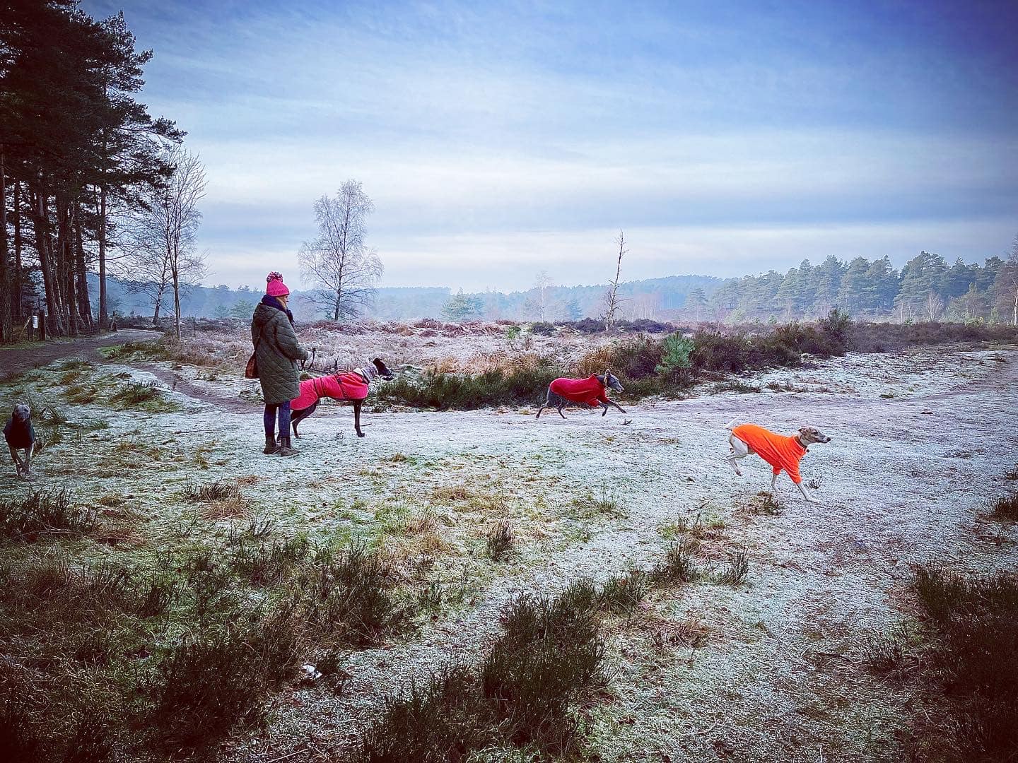
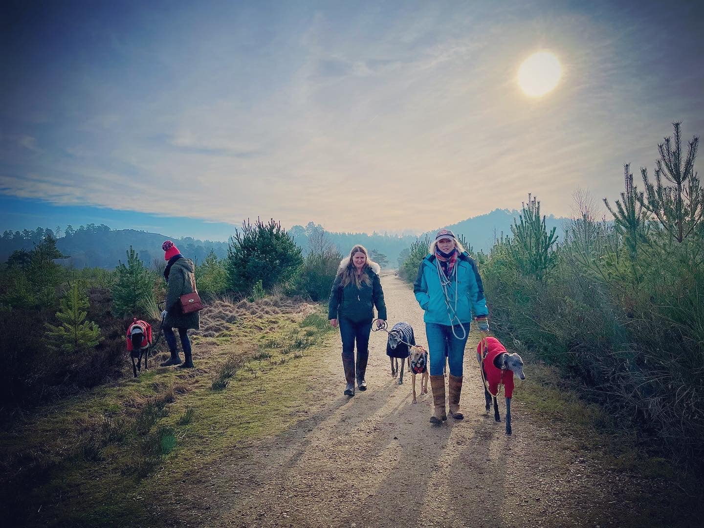
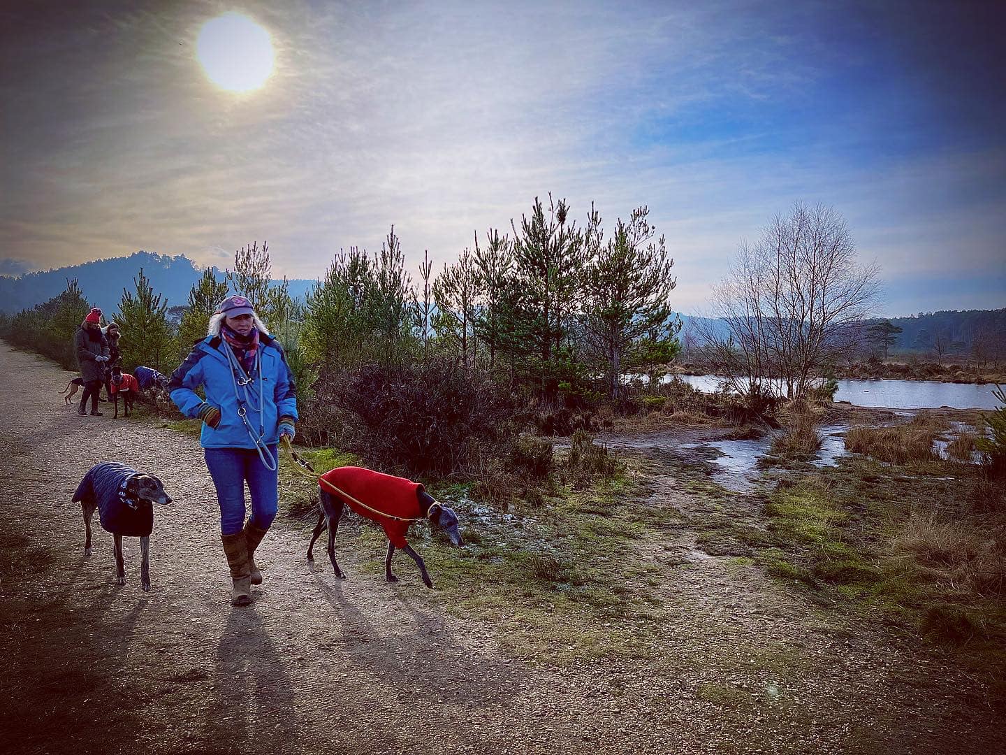
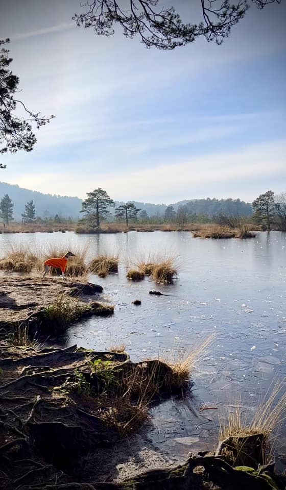
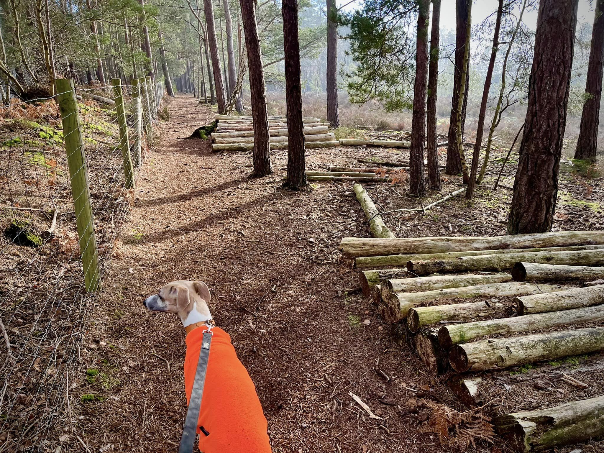
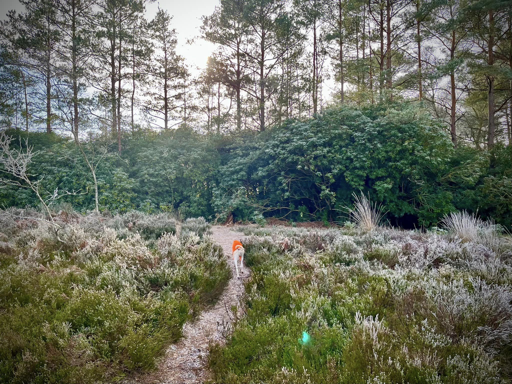
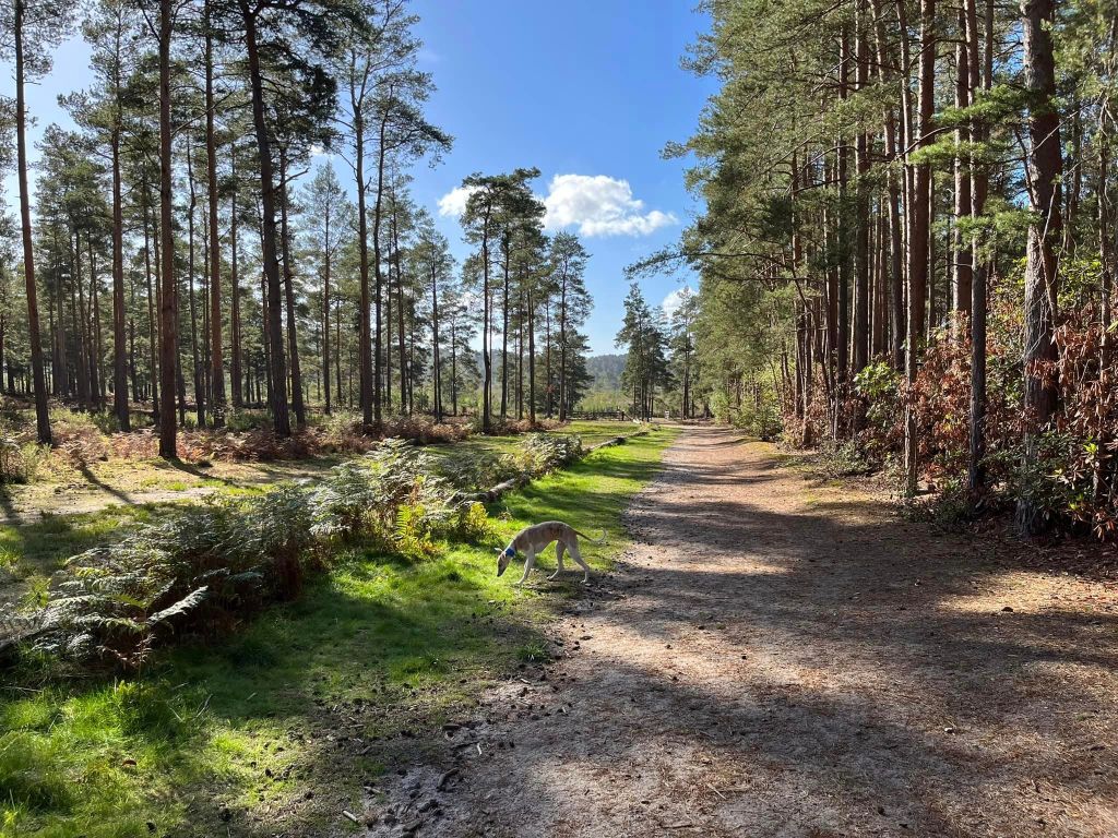
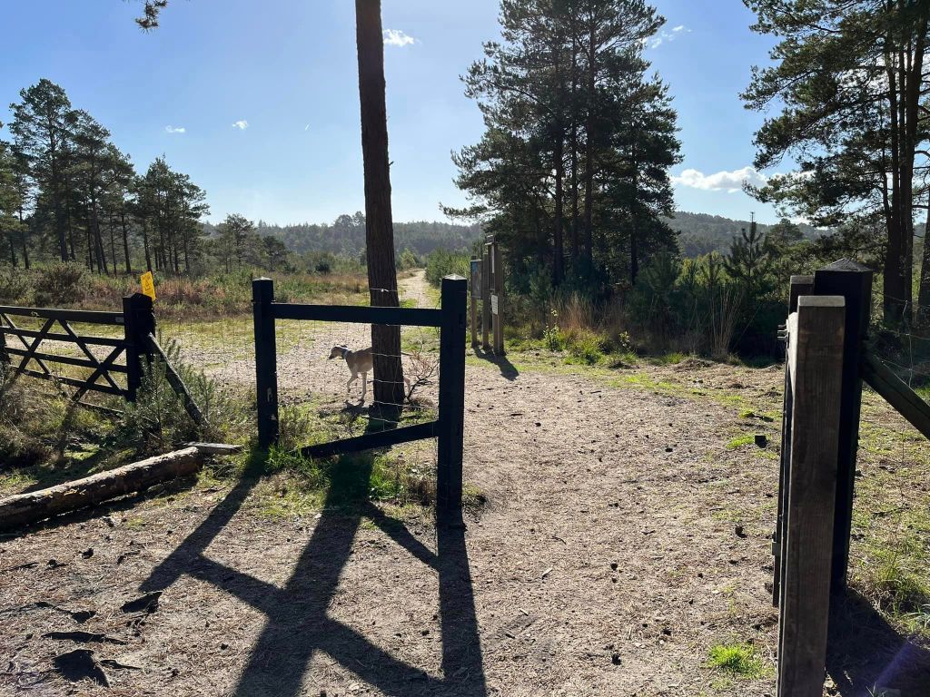
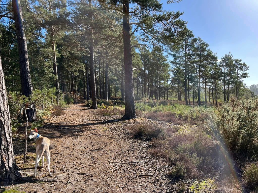
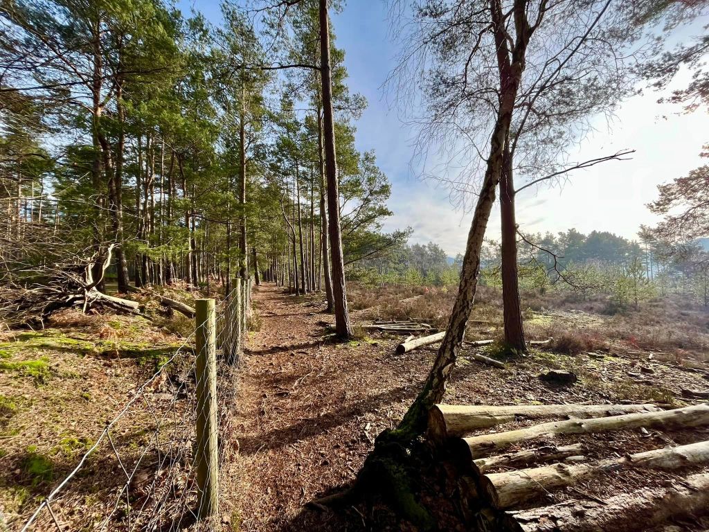
The Gallery: What’s it like here?


Instagram reel showing this place
Parking
Park on Sandy Lane in Rushmoor.
Drive straight down Sandy Lane and round the sharp bend to the left. The houses will come to an end – keep going until you come to Lowicks House (it is on the left). Park on the roadside here. The kissing gate just before the house’s driveway is the one you’ll go through to access the walk on this page.


Poo bins?
There is a poo bin by the gate on Sandy Lane.
Self-guided walk
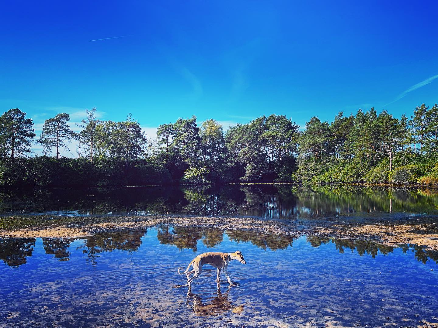
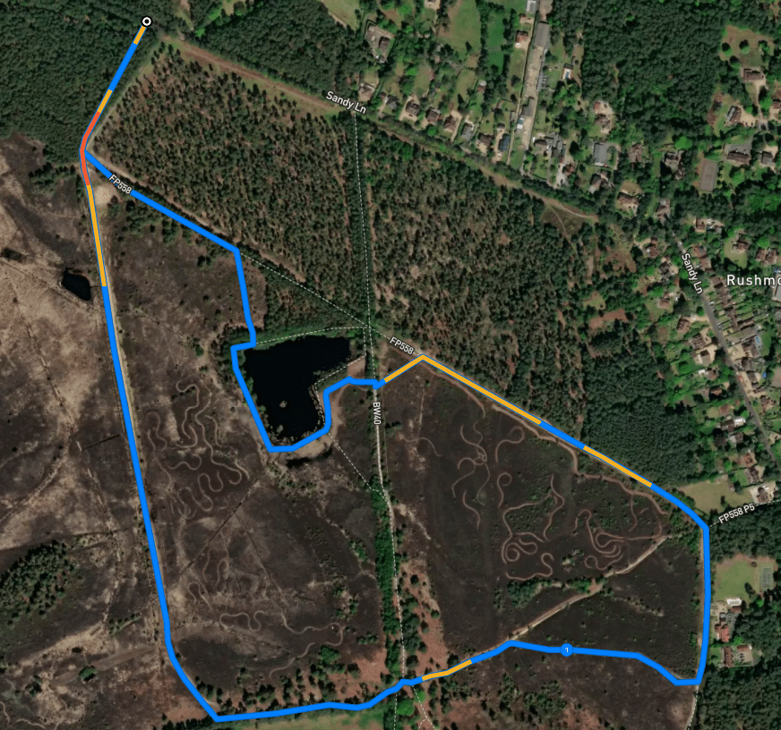
Here is a Footpath app route that takes you around the area known as The Flashes. Also on AllTrails. It goes around the perimeter of Axe Pond, then up Stony Jump, and includes an optional detour to the viewpoint.
Length: approximately 2.2 miles/3.5 km
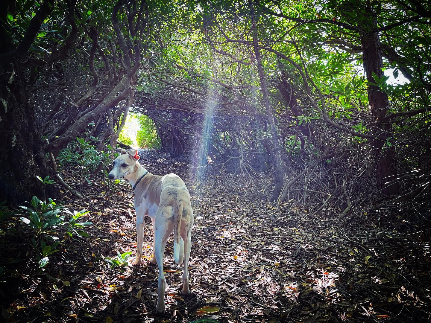
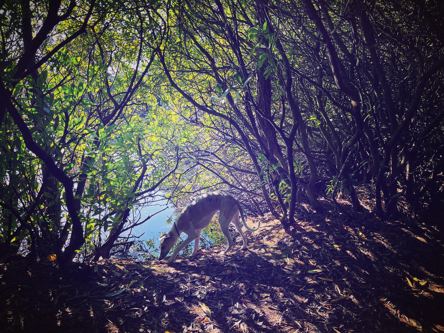
Terrain: Mainly wide sandy paths but also a section of narrow paths through heathland and inside (!) a rhododendron bush that goes around Axe Pond.
Stiles/kissing gates? No stiles, one kissing gate
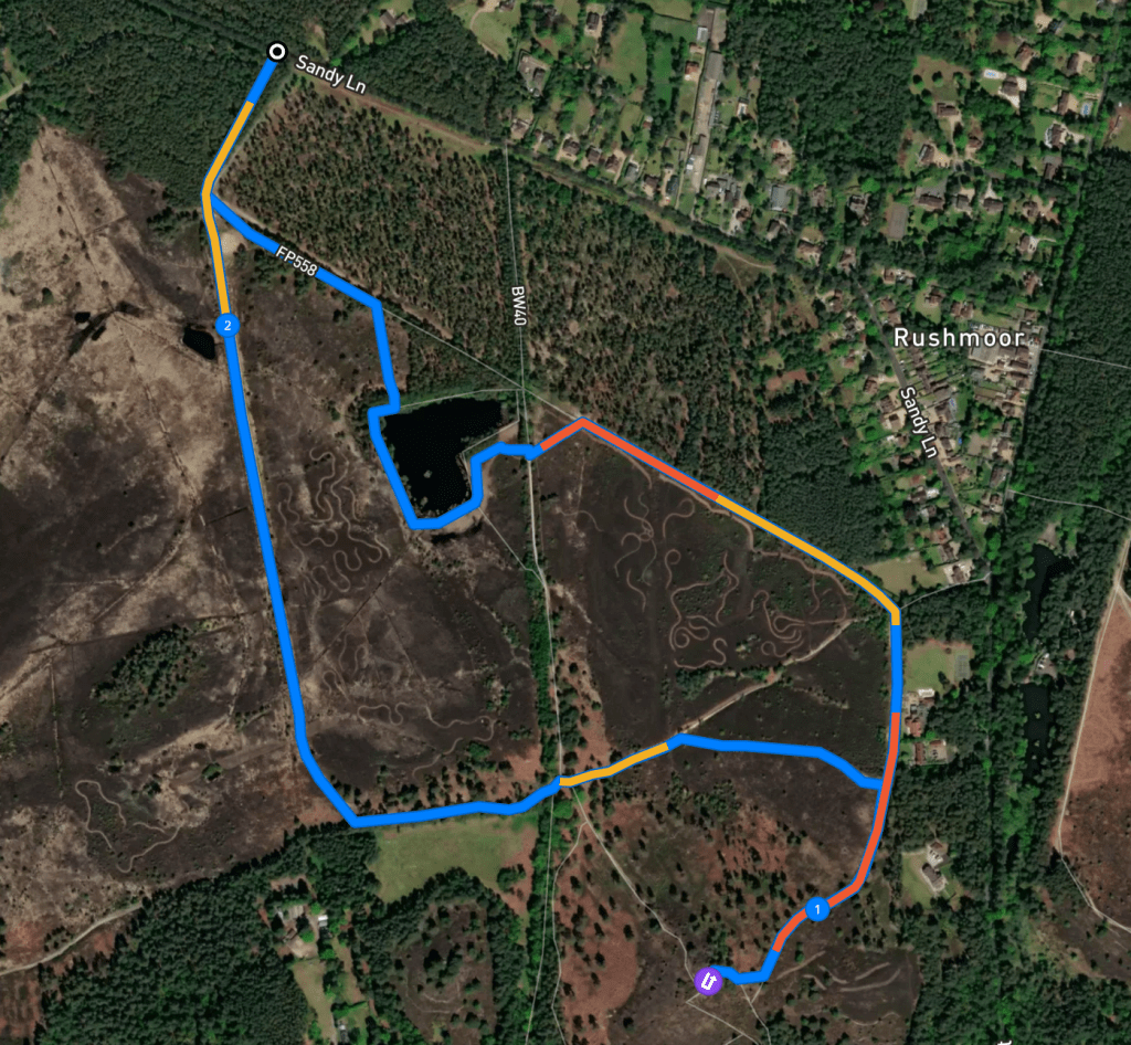
Two alternative routes cut out Stony Jump hill – one is 1.7 miles (2.74km) long and totally flat (Footpath app link). The other is 1.79 miles (2.88km) long and includes some of the hill (Footpath app link). Directions for both are incorporated in the full walk description.

Full route directions
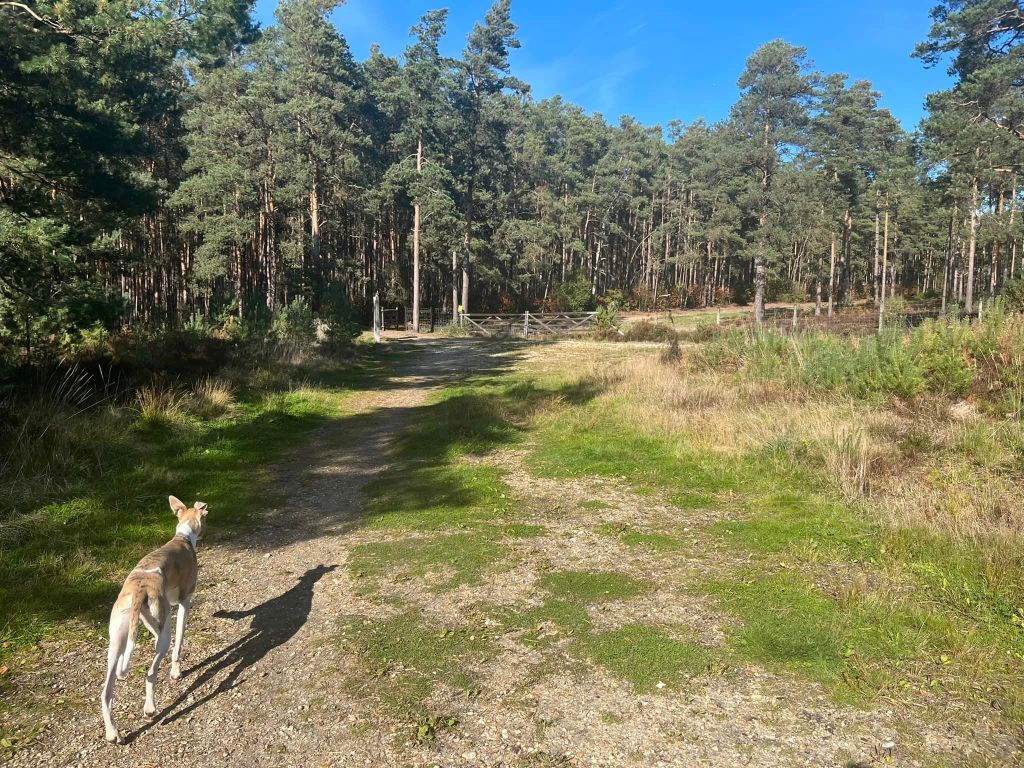
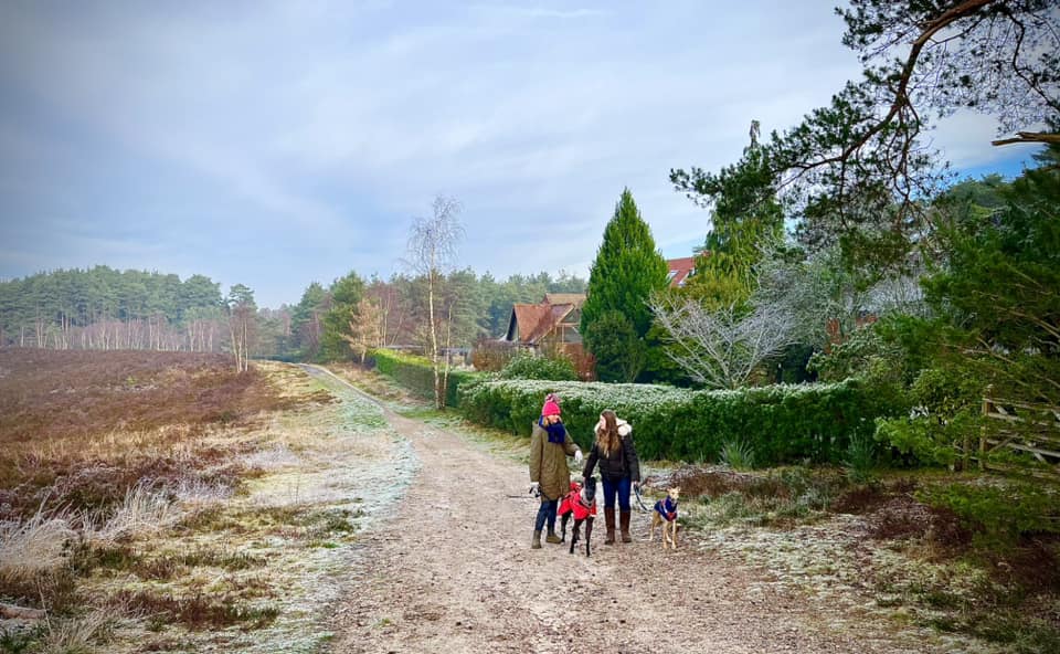
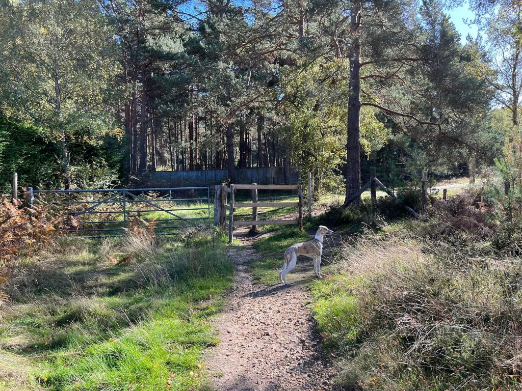
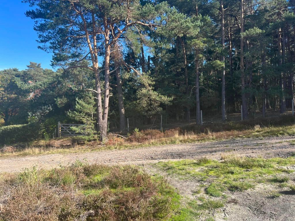
Go through the metal kissing gate to the left of the driveway to Lowicks House and follow the path lined by tree trunks on its left-hand side. At the end of this, go through the gate and turn left to walk along with the fence line on your left.
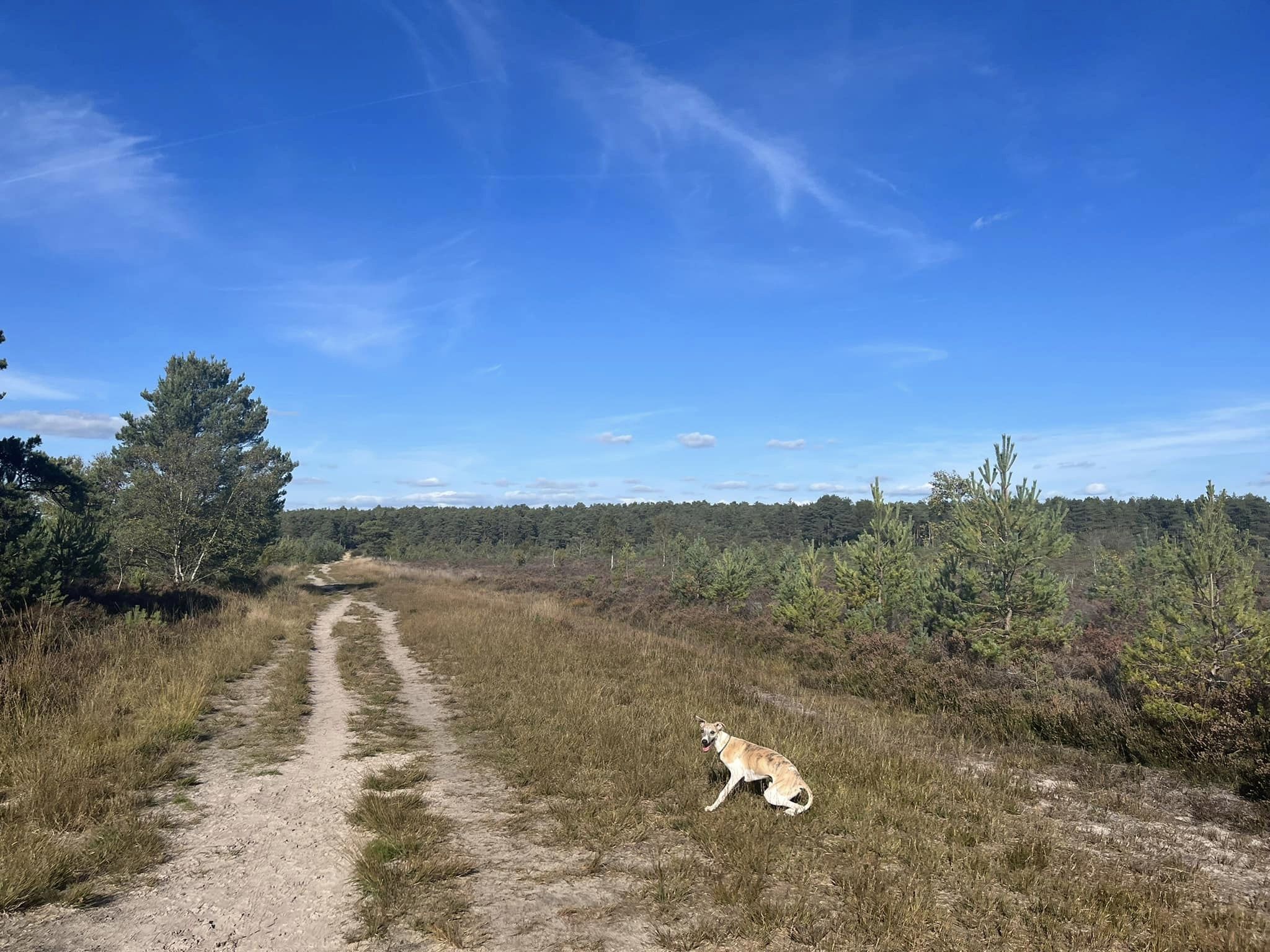
Keep an eye out for a tiny path off to the right – it is after several piles of logs and opposite an upturned tree stump (to the left just on the other side of the wire fence). Take this and wind through heathland and between little fir trees.


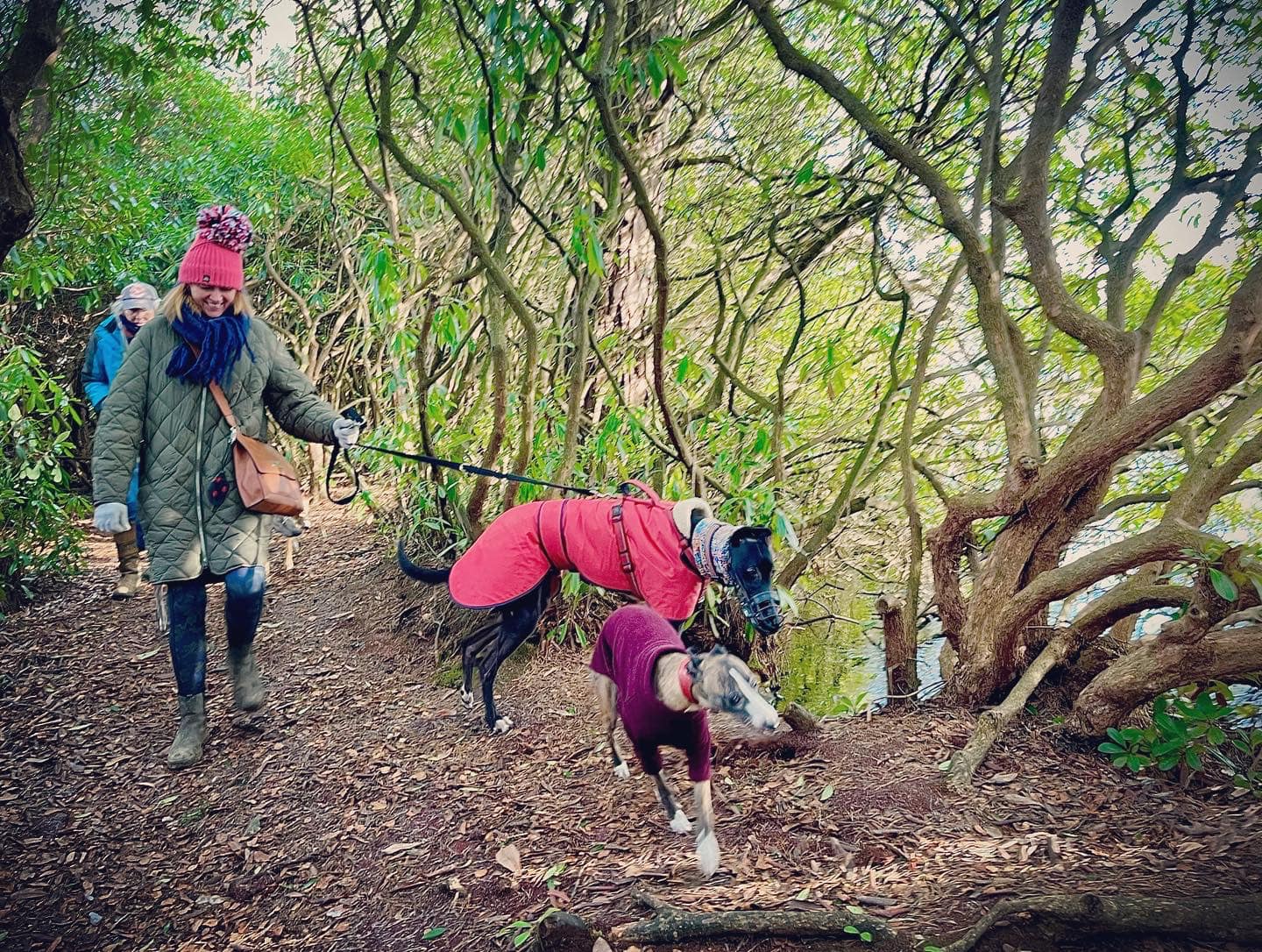
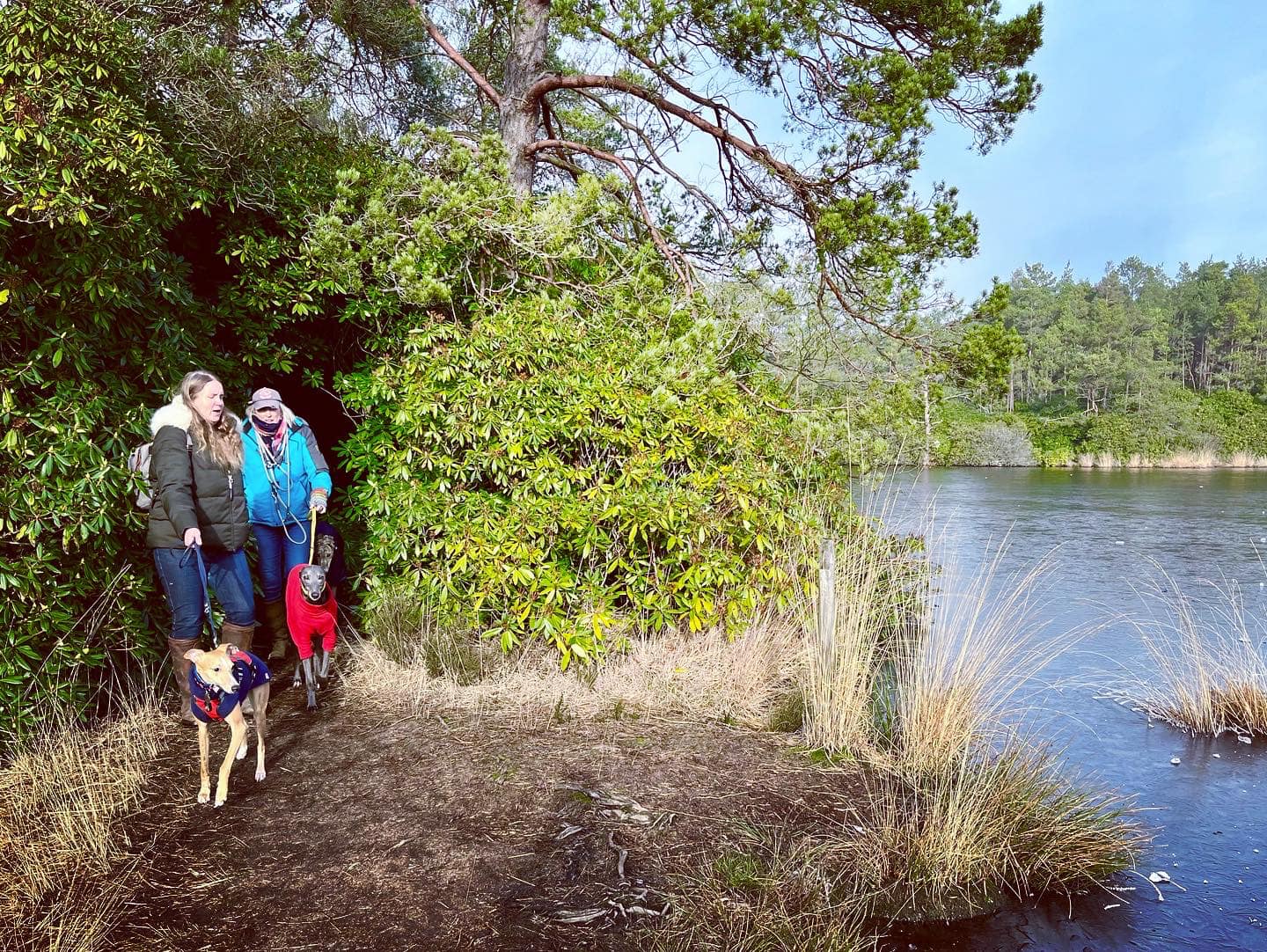
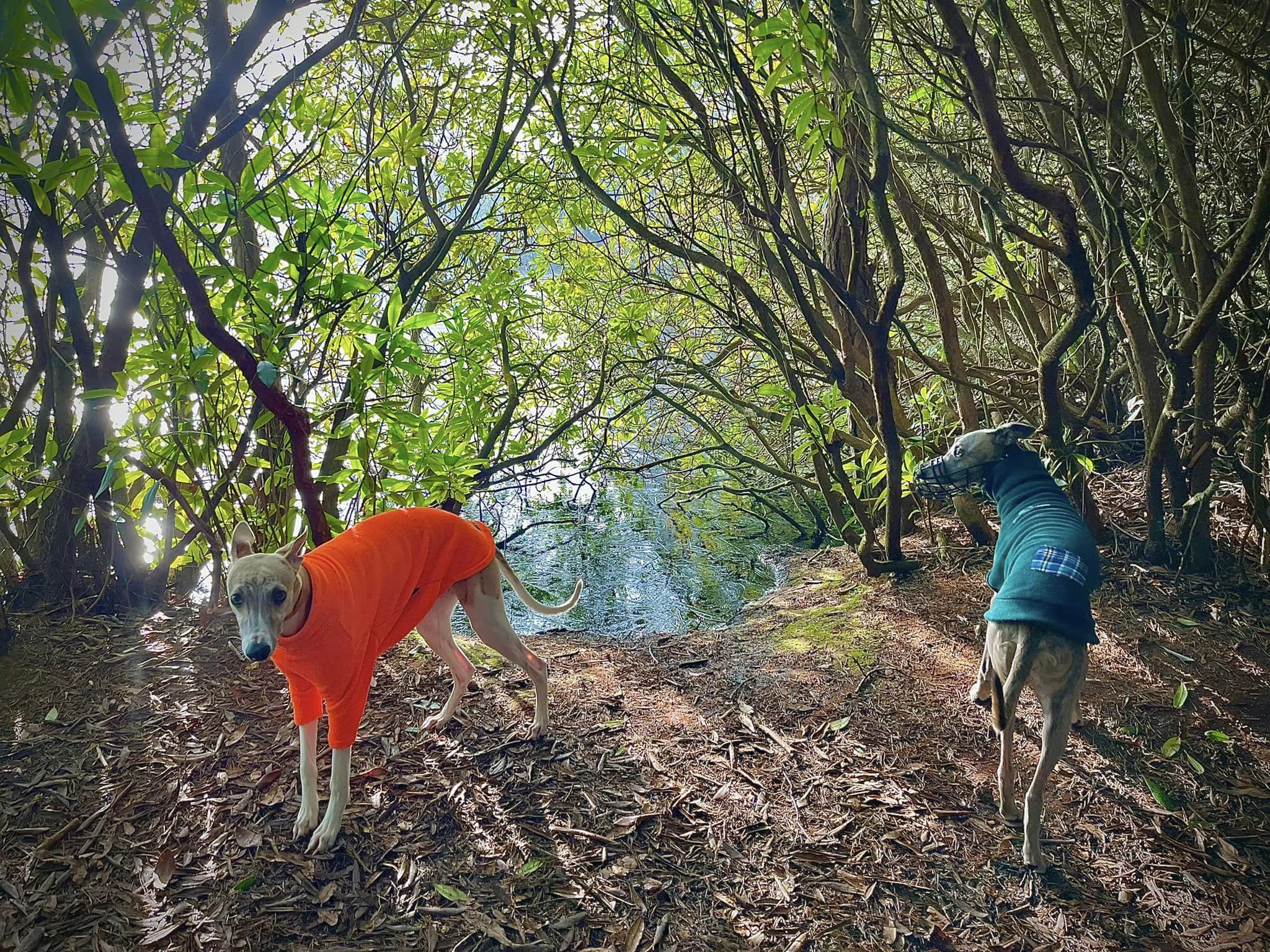
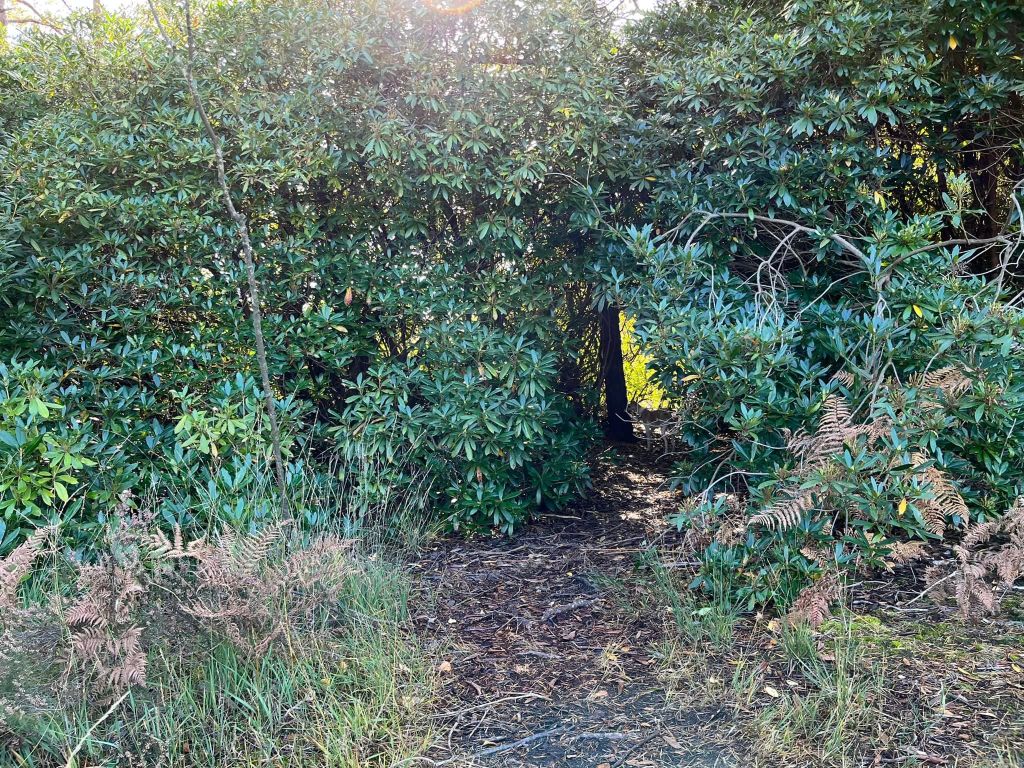
At the end of this path, you’ll find yourself facing a tall rhododendron bush. Look closely and you’ll see an arch/gap in the branches/leaves – continue straight ahead through this and you’ll head down to Axe Pond.

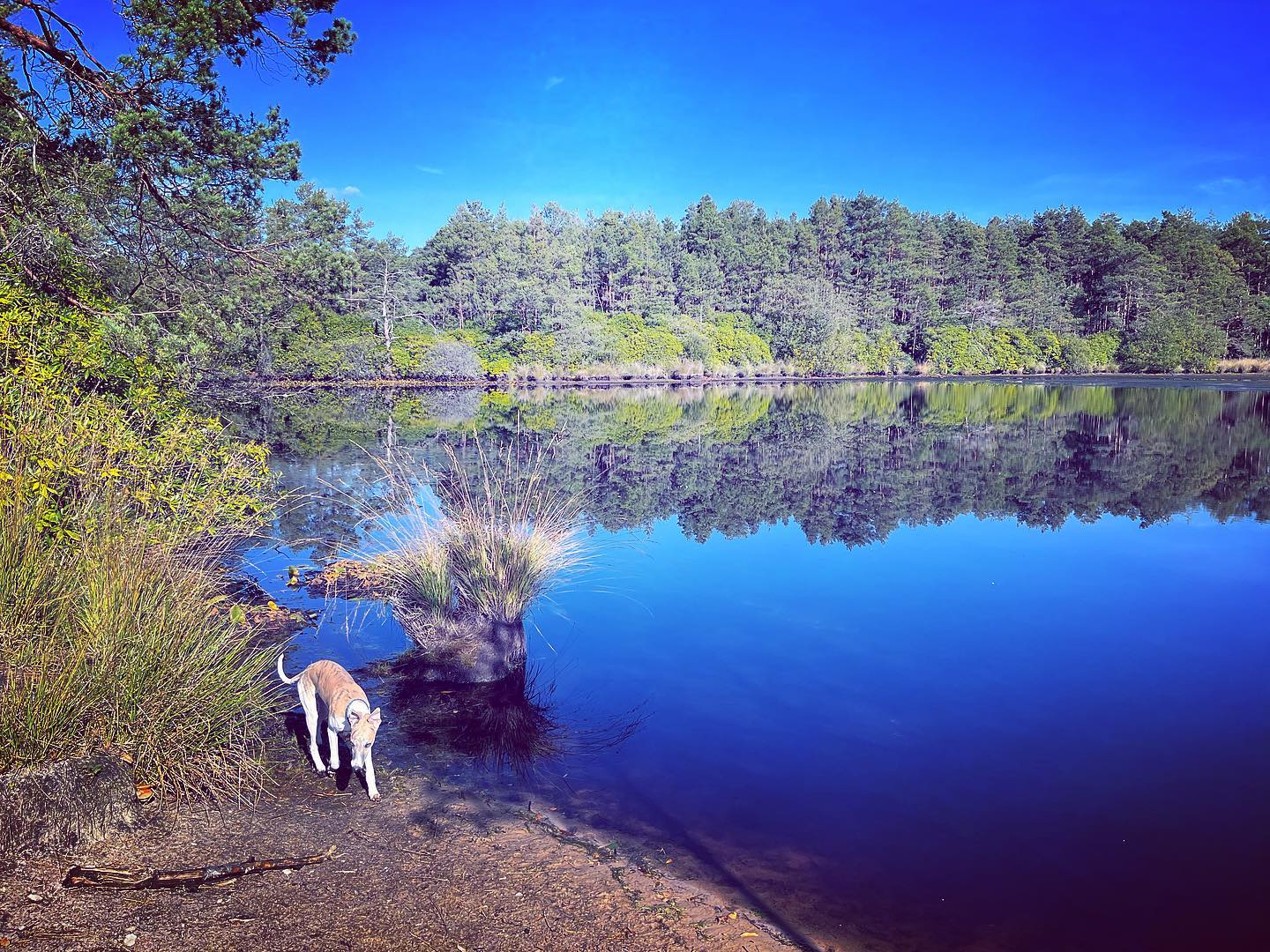
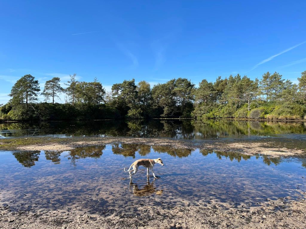
Turn right at the water and follow this sheltered path through the bush and around the pond, crossing over some planks part-way around.
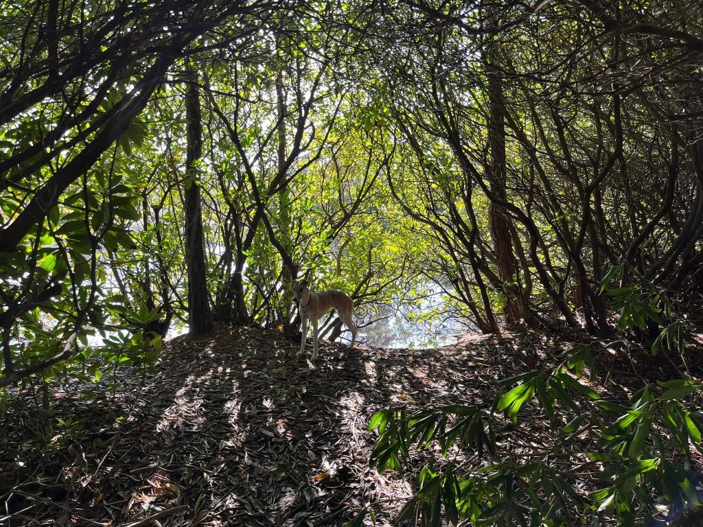
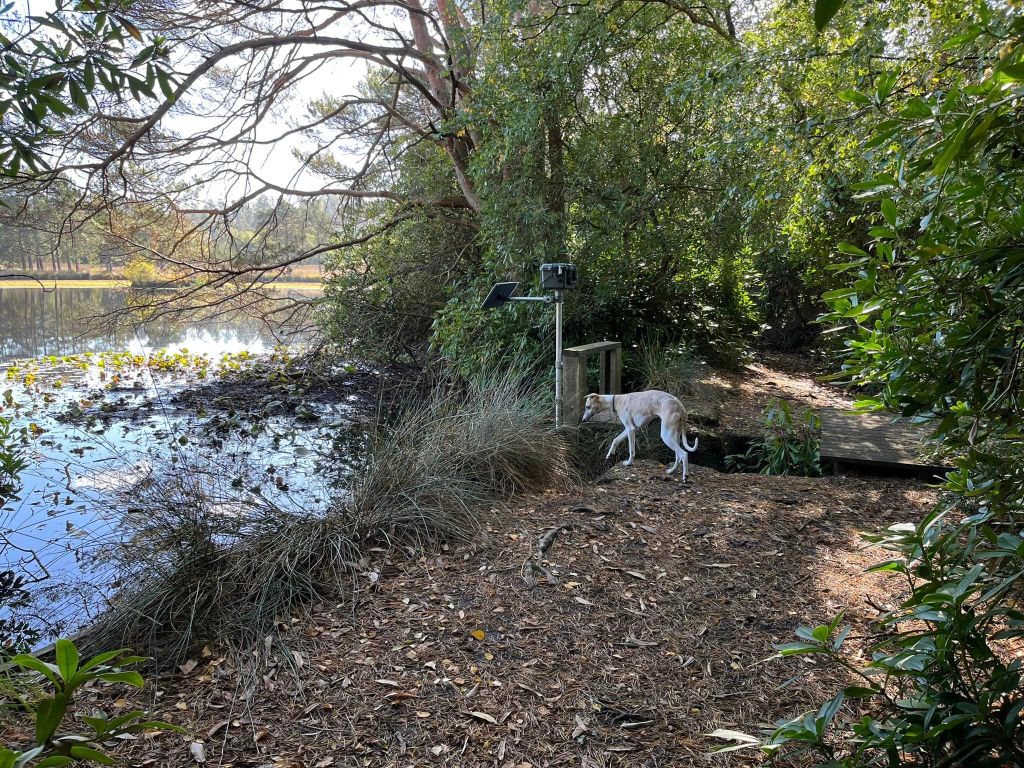


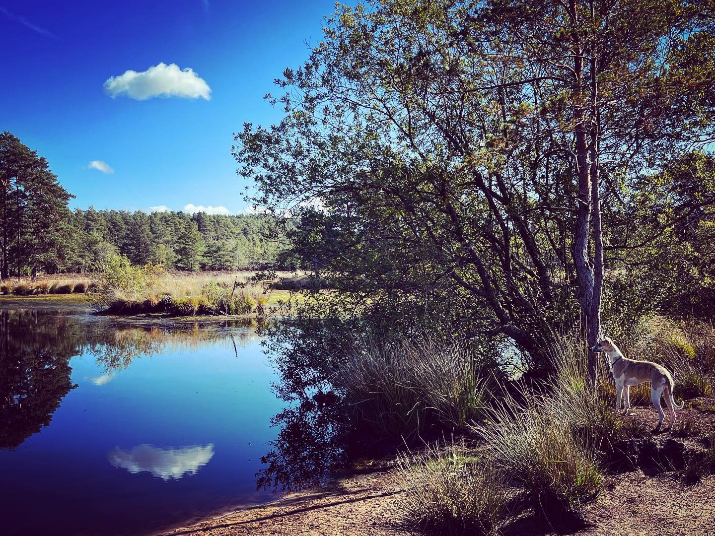
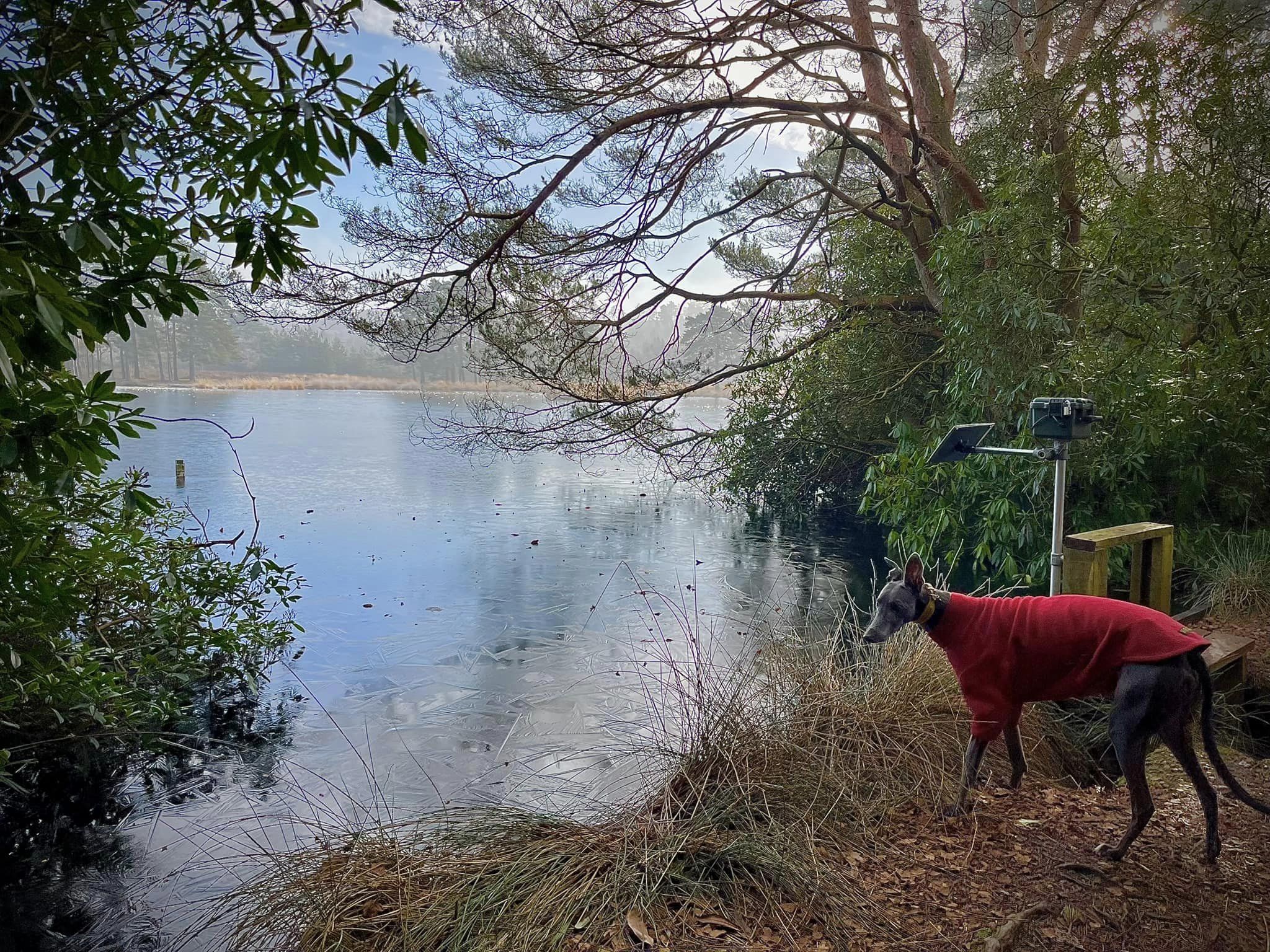
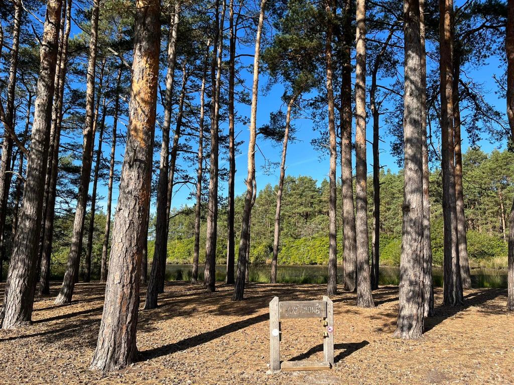
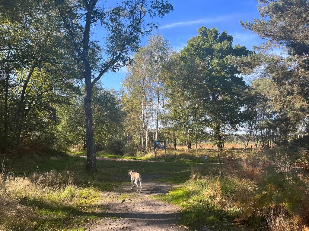
You’ll emerge out to open heathland – continue ahead on the same path. It’ll bend round to the left and go over boardwalk. Stay with the water’s edge and pass a bench, then a sign for Axe Pond.

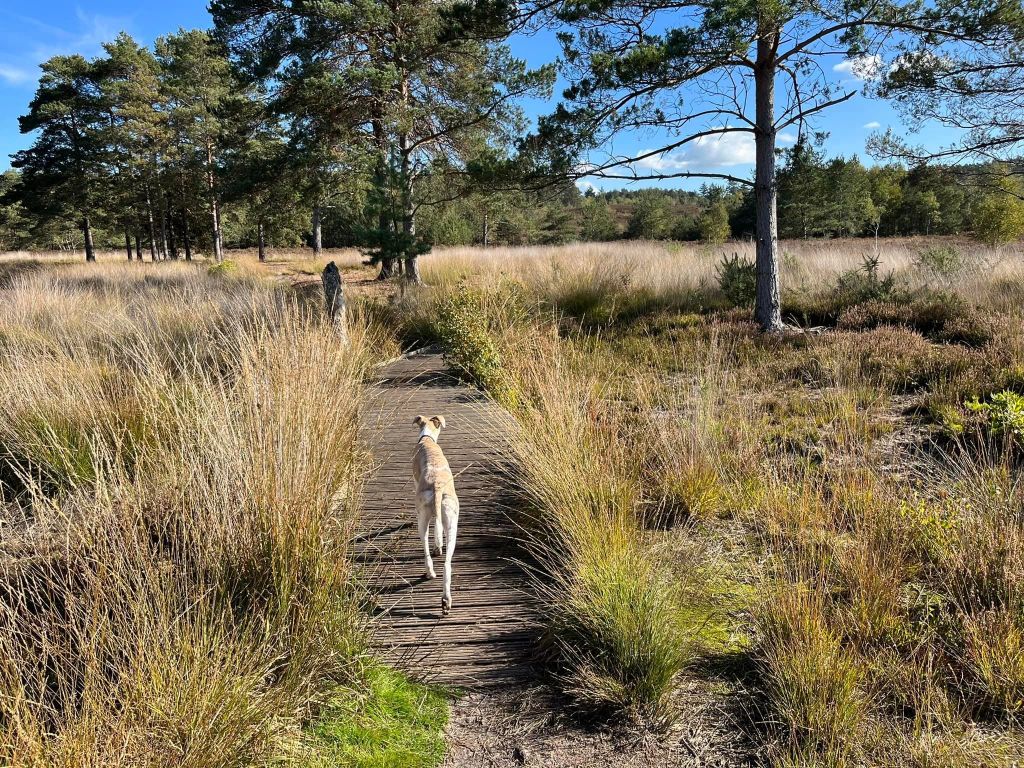
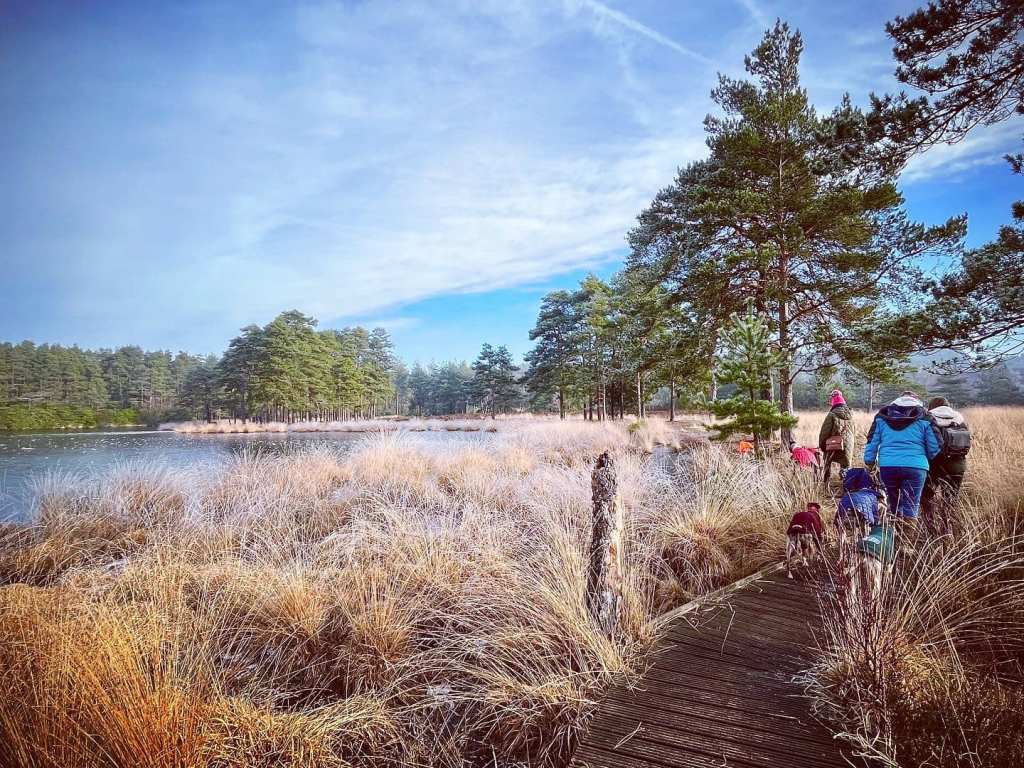
At the sign, there are a couple of paths off to the right (one very narrow, one wider), take either of these away from the pond. They both bring you down to a sandy footpath crossing your way. Go straight over this path and head towards the fence and gate that you can see ahead of you.
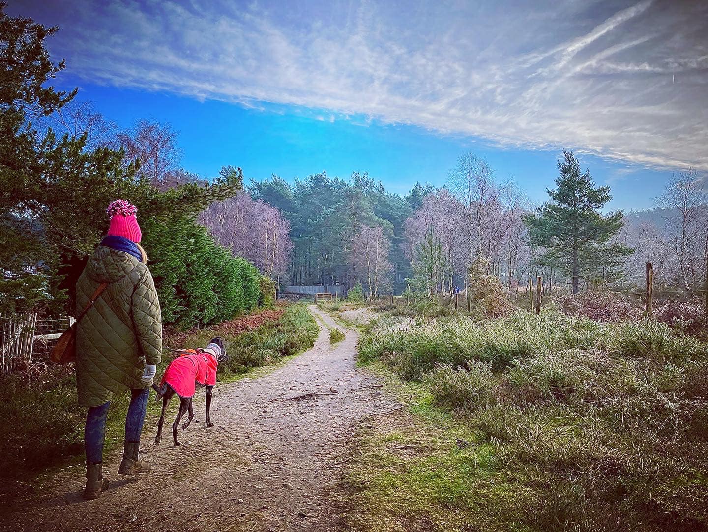
Pass through the gap at the side of the gate and then turn right onto a wide, sandy path that heads up a slope. At the brow, pass a bench on the left dedicated to Kim. The path then goes down a dip before rising again, but now with a wooden fence on the left.
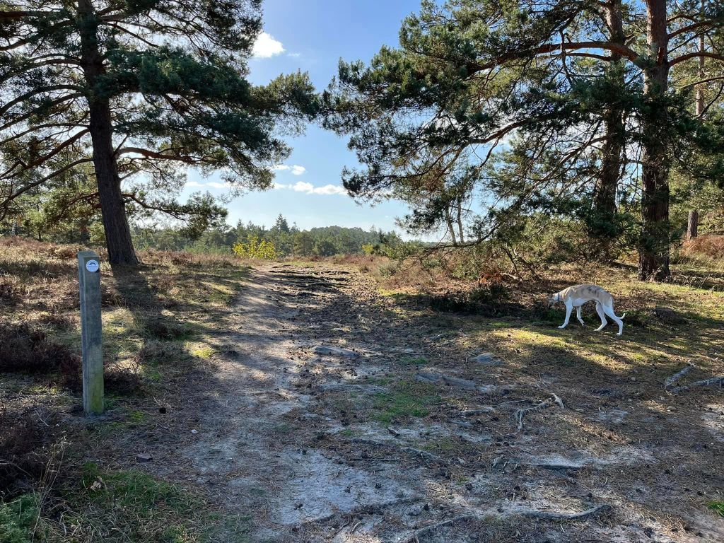
Go through the gap next to the vehicle gate and at the cross paths you are now at (with a wooden information board to the right), you have a choice – head up to the Stony Jump viewpoint, or don’t, and take a shorter, flat route.
To go to the Stony Jump viewpoint
After passing through the gap, continue straight at the cross paths on the path that has a wooden fence on the left with a smaller wire fence in front of that. Further on, the boundary on the left becomes a big hedge with a couple of houses behind it, then there is a wooden five-bargate (make a mental note of this.)

[There is one last chance now to change your mind about going up the hill if you decide you don’t want to do it after all – take the first path on the right just after passing the vehicle gate. Follow this path through the heather down to a sandy path, then turn left and click here to jump down to the last few directions to the end of the walk.]
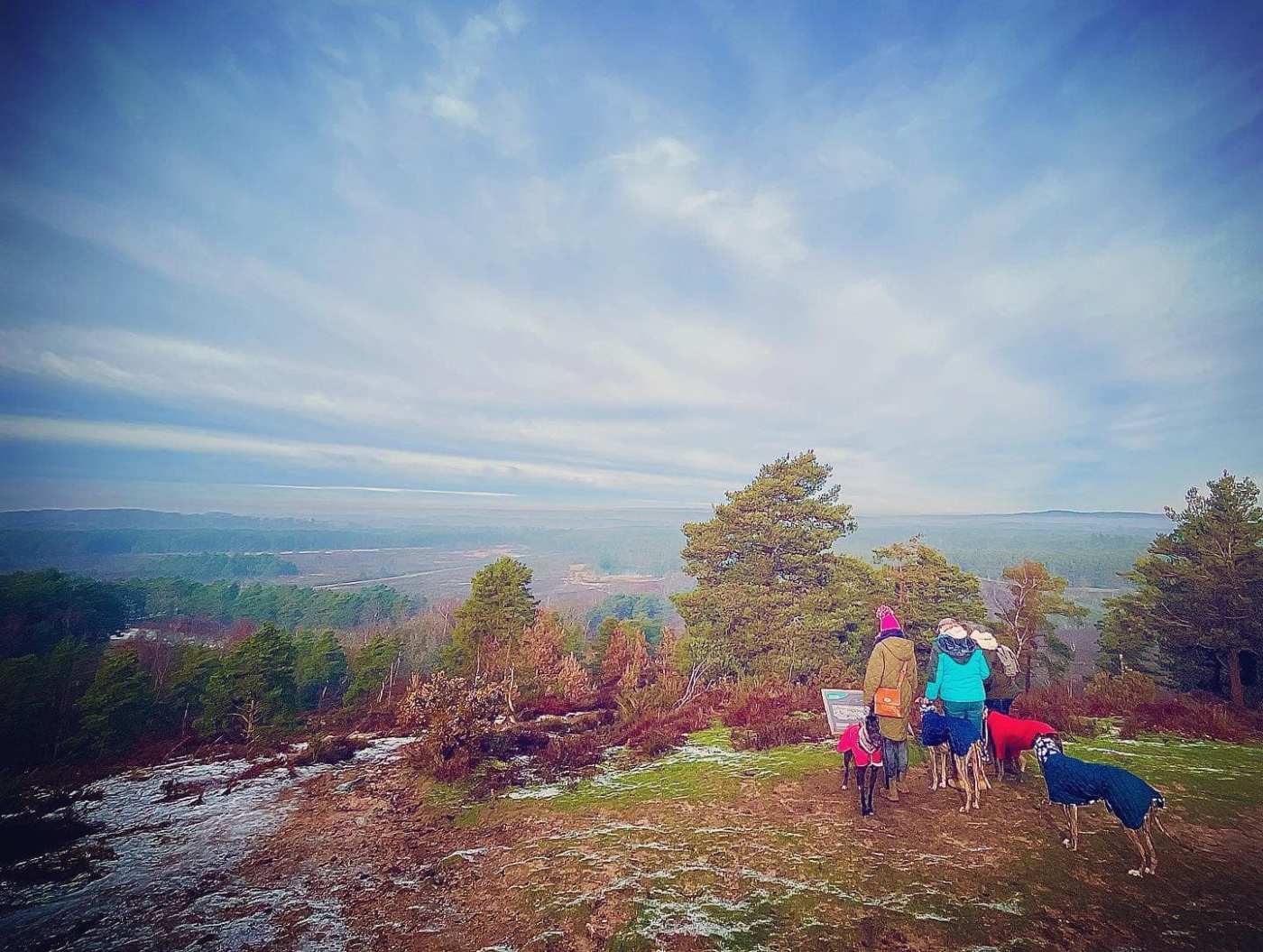
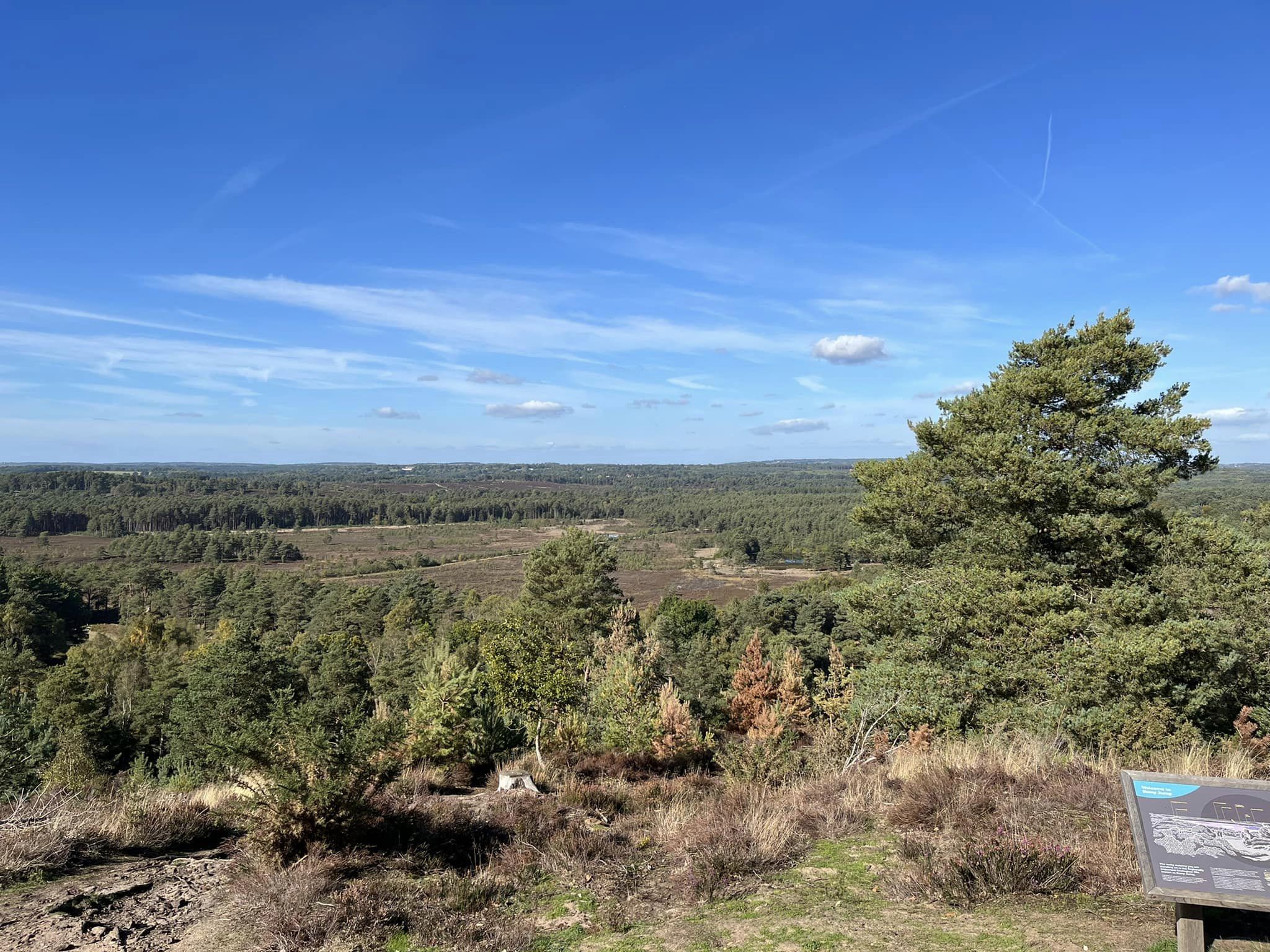
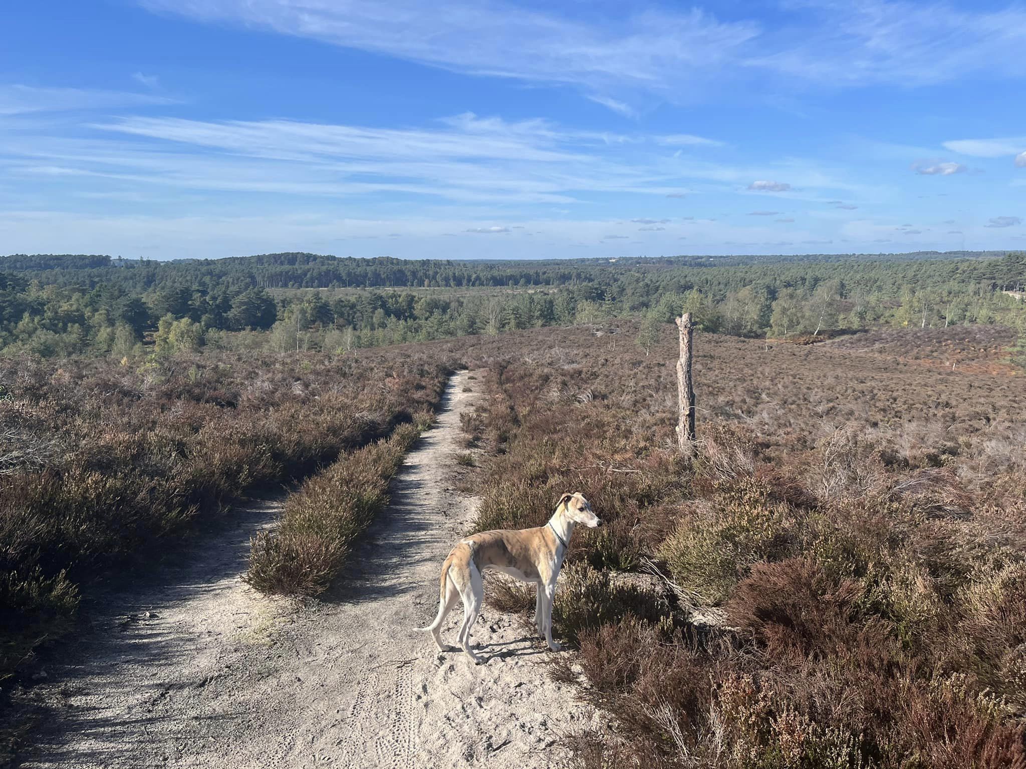
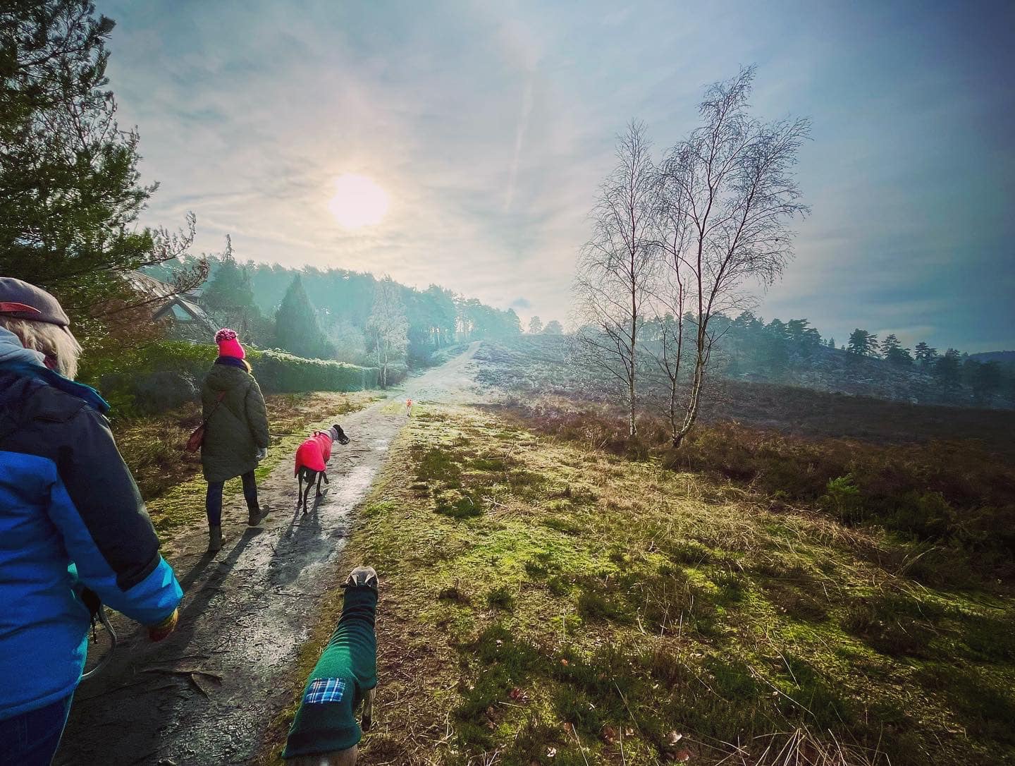
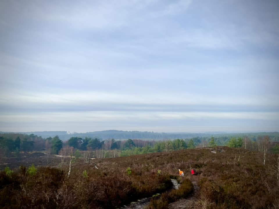
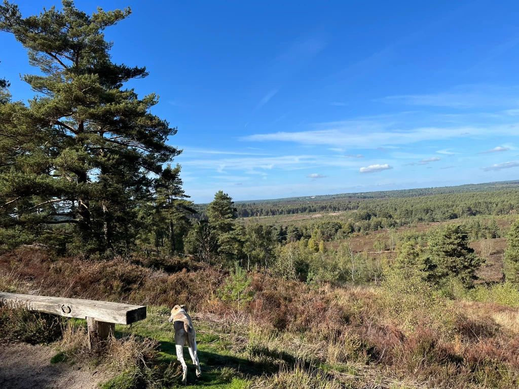
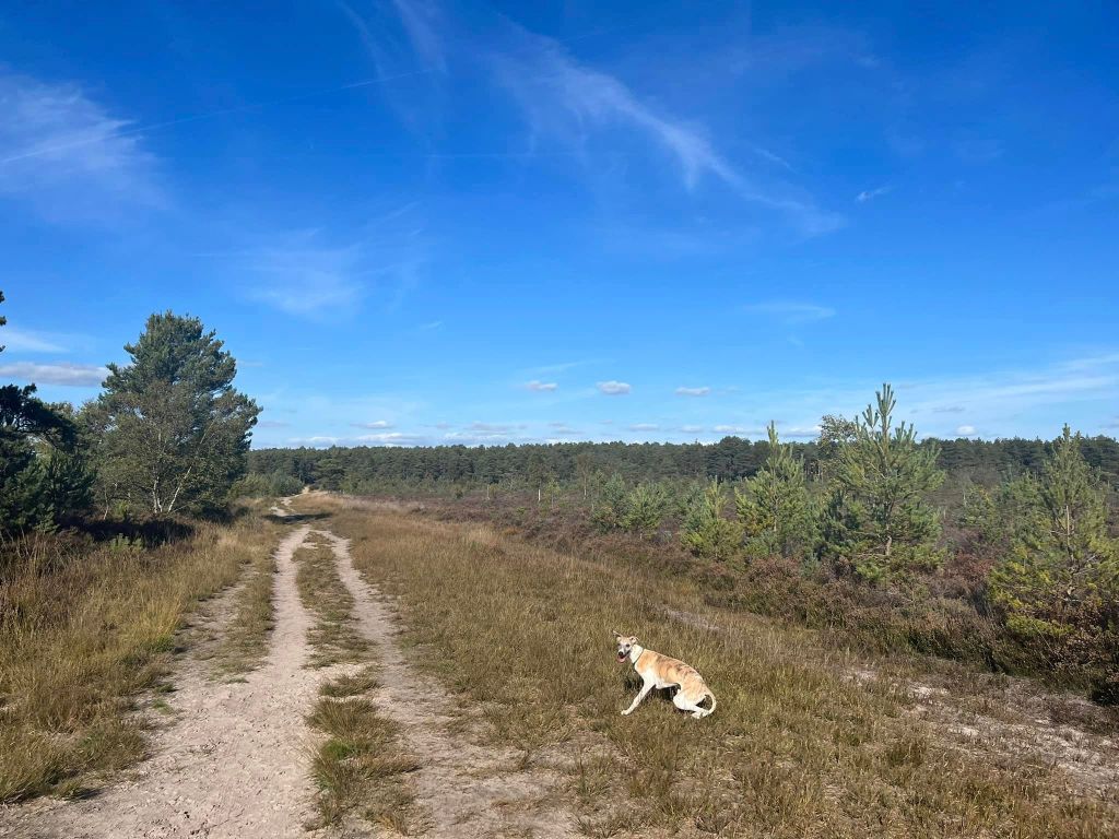
To go to the viewpoint, continue on the main path straight ahead, which goes off up the hill (to be honest, it isn’t that bad a climb and the view is worth it.) The gradient steepens – and, just so you know, you are climbing one of three hills known as The Devil’s Jumps – this one is called Stony Jump.
The slope will ease off a bit and the path bears around to the right, passing a bench, where you can enjoy the view if you need a breather. When you’re ready, continue on up the slope.
At the marker post, keep going around to the right (it’s a steeper path than the option to the left).
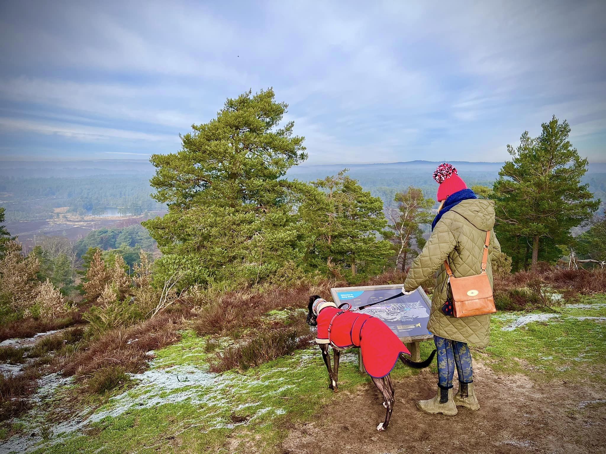
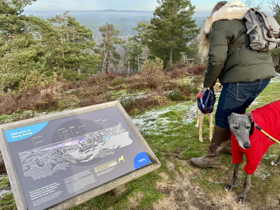
This path takes you to the viewpoint at the top of Stony Jump where you’ll find a couple of benches and an information board. You can see The Flashes sweeping away below you and Axe Pond. (By the way, Stony Jump is 120m above sea level (394 feet) and the eastern-most of the three Jumps. The highest of these hills is High Jump, which lies furthest to the west and has an elevation of 126 m (413 feet). Middle Devil’s Jump has an elevation of 100m (328 feet) and once supported an observatory built by 19th century British astronomer Richard Christopher Carrington, who is known for his observations of a solar storm in 1859.


When you’re done admiring the view, retrace your steps back down the hill, passing the marker post (on your right on this return leg) back to where the wooden vehicle gate is by the houses (all on the right now).
Just before you reach the five bar gate you made a mental note of earlier, turn left onto the path through the heather. This path cuts through the heather and passes a lone dead tree. It descends fairly gently but is quite uneven underfoot so watch your step. At the end of it, turn left onto the sandy footpath. Click here to jump down to the last few directions to the end of the walk.

To miss out the viewpoint
After passing through the gap, turn right at the cross paths and take the sandy path. Follow this straight down to the cross paths, where there is an information board to the right of the junction.
All routes now follow the same directions to the end
At the cross paths by the information board (on the right), continue straight over.
Take care where the logs are set into the ground – to help you navigate this bit of path when it is muddy in winter – but keep on straight with the wooden fence on the left.
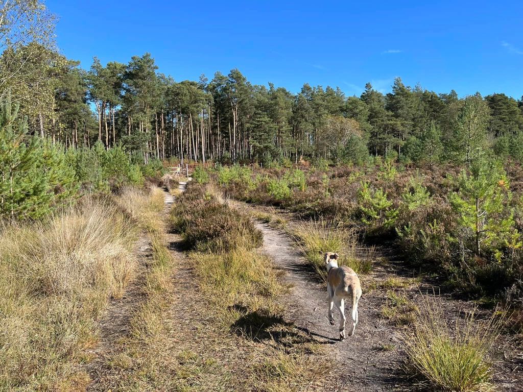
After a little way, just after the wooden fence on the left ends and a wire fence begins, there is a path off to the right, which passes a number of tree stumps. Take this path. It is wide and sandy and heads away from the tree line and back through the heathland.
This path goes all the way back to the first notice board you came to on this walk. (Notice another pond over to your left as you near the end of this path). With the noticeboard on your left, continue ahead back through the gate you entered The Flashes through earlier and up the path with the logs on the right-hand side back to Sandy Lane, where you parked.