
Page contents
About
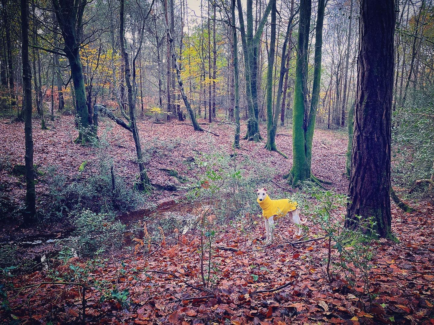
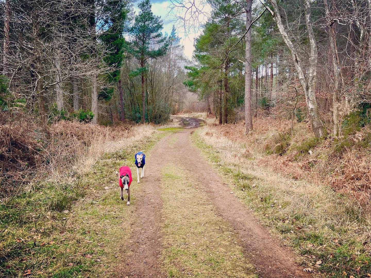
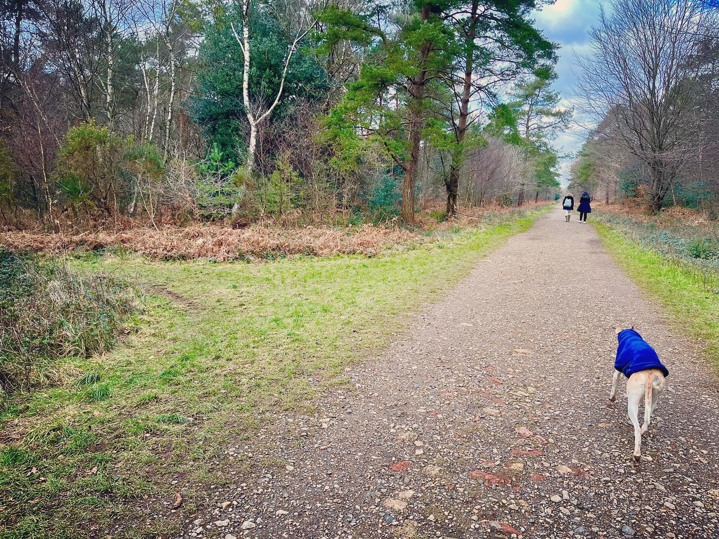
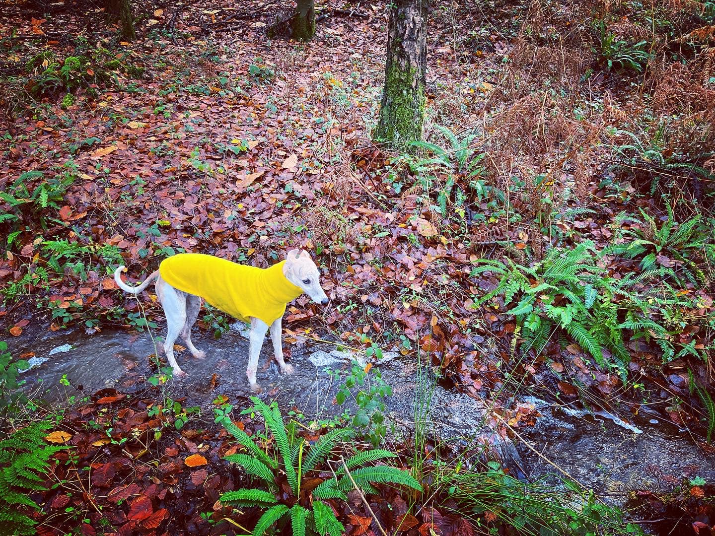
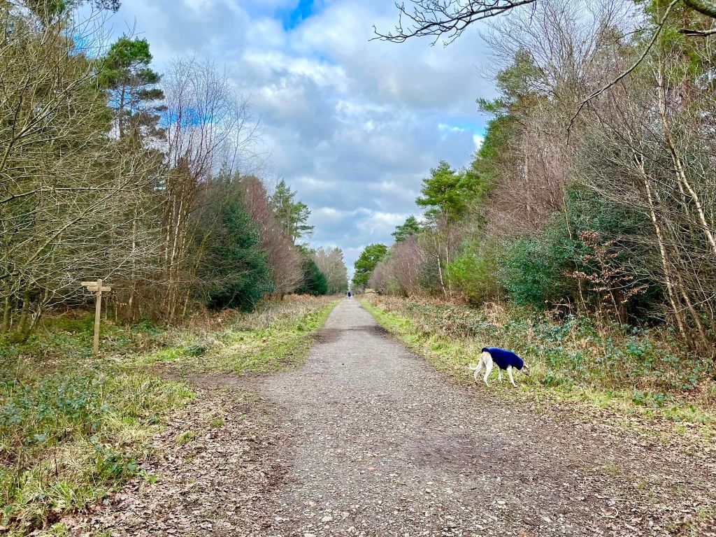
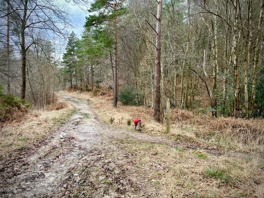
Gallery
Instagram reel showing this place
Parking
Poo bins?
Self-guided walk
About
Roosthole (some say Roost Hole and others say RoostHole*) is an area of St Leonard’s Forest, an ancient woodland between Horsham and Crawley in West Sussex. It forms part of the High Weald Area of Outstanding Natural Beauty and consists of just over 700 acres of mixed deciduous and conifer woodland, as well as some areas of open, wooded heath.
Owned and managed by the Forestry Commission for timber production, conservation and recreation since the 1950s, it is a popular spot for walkers, cyclists and horse riders – so be prepared to meet any, possibly even all, on any walks you take here. Many of the trees throughout the site are hundreds of years old and support rare species of wildlife while storing great amounts of carbon, which helps reduce global warming.
The forest has some quirky tales attached to it, the most ‘famous’ being that, back in the 6th century, a fearsome bloodthirsty dragon used to roam the area, killing local people as it pleased. A Saxon chronicle mentions that “monstrous serpents were seen in the country of the Southern Angles that is called Sussex.” Anyway, at that time, a French hermit (some versions say he was a nobleman by birth but turned abbot and then hermit) called St Leonard of Limousin also lived here (which is why the area is so-called). St Lenny apparently slayed the terrible dragon. He fought hard but was badly injured during the long battle and, apparently, God (if you believe in such things) made white lilies grow where his blood was spilled. To the east of the forest, there is an area of lily beds (our walk below goes by these) and this is apparently where that great fight occurred.
Another lens on the story suggests that smugglers used to travel through and stop over in the forest as they stole their booty towards London, and the myth of the terrible forest dragon is thought to have been used to keep inquisitive locals and tax inspectors away!
As if those titbits aren’t enough for you, there’s another tale to tell involving mythical beasts that, in all likelihood, don’t exist. This one features our friend the Devil – he did get about, didn’t he? Anyway, a local called Mick Mills – bit of a geezer, you know the type, all mouth – boasted that he could out-race anyone. (Why? Didn’t these people have anything better to do?) Well, the Devil (of course) took him up on the challenge with the prize being Mick’s soul. (Goodness me, what was wrong with folk back then? Why would you just offer up the possibility of having to give your soul to the Devil? Fools. Too much grog, that’s what I reckon.) Lucky for Mick (or as expected depending on how you look at it), he won and was allowed to keep his soul (which I suspect he pickled in booze.) I bet the guy was unbearable after that. The mile-long, totally straight path down which the two ran is now known as Mick Mills’ Race, having (apparently) been burnt into the ground and no vegetation ever growing on it. The simpler of the two walks on this page incorporates a stretch of this long, straight path.
Anyway, back to the sensible facts. For more than two decades, local conservation volunteers, supported by Forestry England and the Gatwick Greenspace Partnership (part of Sussex Wildlife Trust), have been helping to improve the forest’s bio-diversity, clearing invasive Silver Birch and Scots Pine saplings from heathland areas to allow the slow growing heather to flourish and provide a colourful display in late summer. The heather attracts numerous insects, including bees, hoverflies, beetles, crickets, grasshoppers, butterflies and moths. In turn, species that prey on those – such as spiders, dragonflies and parasitic wasps – have colonised the area and provide food for larger animals and birds, such as the Nightjar, which migrates from Africa to breed here each summer and is only found in heathland areas of north west Europe.
To read a thorough, factual account of the forest’s history (one that doesn’t entertain frivolous stories of dragons and devils), visit All About Horsham.
I only know about Roosthole because the West Sussex Greyhound Walking Group used to come here, otherwise I may never have found it to explore…
*I cannot find a definitive answer on this.
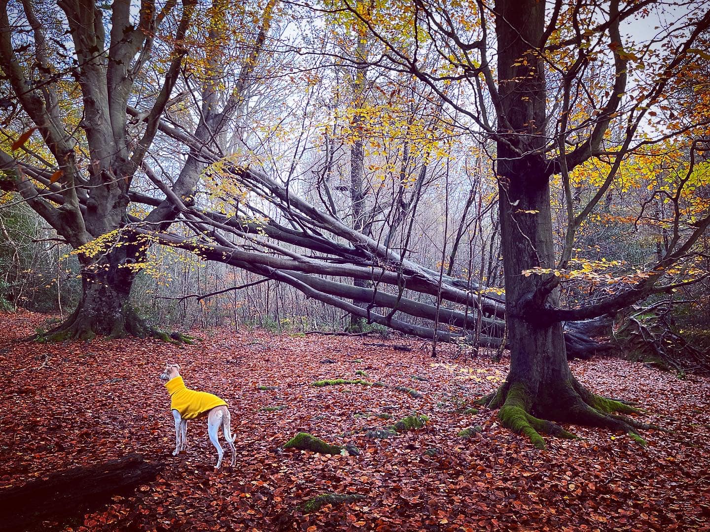
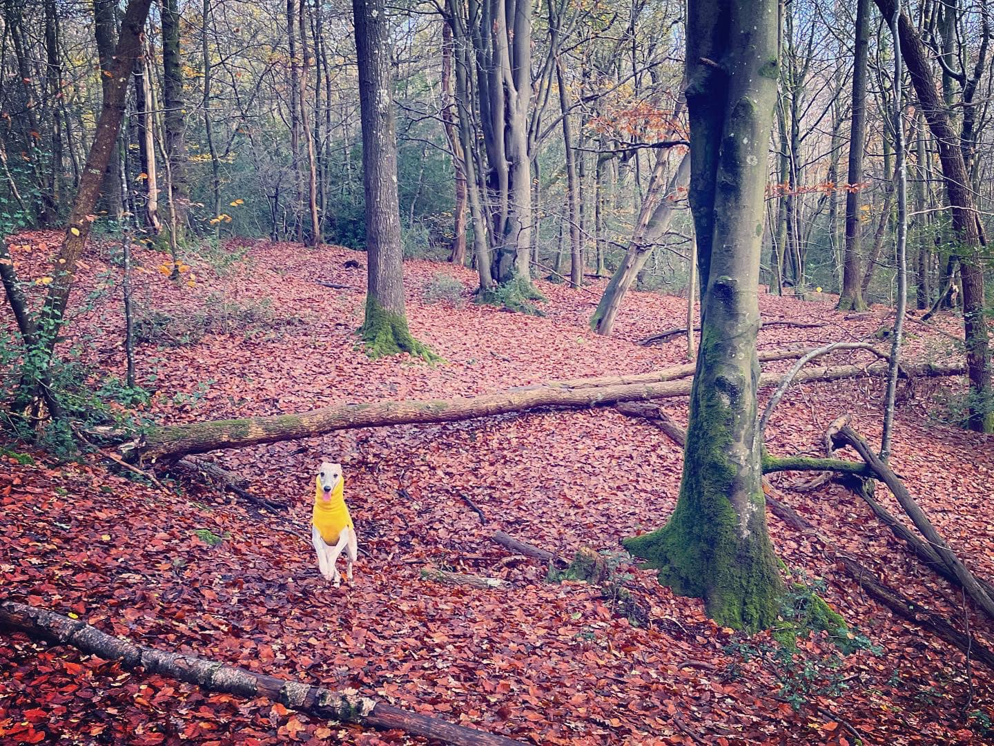
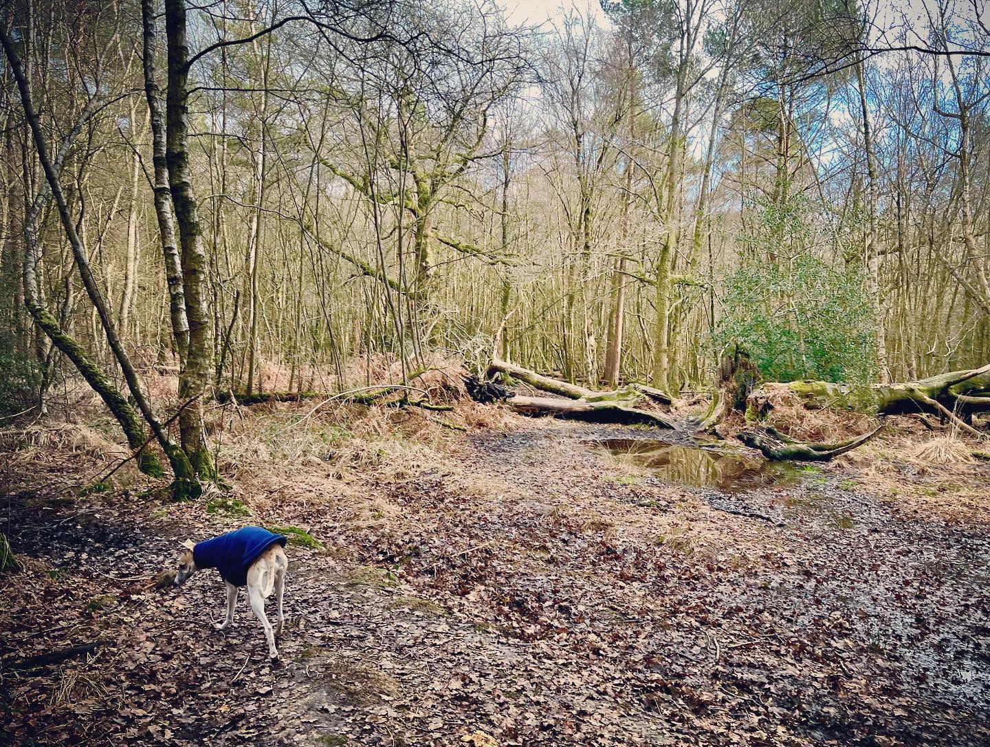
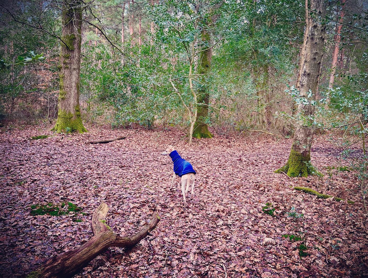
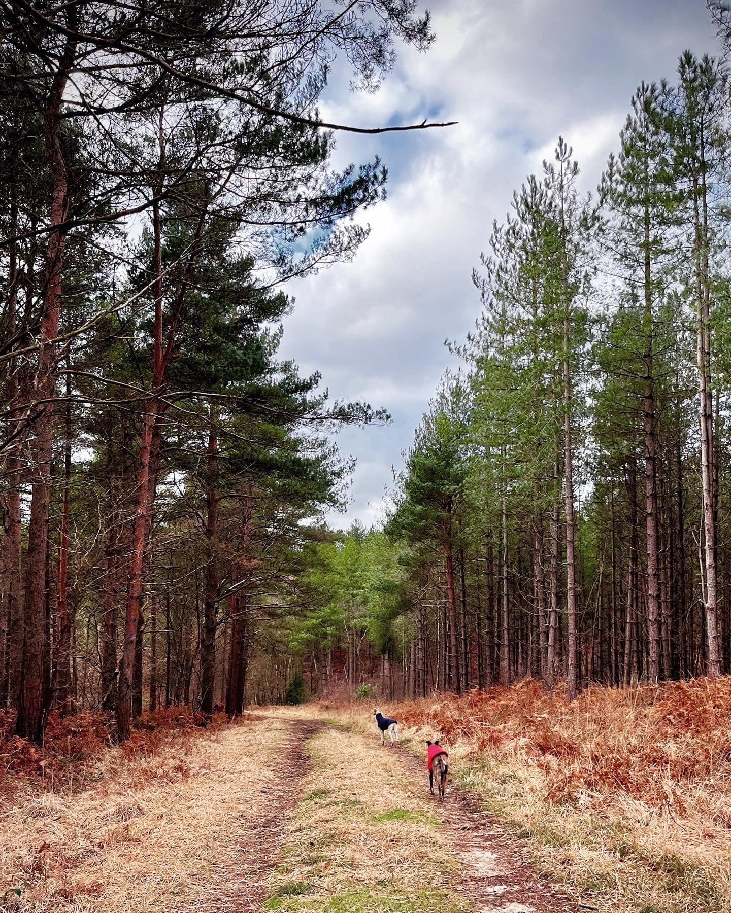
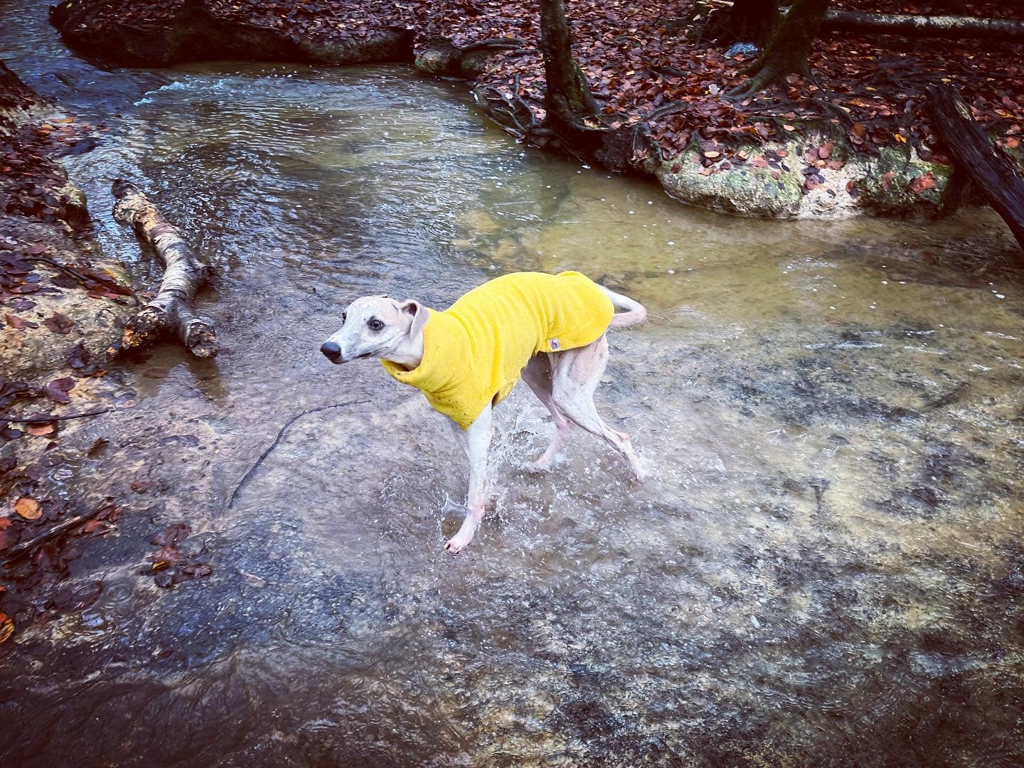
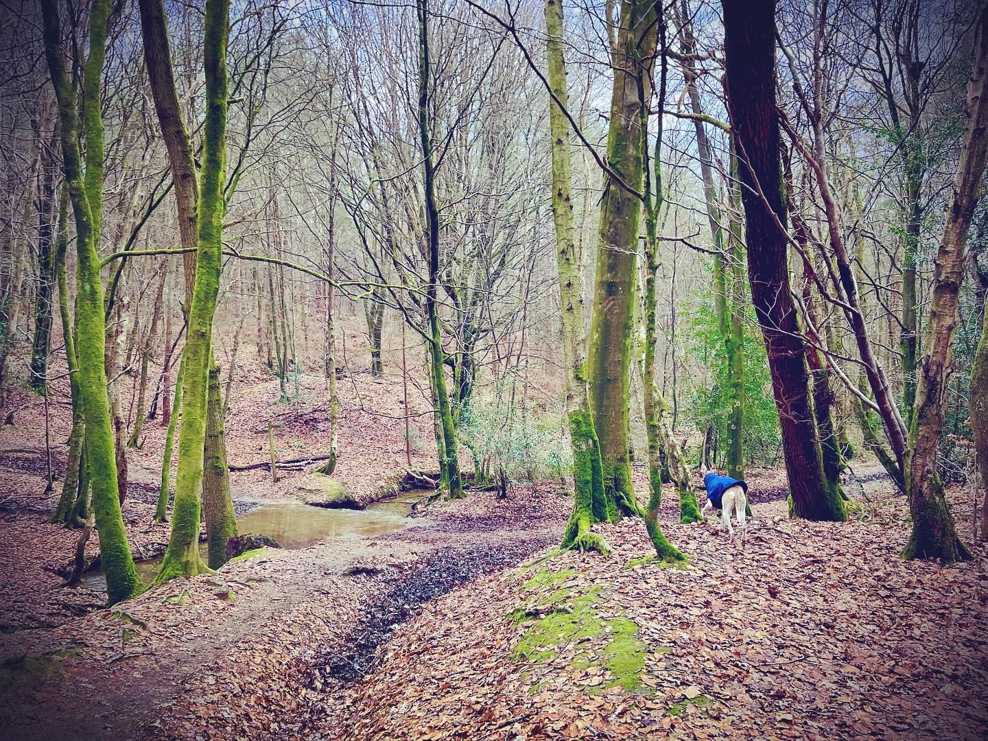
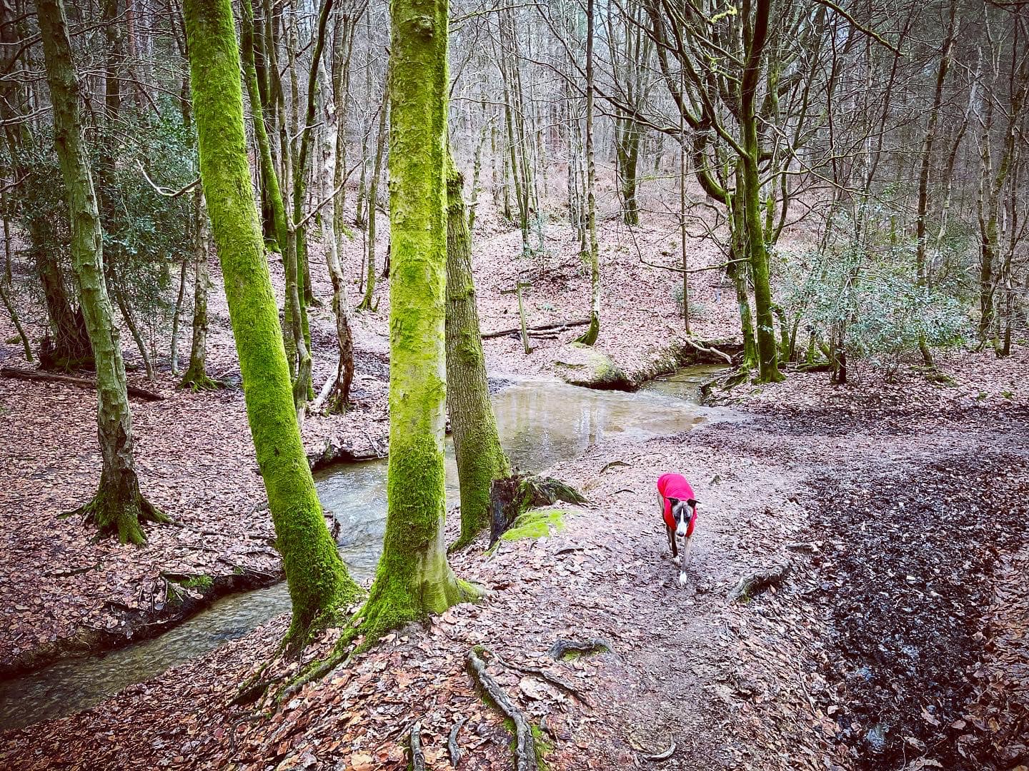
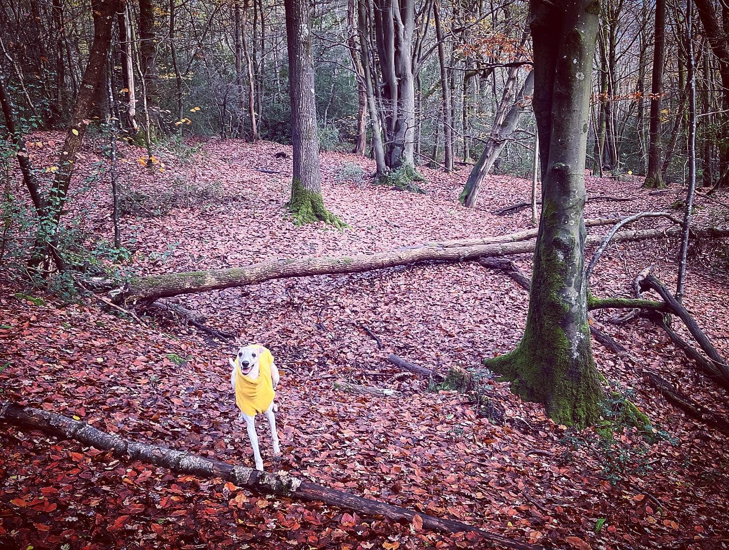
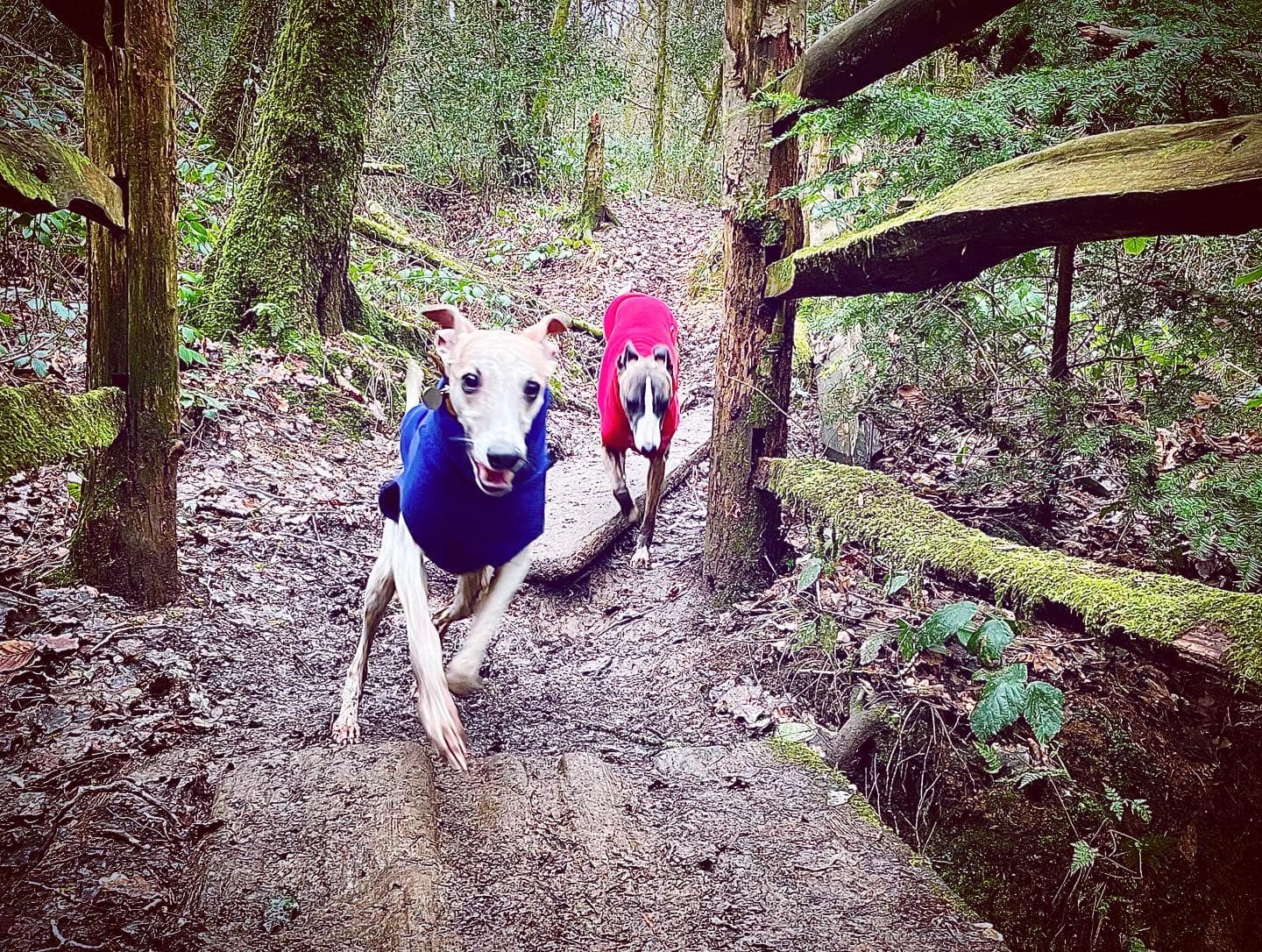
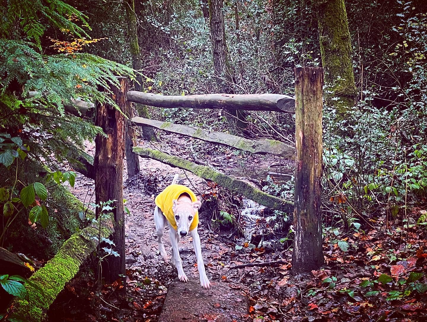
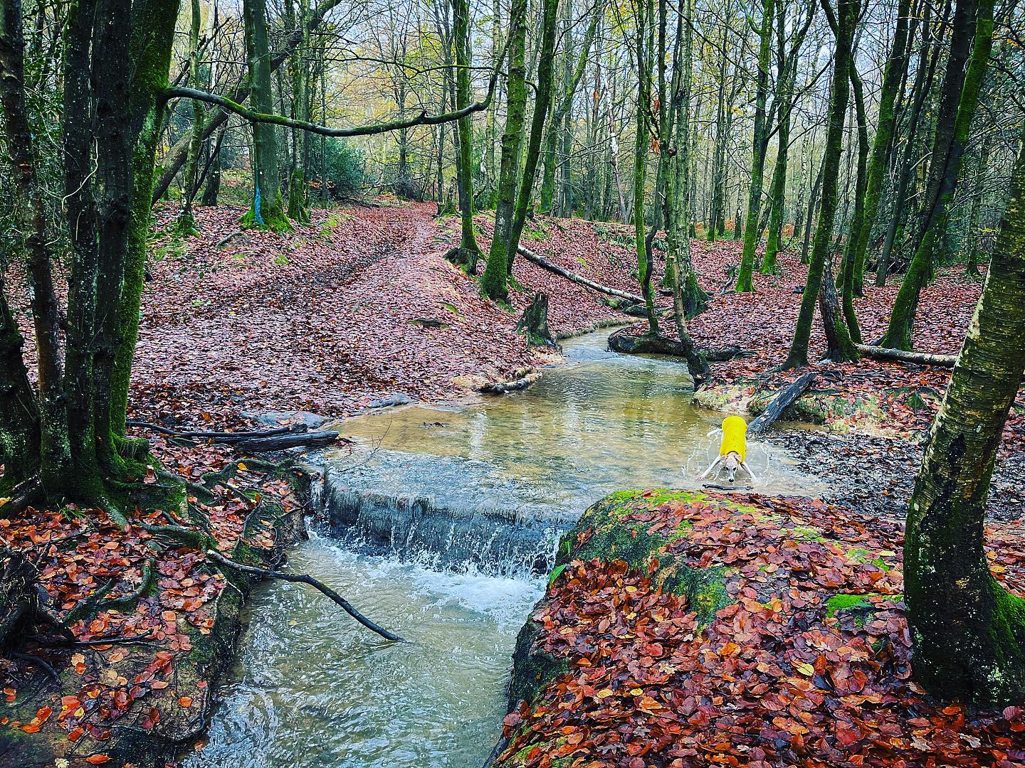
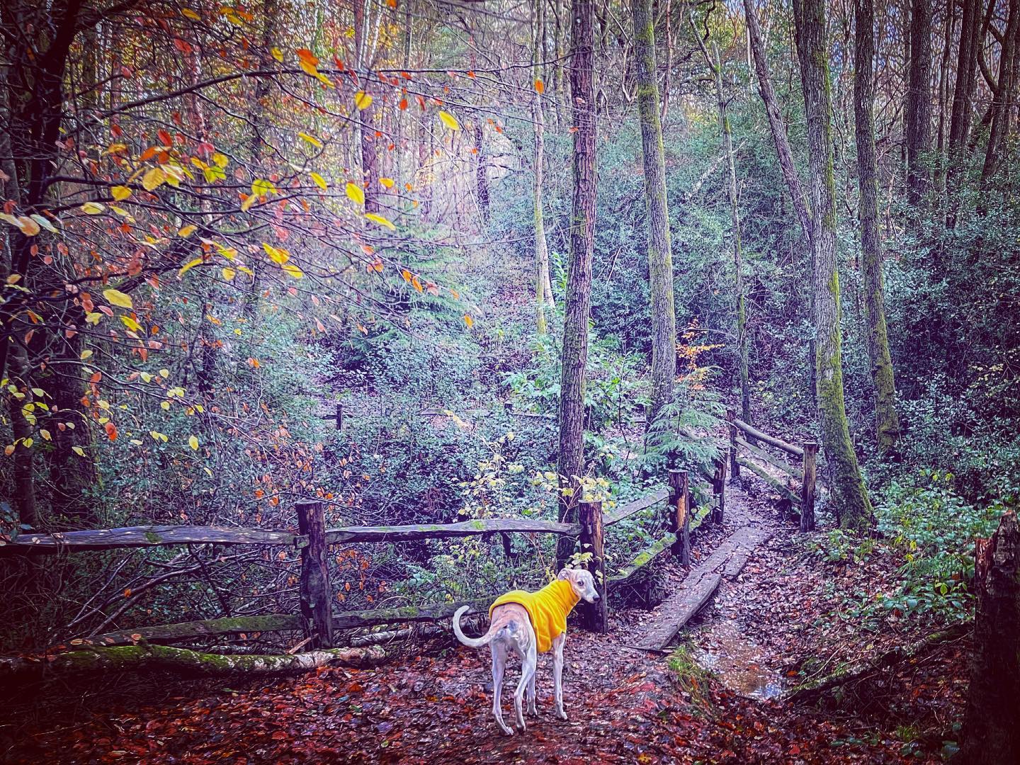
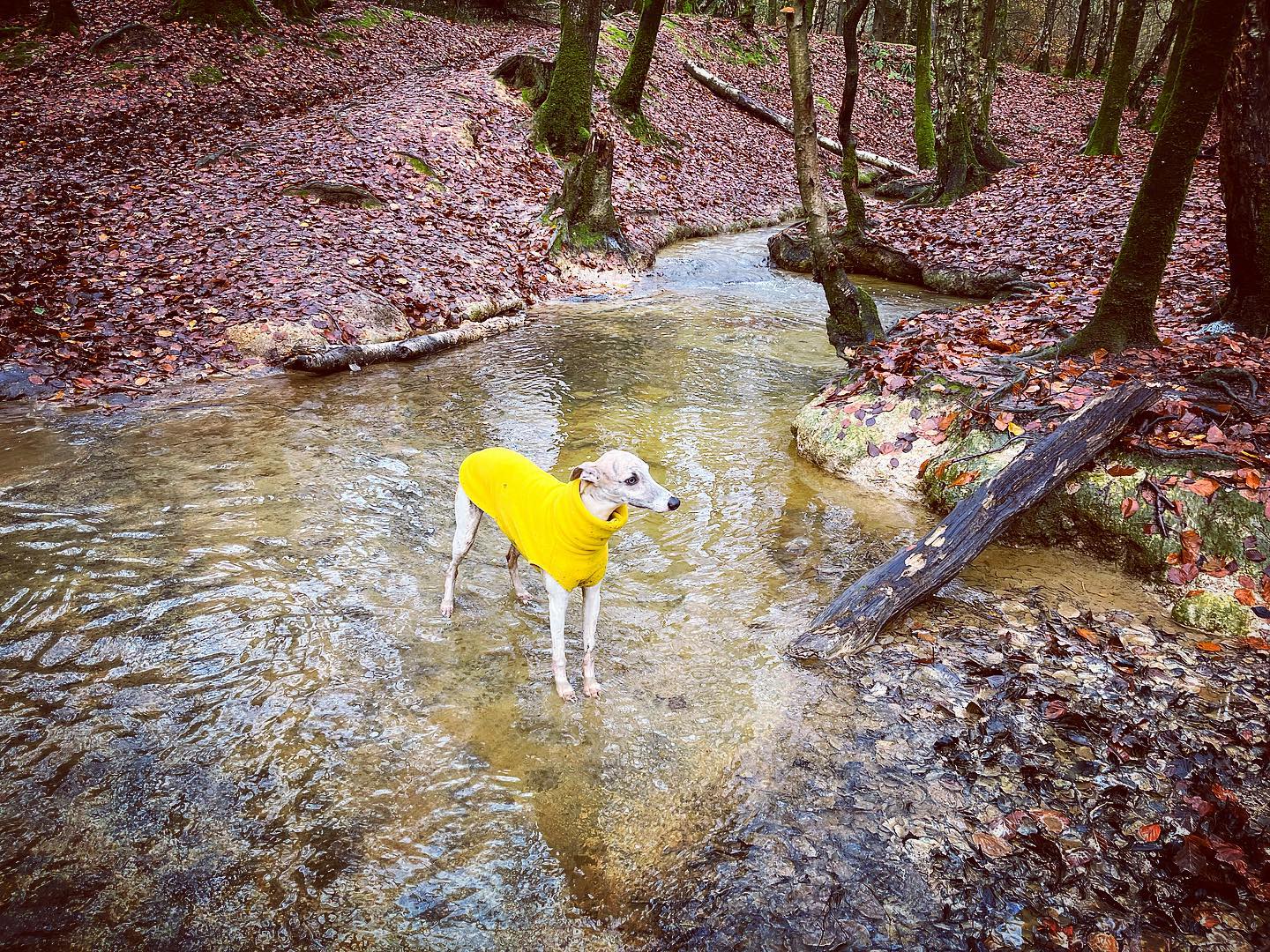
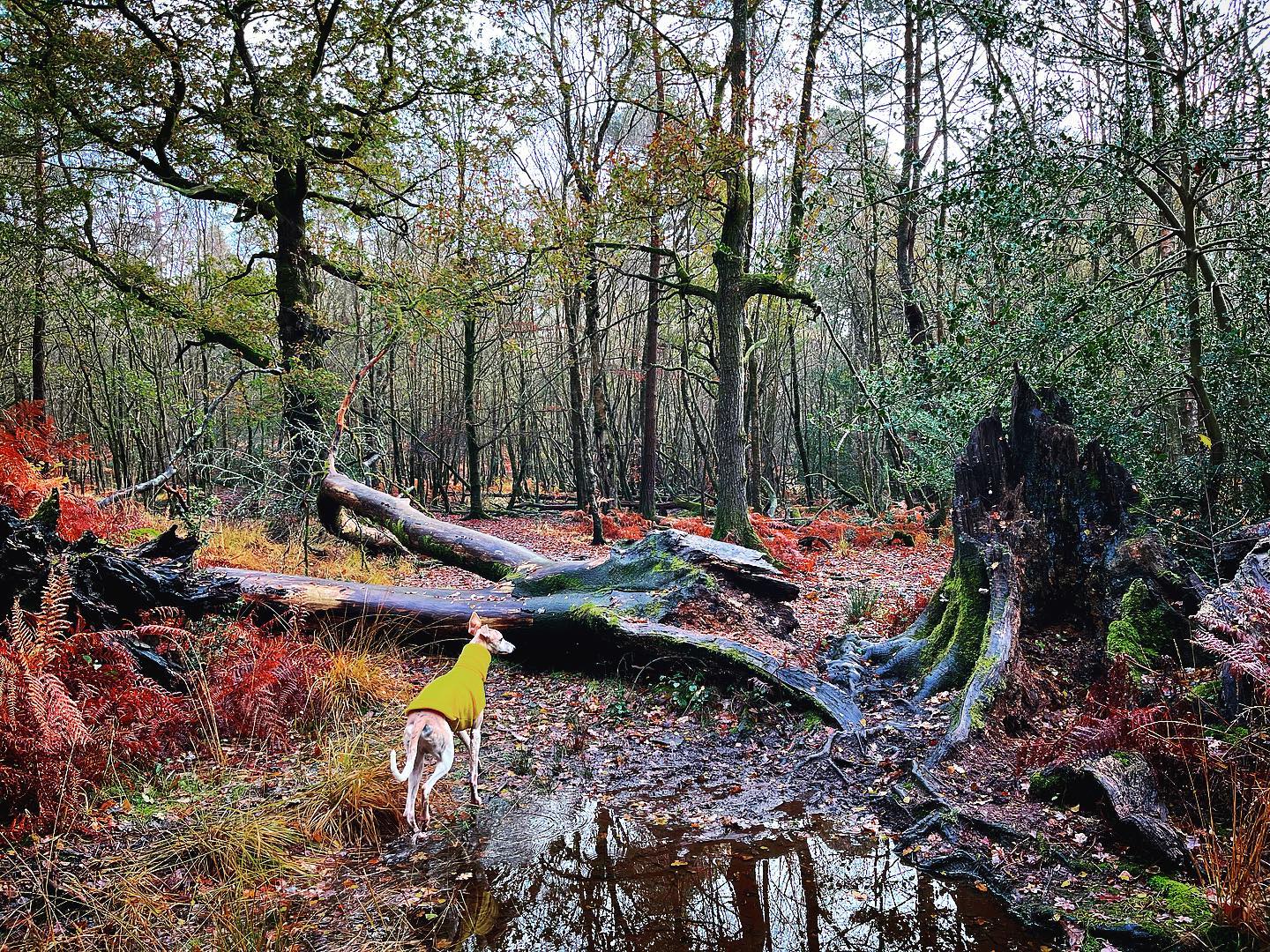
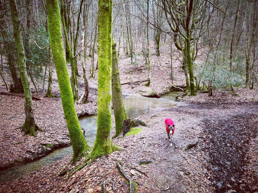
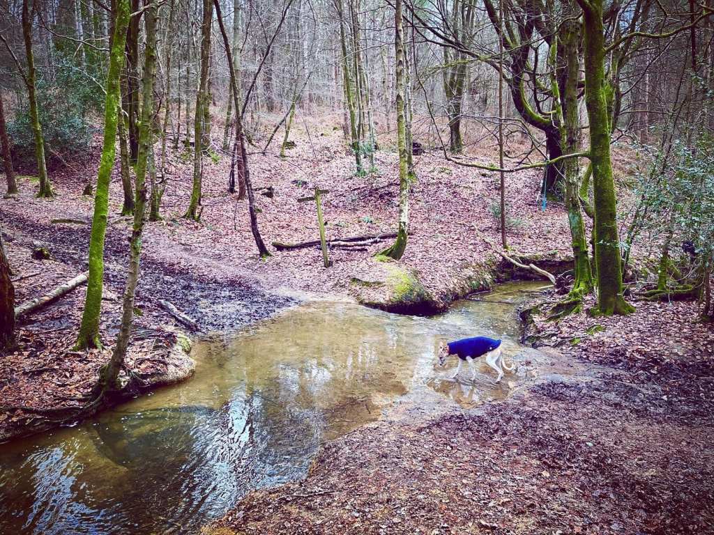
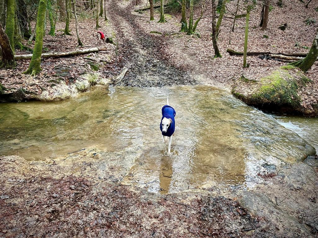
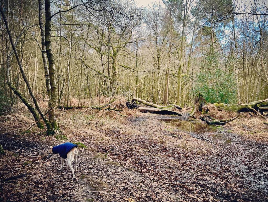
The Gallery: What’s it like here?


Instagram reel showing this place
Parking
Free parking in Roosthole car park to the south of the forest on Hammerpond Road.
Poo bins?
There is a poo bin by the information board at the start of the main path from the car park.
Self-guided walks
There are two self-guided walks on this page – they are very similar but the first is a simpler route and includes part of Mick Mills’ Race. The second takes smaller paths through the trees, which are quite hard to describe when there are no ‘landmarks’ of any particular note (I mean, it’s a wood. ‘Turn left at the tree’ isn’t that helpful but sometimes that is literally all there is.)
While the second is, in my humble opinion, more ‘magical’, I would suggest only doing this one if you are using the Footpath app with the route line as well as the directions on this page (and even the route line is a bit hit and miss and there is bit of ‘follow your nose and hope’.)
Walk 1: Mick Mills’ Race
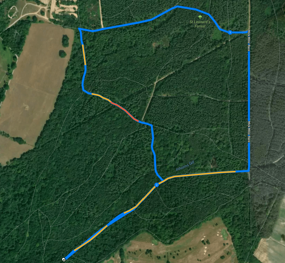
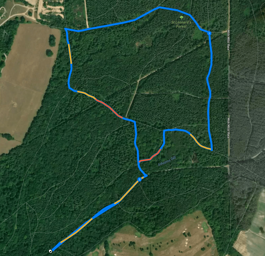
Here is a Footpath app route from Roosthole car park which follows wide, surfaced paths through the forest, before sweeping down past the lily beds and taking a little windy path through the trees to the stream. You’ll need to cross this and then head uphill through the forest back to the main outward path. This route is on AllTrails.
Length: approximately 2.3 miles/3.7km
Terrain: Wide, surfaced paths, small (often muddy) woodland tracks, there is no bridge at the point you need to cross the stream and during wetter months, it isn’t deep but it is very much a stream so your feet and lower legs need to be able to cope with water. The outward part of the route is largely flat, but the second half is quite up and down with at least one fairly noticeable slope. Sturdy footwear is an absolute must for this one – can be muddy and uneven.
Stiles/kissing gates? No stiles, no kissing gates
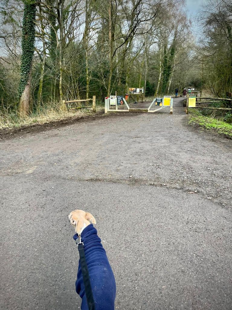
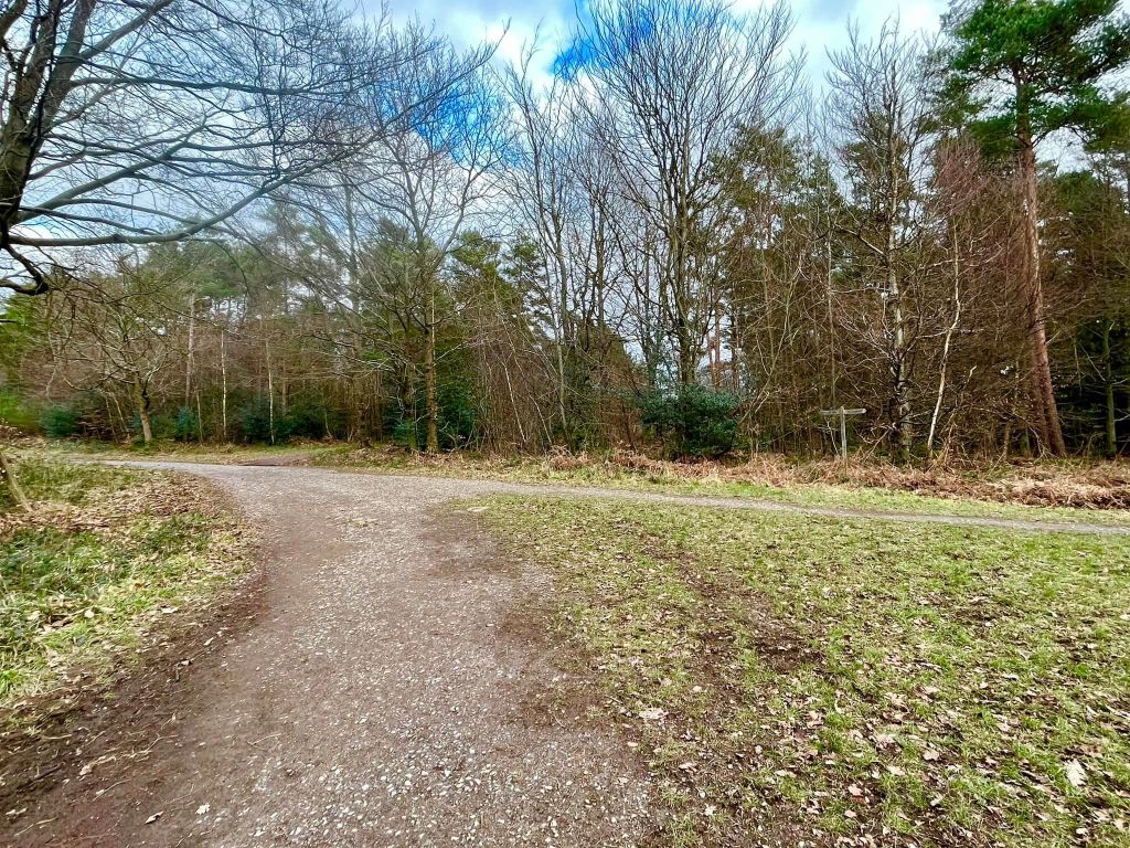
The little access road to the car park sweeps round a sharp bend to the left. Off to the right of this bend, there is a wide, surfaced path heading away behind a barrier and passing a poo bin and information board. Take this. It’s largely straight and you’re on it all the way to its end at a T-junction. The woods dip down to your left to a stream that you can’t see from the path, which is a shame.
At the T-junction, turn left onto the mile-long straight that is Mick Mills’ Race.
Ignore the first left, which has a sign post right by it, and then ignore the second left, which is a fairly wide, grassy path. At the third left, where there is a white gas pole topped with red, turn off Mick Mills’ Race. You’ll immediately come to a fork – take the path on the right-hand side.
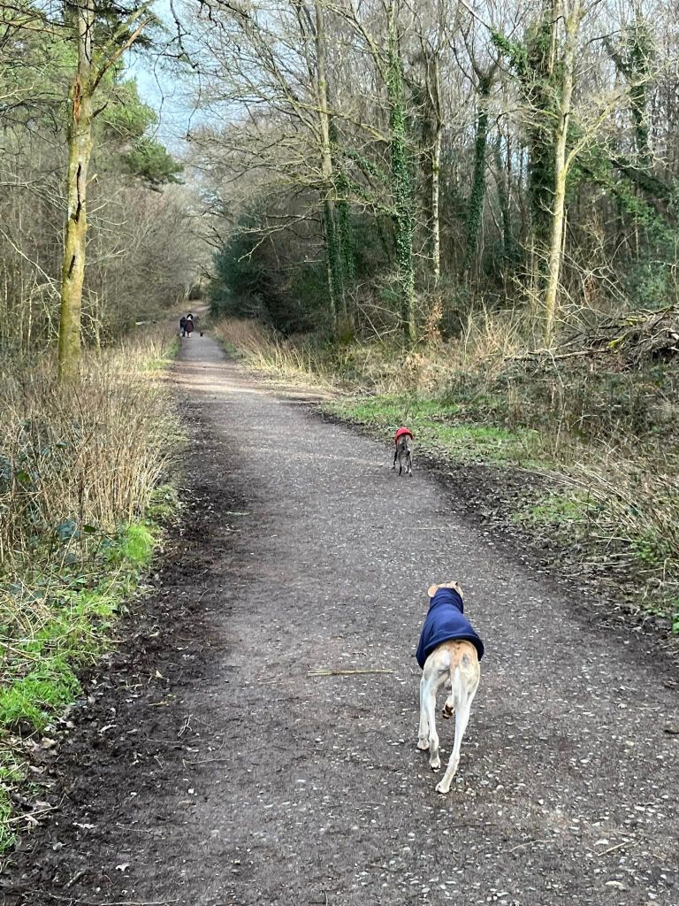
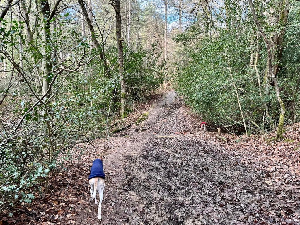
This initially little path widens as it bears round to the right. Ignore any paths off either side and just stay on it. It goes downhill and is lined either side by tall pines. You’ll pass a marker post (on the right) with a yellow arrow and a path joins here. Keep going ahead and shortly you should become aware of the stream running parallel on your left.

After some way, ignore a wide path that heads up and off to the right (it is opposite a marker post to the left of the path.)
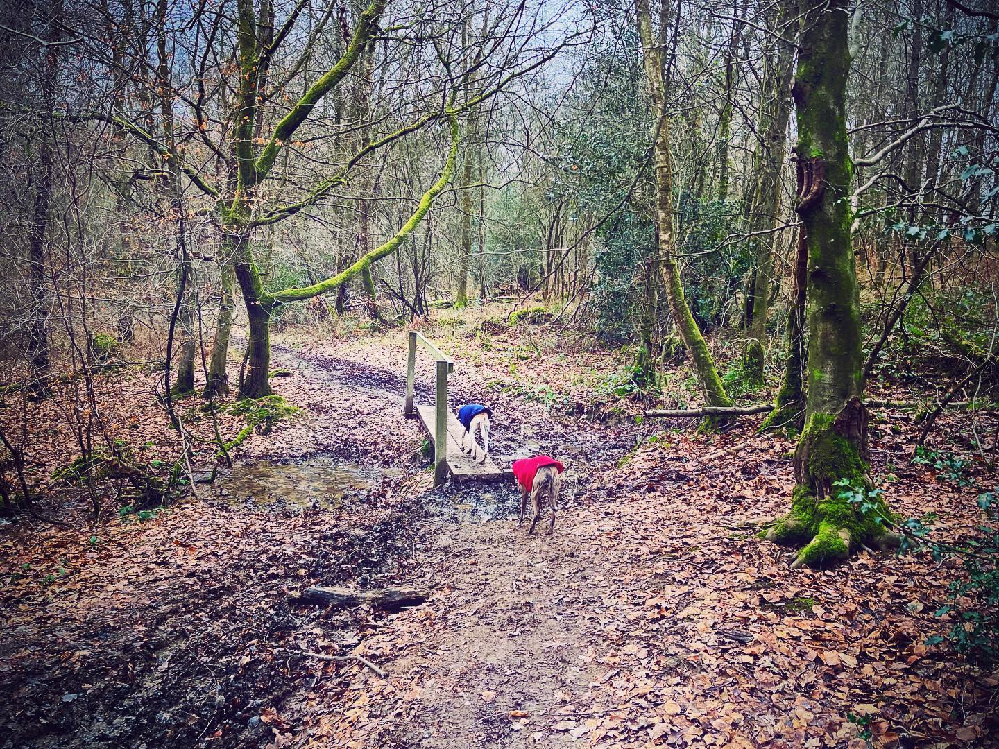
Continue ahead through the lily beds and then turn left onto a very small (often muddy and can be overgrown) path just before the fence, behind which is a tree diagonally across the way.
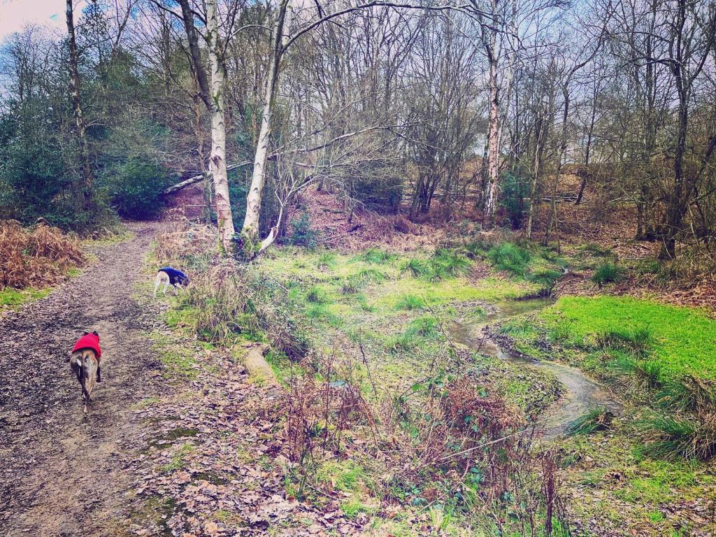

Cross the stream using the plank bridge and this path takes you down to the main stream – Sheepwash Gill.

Turn left at the water and go through the stream and up the hill on the other side.
Continue straight on at the cross paths, where the way to the right is blocked by a fence and a black barrier.
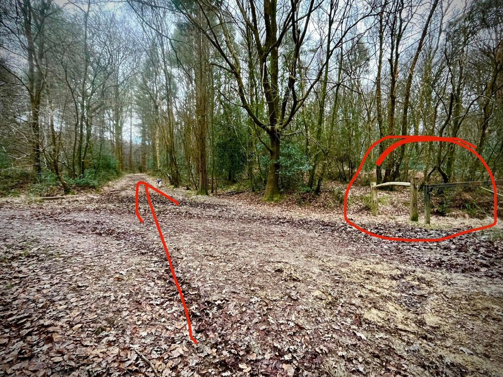
A bit further on, you come to a weird junction of paths – two to the right, one to the left. Continue straight here for a very short way and you’ll come to another junction, this time with a signpost to the left. Turn right here…

…and then you’ll come to a fork straight away, where you go left.
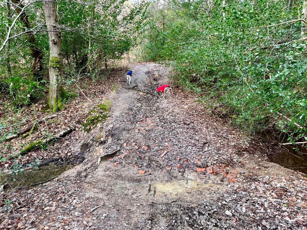
Stay on this path and wind through the trees. It’ll go down a little dip to cross a stream at a point where the path has lots of fragments of red brick in it. Take care here as it is uneven. Go over the water and up the other side. The path comes out at the main surfaced path from the start of the walk. Turn right and follow it back to the car park.
Walk 2: Woodland trails
Here is a Footpath app route from Roosthole car park which winds through the forest on little woodland paths, before sweeping on wider paths down past the lily beds. It then takes another little windy path through the trees to the stream. You’ll need to cross this and then head uphill through the forest back to the main outward path. This route is on AllTrails.
Length: approximately 2.3 miles/3.7km
Terrain: small (often muddy) woodland tracks, there is no bridge at the point you need to cross the stream and during wetter months, it isn’t deep but it is very much a stream so your feet and lower legs need to be able to cope with water. Quite up and down with at least one fairly noticeable slope. Sturdy footwear is an absolute must for this one – can be muddy and uneven.
Stiles/kissing gates? No stiles, no kissing gates
The little access road to the car park sweeps round a sharp bend to the left. Off to the right of this bend, there is a wide, surfaced path heading away behind a barrier and passing a poo bin and information board. Take this.
The woods dip down to your left to a stream called Inholms Gill that you can’t see from the path, which is a shame. [There used to be another way into Roosthole Woods from the car park that goes over a little bridge and follows the gill a bit more closely but this way has been cordoned off by the fence surrounding the parking area (in fact, you can still get to it by ducking between the fence slats if you know where it is.)]
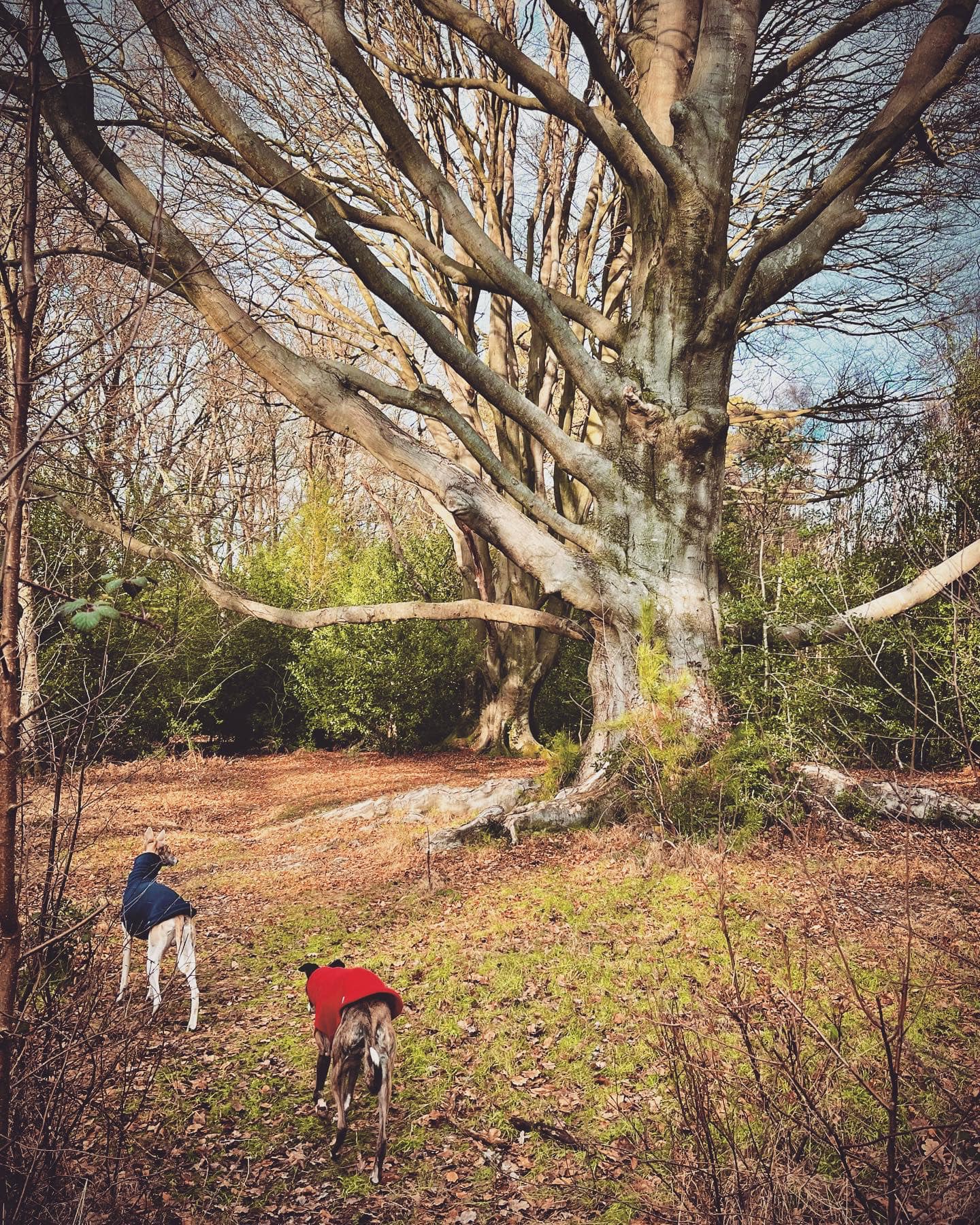
You need to pay attention now because you’re looking for a particular tree but after some way, the path will curve gently to the left and over to your right there is a little run off stream babbling down towards you. Keep going, ignoring a few little paths off to the left.
There’s really not much along here to help you find where you need to go so keep an eye out to your left for the tree in the photo below. It’s a bit of an odd shape.

When you have found that tree, continue a little further and there’ll be a small mud path off to the left that goes back on itself and down slope slightly. Take this and follow it down a little dip to cross the gill at a point where the path has lots of fragments of red brick in it. Take care here as it is uneven. Go over the water and up the other side.
Almost immediately, there’s a post on the right – it is tucked back in the trees/foliage (see next photo).

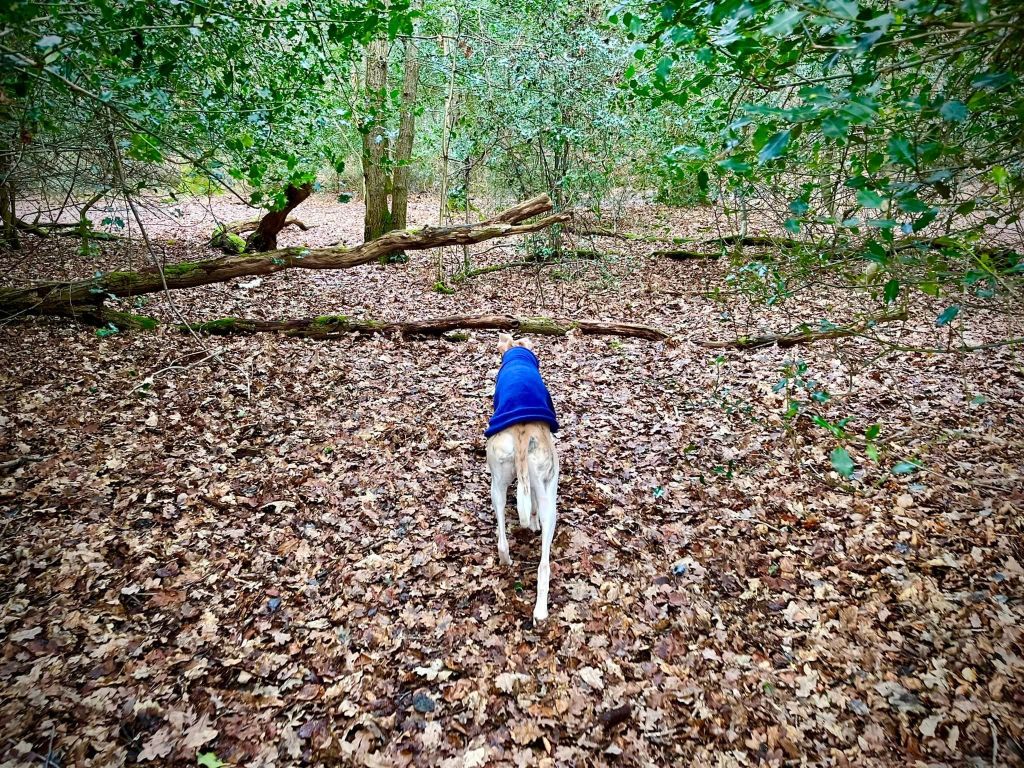
Go a few more steps on and take a little path on the right. Pass to the left of a fantastic tree with a fallen tree right by it and then follow the tiny path as it winds along. You’ll go through a tiny area of scrub and u-bend between the two halves of a fallen tree trunk before emerging by another magnificent tree. Continue straight past that and keep winding with the little path.


Go around a small fallen tree blocking the path and you’ll arrive at a junction with another woodland path. Turn right here.
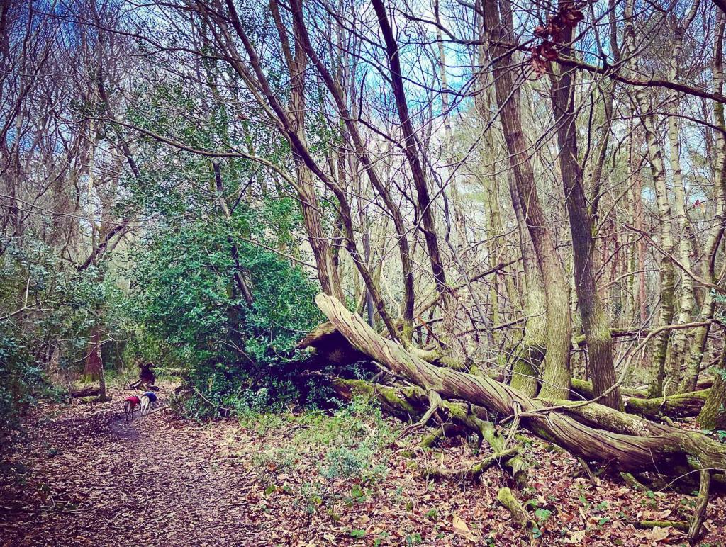
Go over the large fallen tree (there is a gap in the trunk) and continue straight.
It’s very easy to lose the path here, especially when it is wet and muddy but so long as you bear slightly to the right, you should pick it up again. Basically, follow your nose is the best advice I can give.
Look out for a signpost on the right of the path with arrows pointing ahead and behind you. There’s a path off to the left opposite it – take this little path.
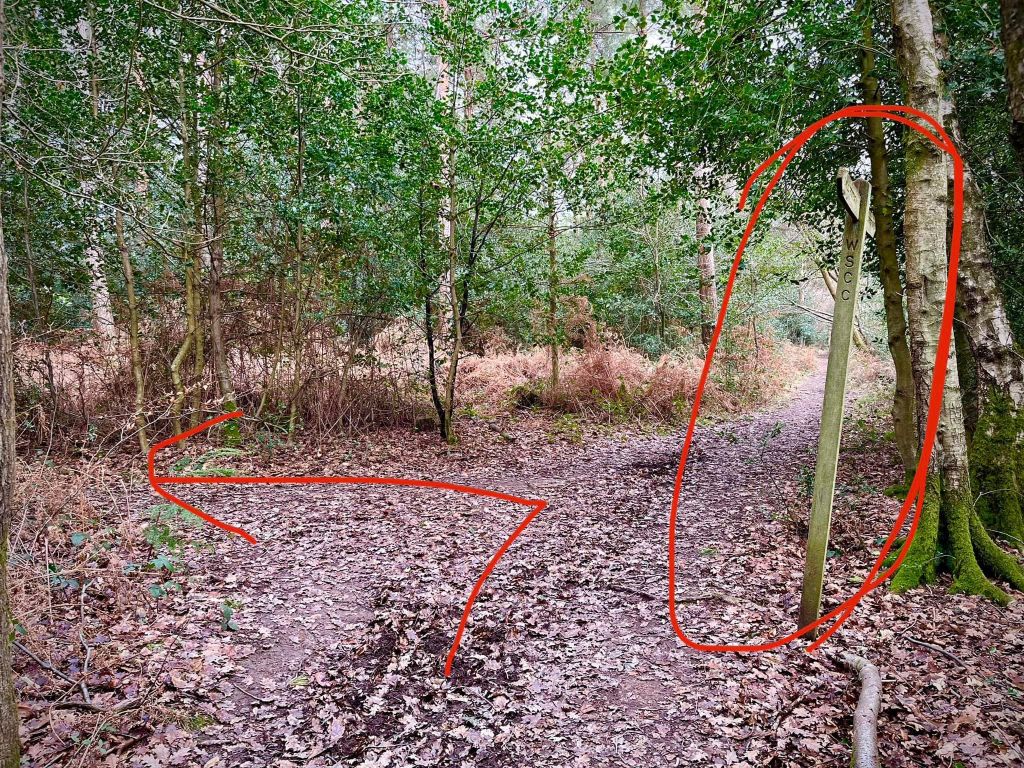
Then, at the cross paths go straight over..
Pass some amazing twisted trees that have fallen alongside the path.
You’ll come down to a cross paths with a main path, go straight over. Then at the next cross paths which you come to almost immediately, turn left.
This path widens as it bears round to the right. Ignore any paths off either side and just stay on it. It goes downhill and is lined either side by tall pines. You’ll pass a marker post (on the right) with a yellow arrow and a path joins here. Keep going ahead and shortly you should become aware of the stream running parallel on your left.
After some way, ignore a wide path that heads up and off to the right (it is opposite a marker post to the left of the path.)
Continue ahead through the lily beds and then turn left onto a very small (often muddy and can be overgrown) path just before the fence.
Cross the stream using the plank bridge and this path takes you down to the main stream – Sheepwash Gill.
Turn left at the water and go through the stream and up the hill on the other side.
Continue straight on at the cross paths, where the way to the right is blocked by a fence and a black barrier.
A bit further on, you come to a weird junction of paths – two to the right, one to the left. Continue straight here for a very short way and you’ll come to another junction, this time with a signpost to the left. Turn right here…
…and then you’ll come to a fork straight away, where you go left.
Stay on this path now down the dip at the bricky bit over the stream and up the other side to the main surfaced path from the start of the walk. Turn right and follow it back to the car park.

Leave a comment