Page contents
About
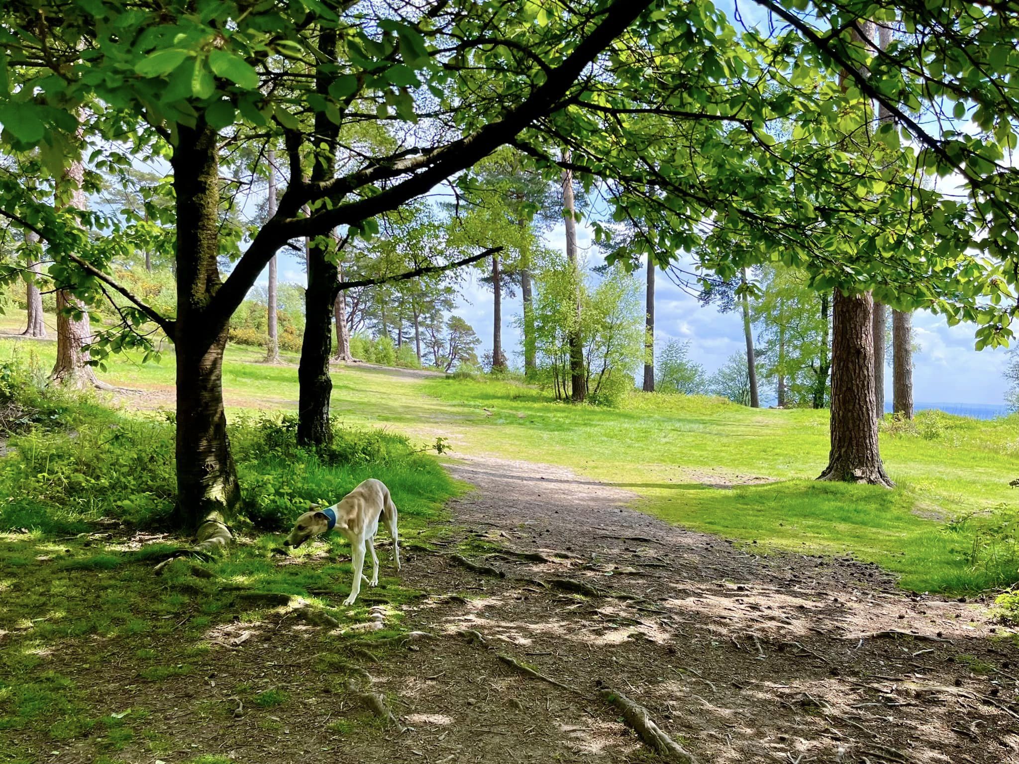
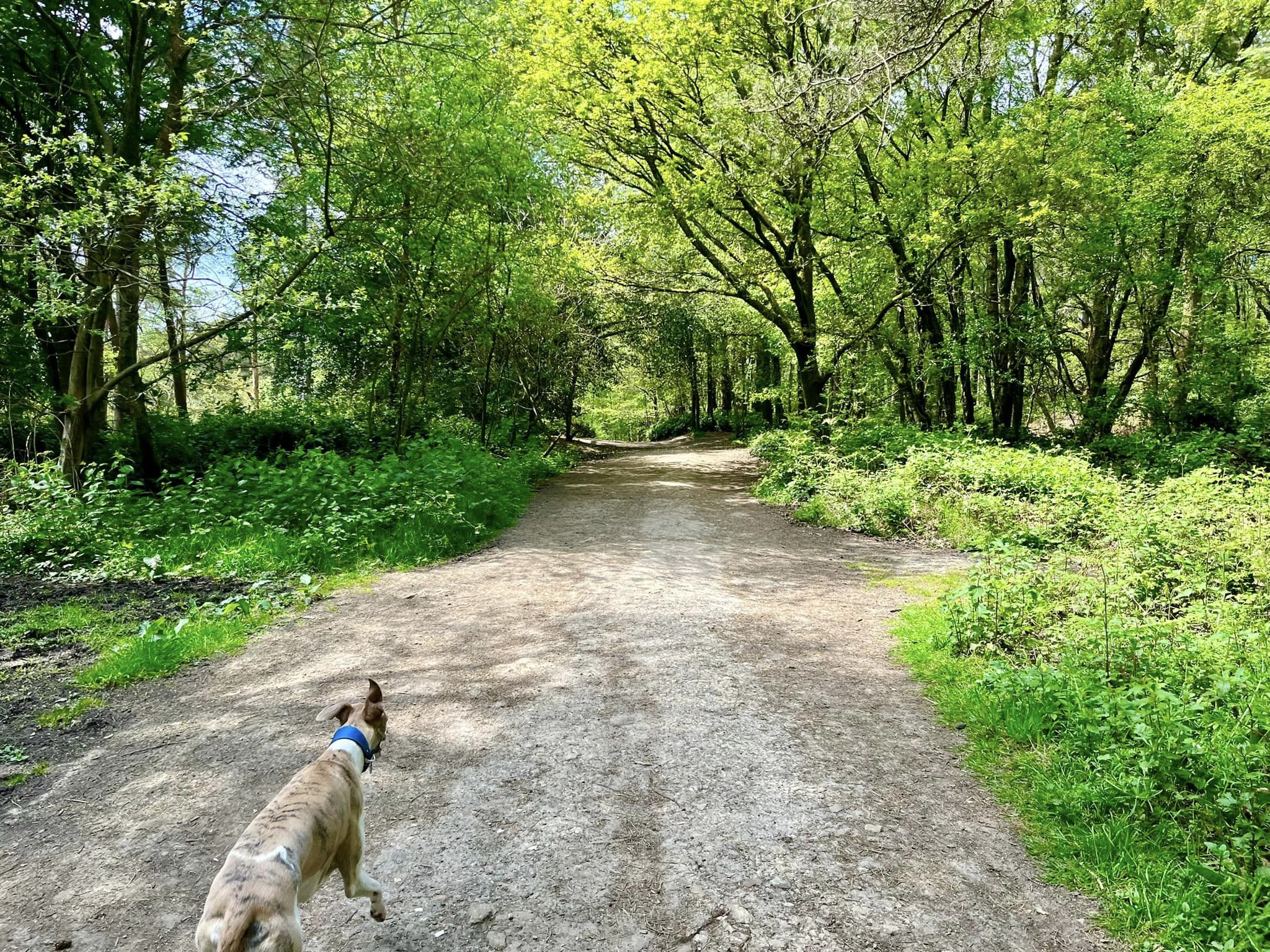
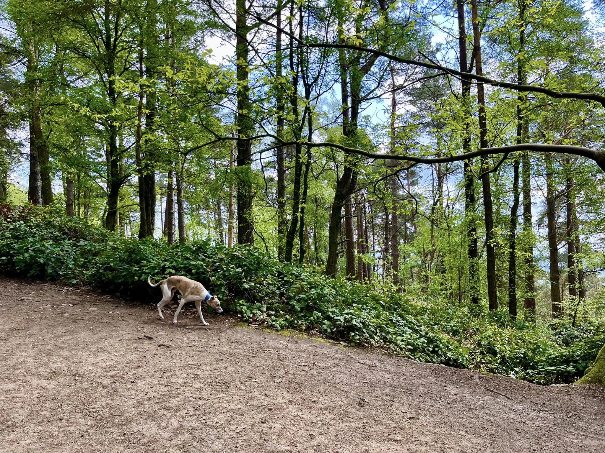
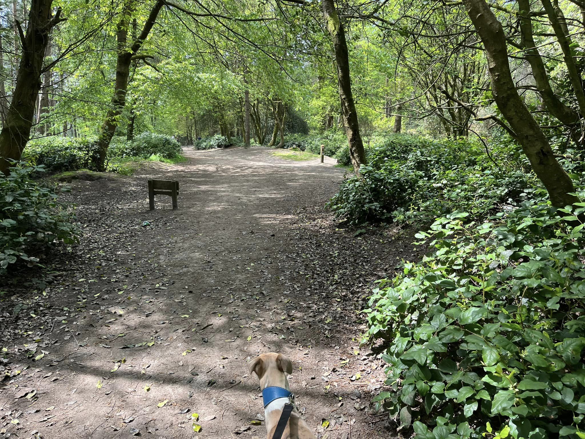
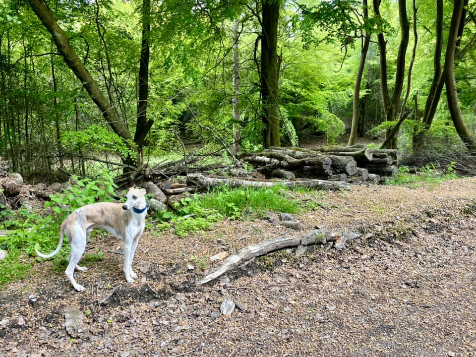
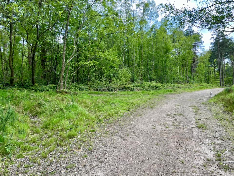
Gallery
Parking
Poo bins?
Self-guided walk
About
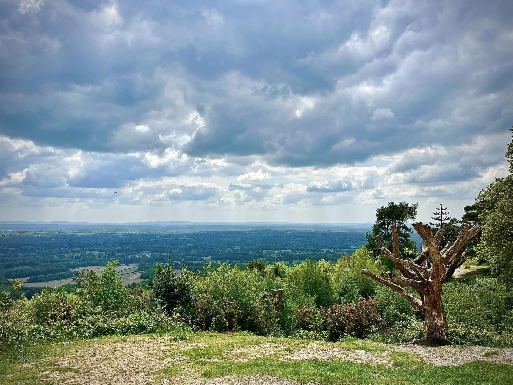
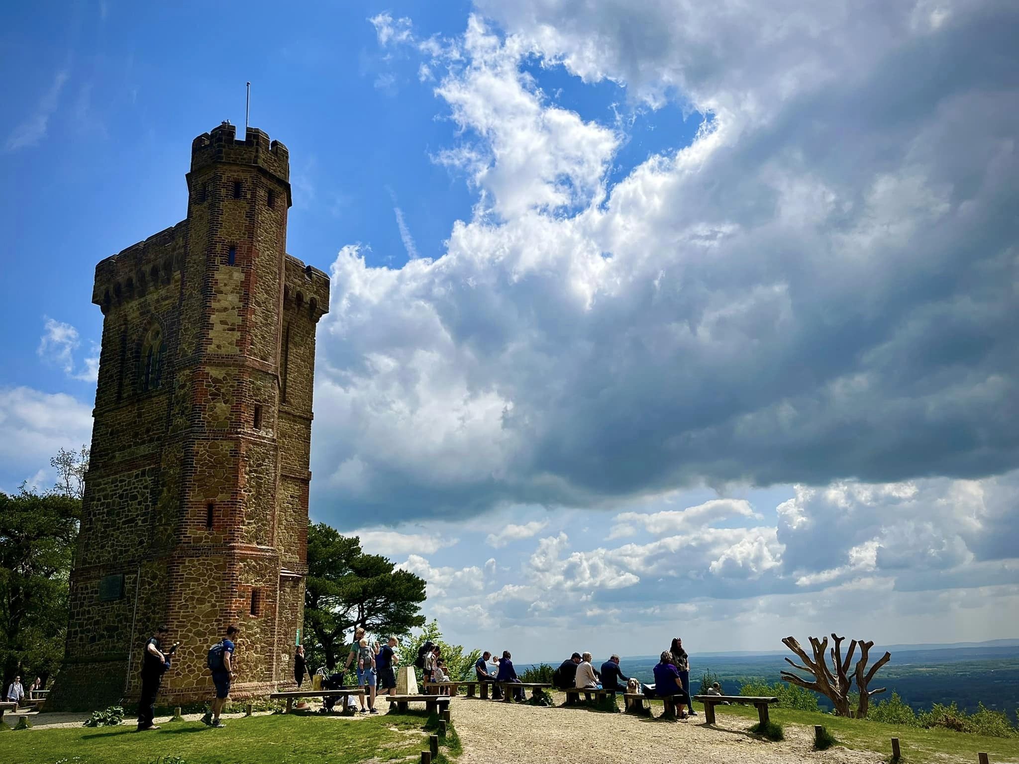
Leith Hill, about 7km south of Dorking in the Surrey Hills Area of Outstanding Natural Beauty, is the highest point along the Greensand Ridge at 294m above sea level. It is the highest point in Surrey, and, if highest points are your thing, also the second highest point in south east England (after Walbury Hill in Berkshire, which is a grand 3m higher!)
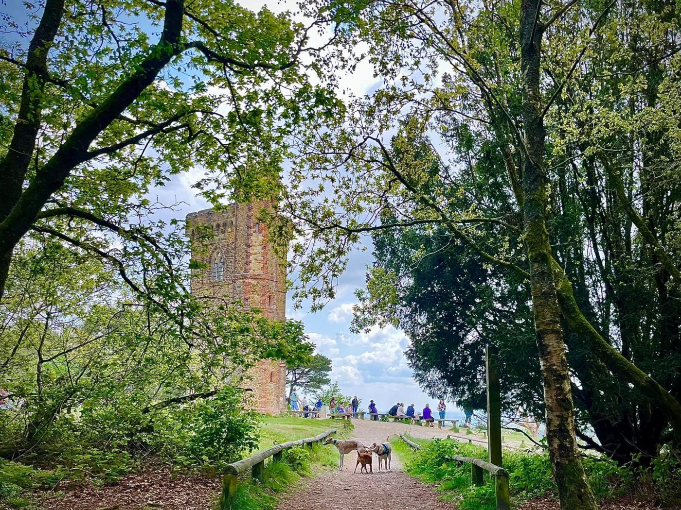
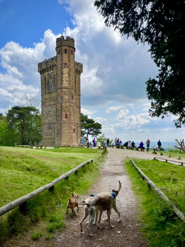
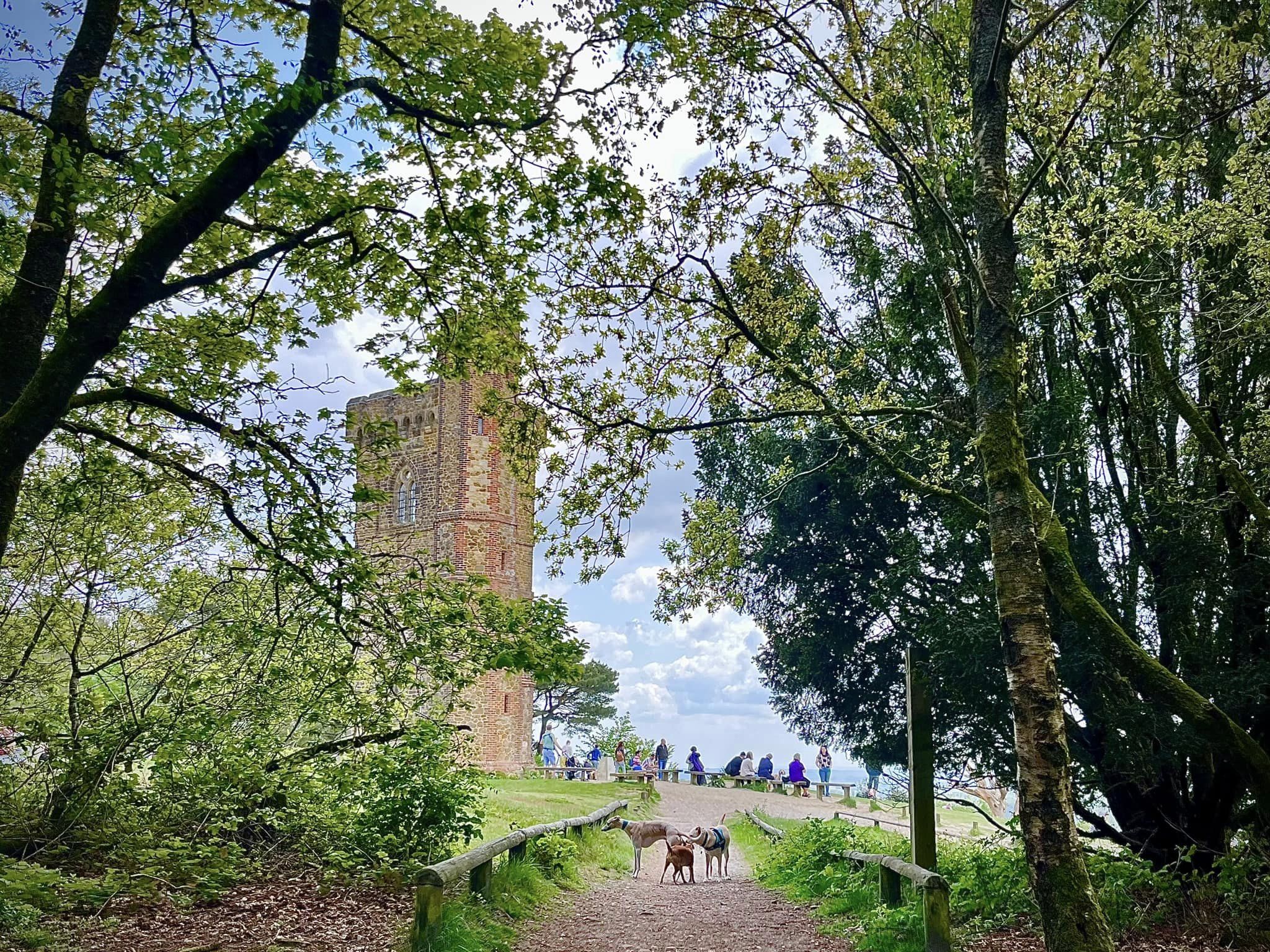
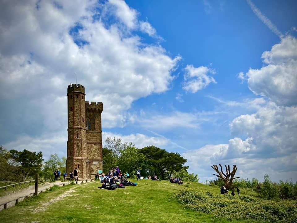
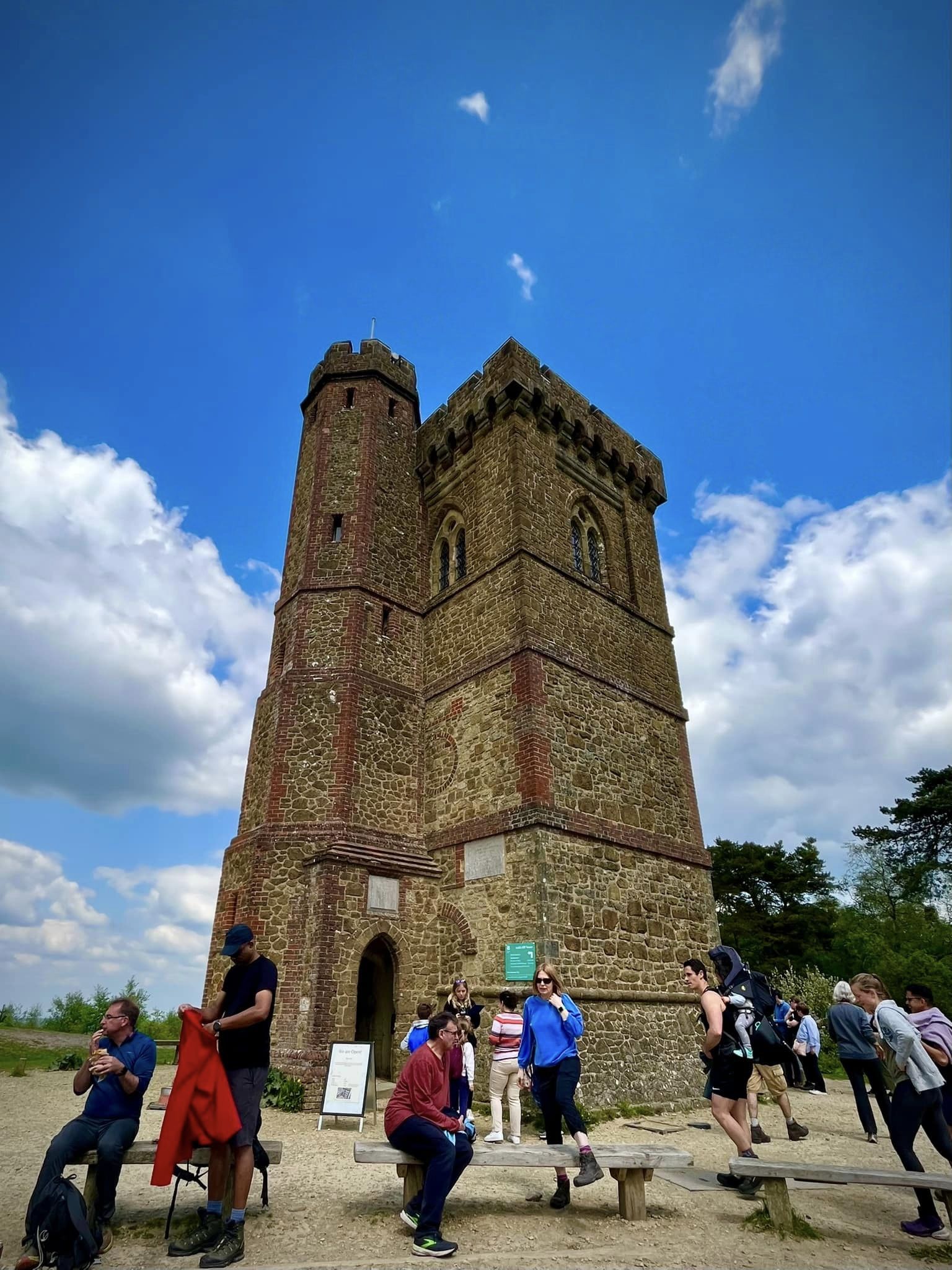
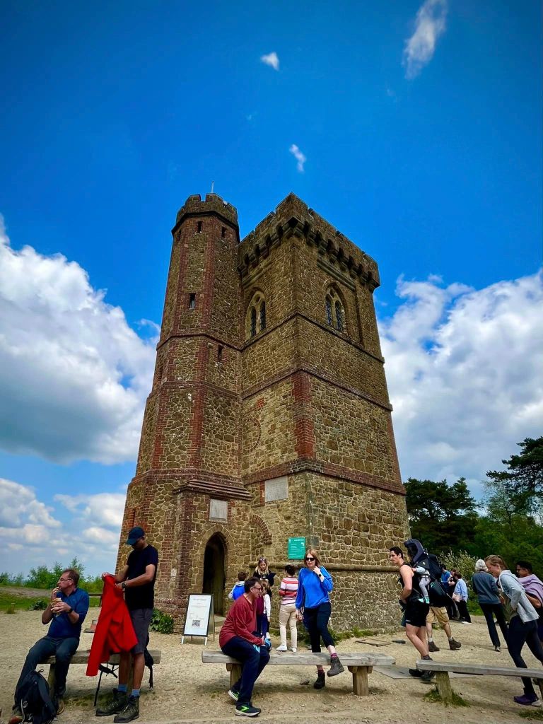
Leith Hill tower, a folly built in 1765, is on the top of the hill. This 18th-century Gothic tower was originally called Prospect Place by the guy who built it, a Richard Hull of nearby Leith Hill Place. Why did he build it? Well, it seems high points were a thing for him and he wanted to raise the hill to over 1,000 ft (305m) above sea level. I’m not sure a building counts as making a hill higher but perhaps I’m splitting hairs? The tower stands 19.5m (64 ft) tall and originally consisted of two rooms, which were apparently “neatly furnished”. A Latin inscription above the door announced that the tower had been built not only for Hull’s own pleasure, but for the enjoyment of others. Either a nice chap, or wanting to show off, Hull provided visitors with prospect glasses, similar to a small telescope, through which to survey the extensive views (hence the name Prospect Place.) From the tower’s battlements, you can see the English Channel in one direction and St Paul’s Cathedral in London in the other.
Hull died in 1772 and was buried under the tower, which, over time, fell into ruin.
The whole area was owned by the Evelyn family of Wotton House from the 17th to the early 20th centuries, and in 1864, they decided to reopen the tower. The entrance had been bricked up, however, and concrete poured into the building, which made getting in difficult so the additional turreted side-tower was added to allow access to the top of the original tower.
When Lt. John Evelyn died in 1922, Leith Hill had to be sold to pay death duties. It was bought by Wilfred James MacAndrew, a resident of Reigate and former co-owner of the shipping company MacAndrew & Co. He donated it to the National Trust, which has cared for the area ever since and which fully restored the tower in 1984. The building is open most of the year and 78 steps up a spiral staircase take you to the top (although dogs aren’t permitted in it.)
For those who prefer their feet on the ground, there is a servery operating through a hatch at the bottom, where you can buy drinks and snacks.
Or bring your own picnic, it is a really lovely spot and, according to the National Trust website, “picnicking around Leith Hill Tower has been popular since the 19th century when Victorian day-trippers would bring large spreads to enjoy on the slopes as they took in the sunny views.”
The Gallery: What’s it like here?


Parking
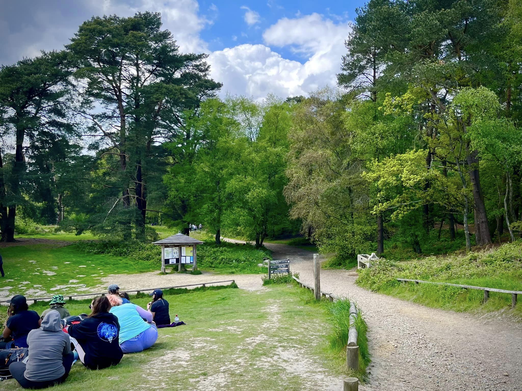
Park in the free National Trust car park at Starveall Corner.
GOOGLEMAPS LINK: https://goo.gl/maps/hgXhUnWdTUgm7DzD9
WHAT3WORDS: https://w3w.co/slate.crowd.lakes
NEAREST POSTCODE: RH5 6LX
Poo bins?
At the car park and at the tower
Self-guided walk
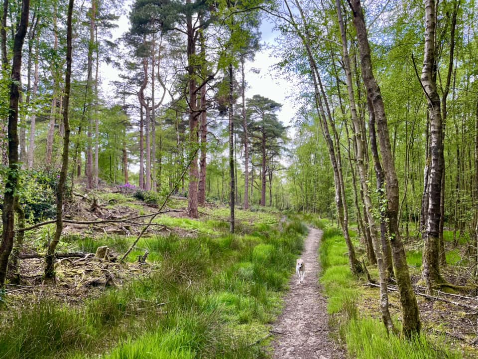
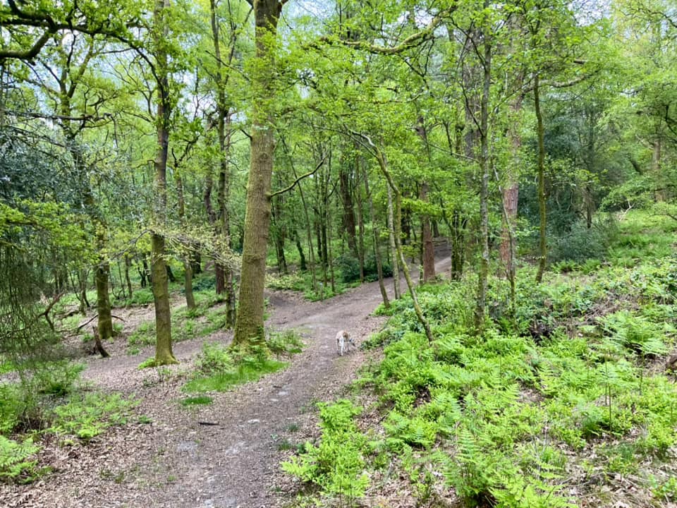
Here is a Footpath app route from Starveall Corner car park. Also on AllTrails. Leith Hill, unsurprisingly, is a hill so you can expect slopes, but this walk isn’t as hilly or steep as the ones recommended by the National Trust (see the NT Leith Hill leaflet with trails on it here). The route goes through Wotton Common and up a long, steady but not awful incline to the tower, then back along the well-trodden main path between the tower and the car park.
Length: approximately 2.3 miles/3.9 km
Terrain: Mix of mud, grass and surface paths. Some stretches of the first part of the walk can be muddy during the wetter months of the year.
Stiles/kissing gates? No stiles, no kissing gates
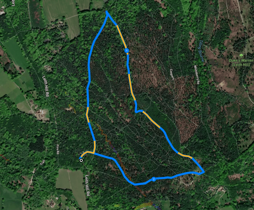
Park in the large car park at Starveall Corner. Despite being a really big space, this car park does get really busy but there are lots of nooks and crannies to shove the car in – just take it easy as it’s really uneven.
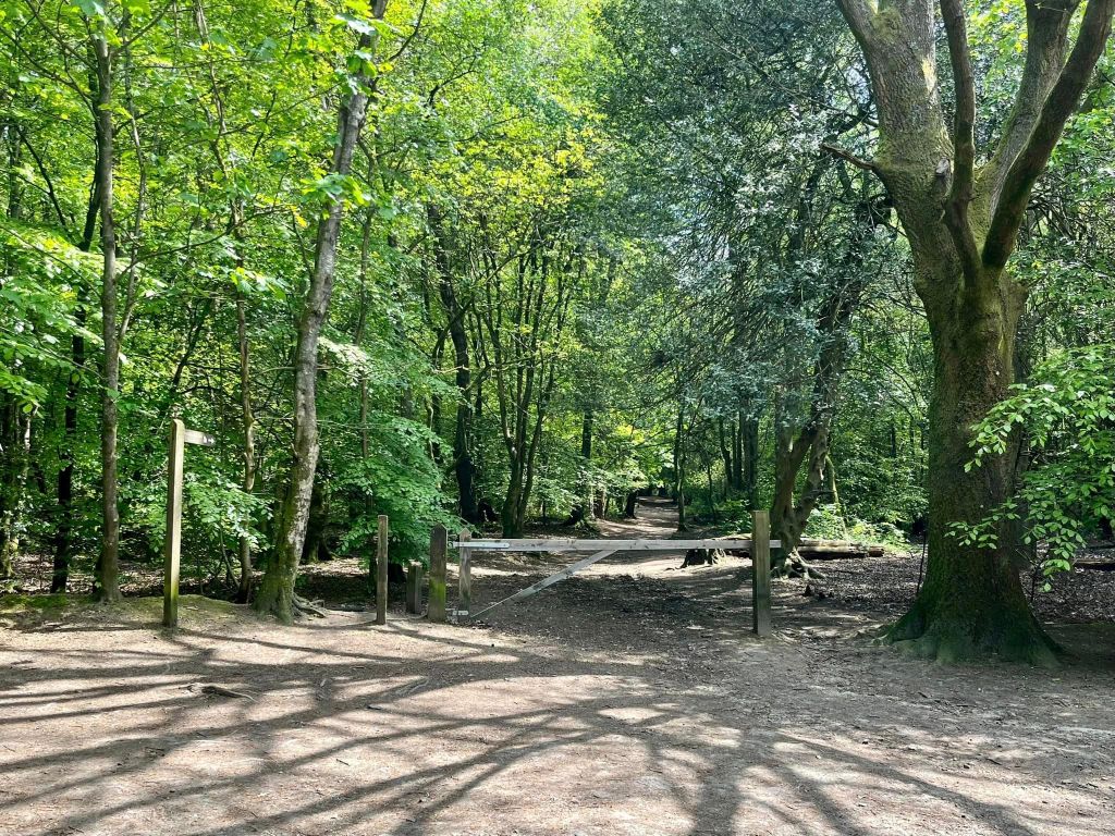
At the back of the car park (with the entrance from the road immediately behind you), pass the vehicle barrier and finger post directing to the tower.
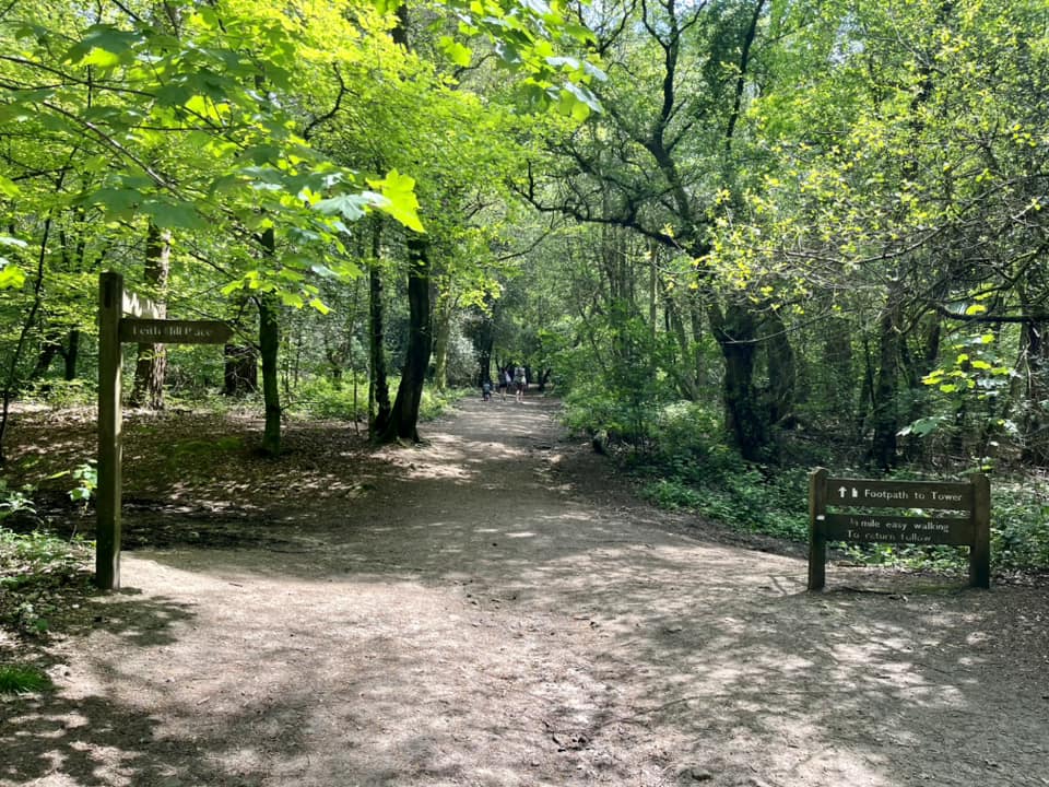
After a few steps, you’ll come to a junction of paths. To the right there is a squat sign saying it’s 3/4 mile of easy walking to the tower ahead. There is also a finger post pointing to the right for Leith Hill Place. Ignore these and turn left.
Almost immediately, you’ll come to a fork, where you take the path on the left.
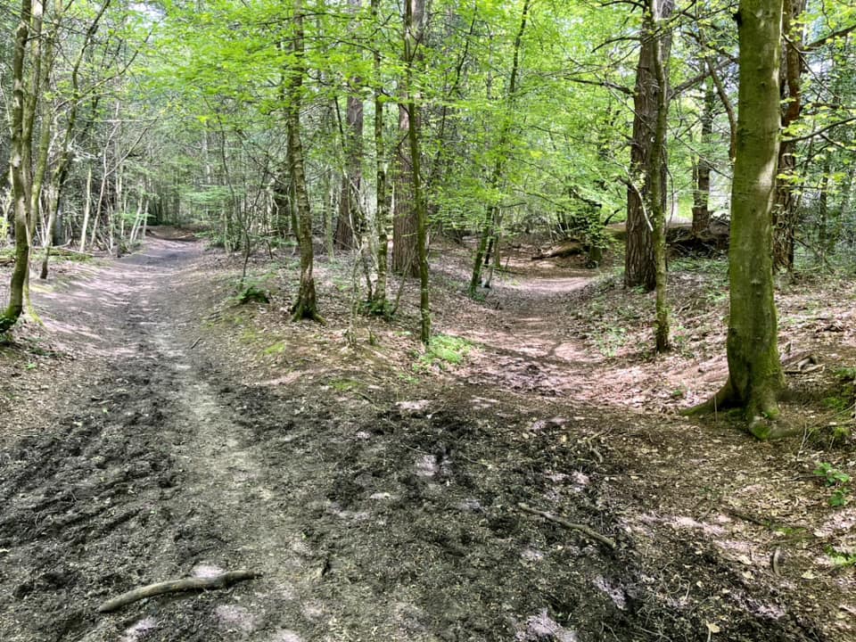
Stay on this path until you get to a cross paths with a marker post and arrows on it, and go straight across here.
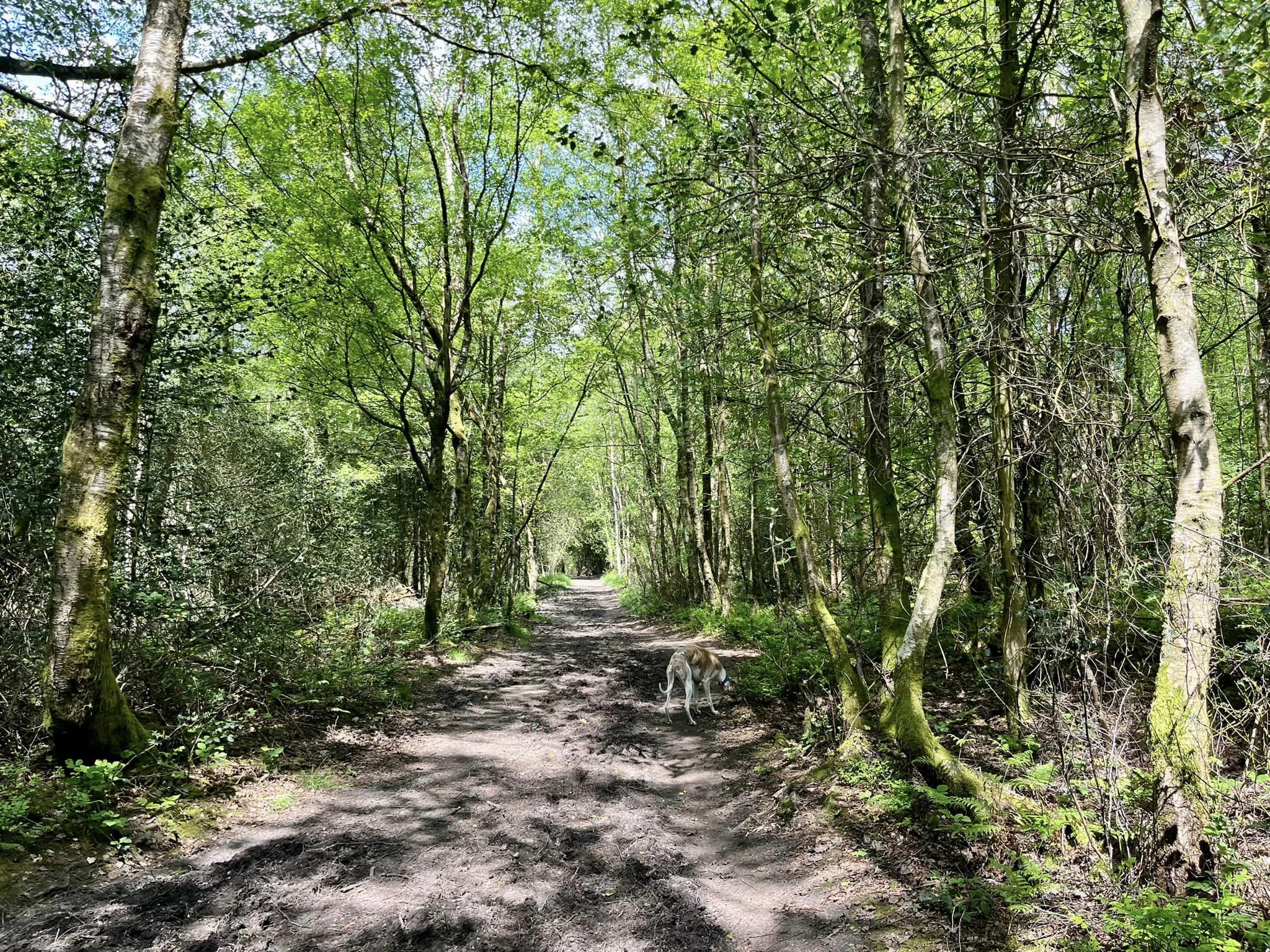
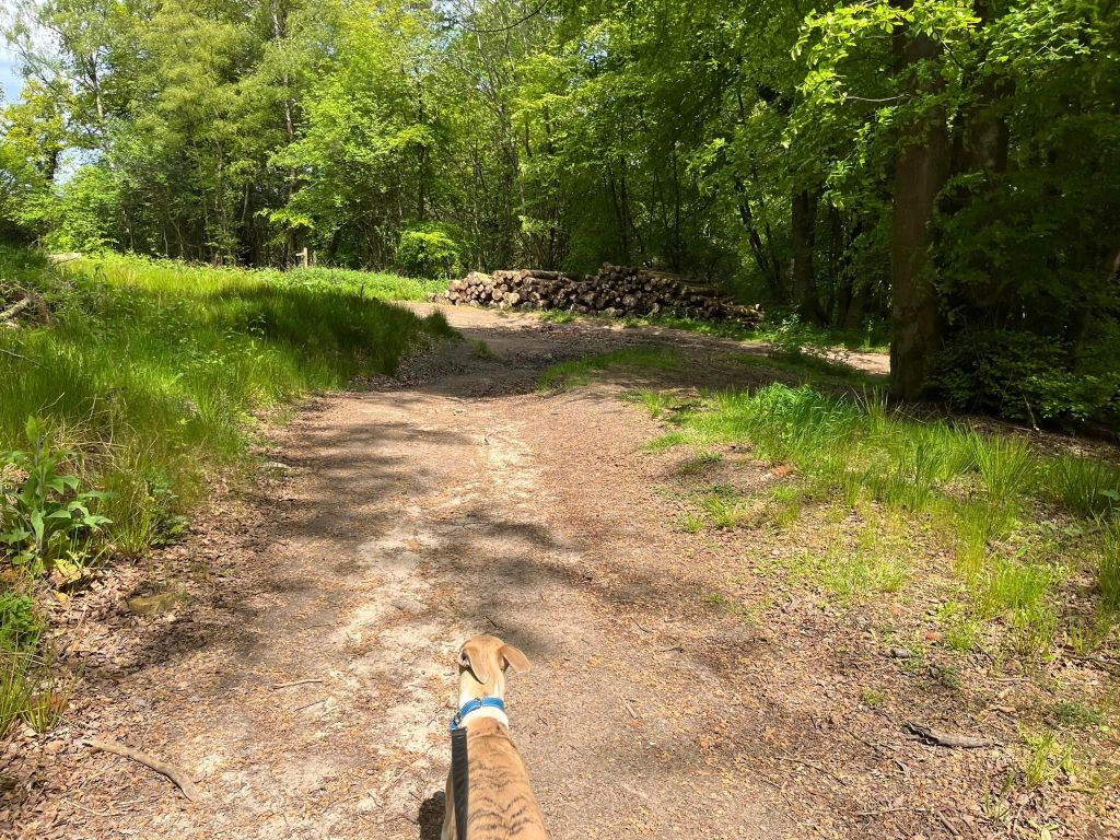
This path is flat for a bit and then goes downhill. At the T junction where there are logs stacked up, turn right.

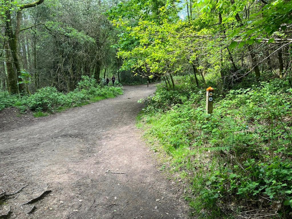
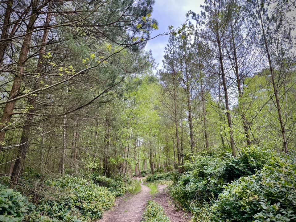
You’re on this wide, roughly surfaced path for a really long stretch (almost a mile.) It goes steadily upslope but isn’t going to wind anyone. Stay on this path, which I freely admit it isn’t the most interesting one ever, but it’s actually a pretty quiet one as far as paths in this popular area go, so enjoy the peace. As you go, ignore a path off diagonally left, then one off to the right, and then another off to the left.
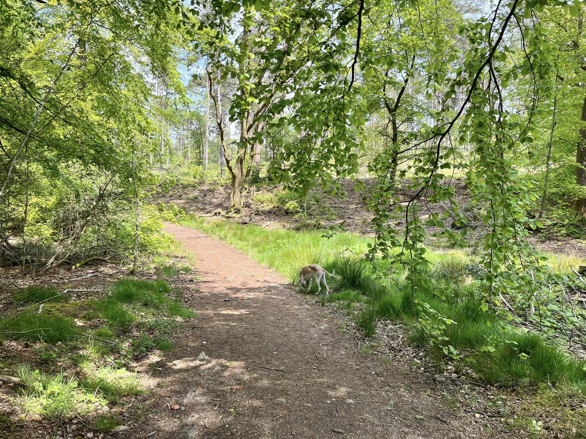
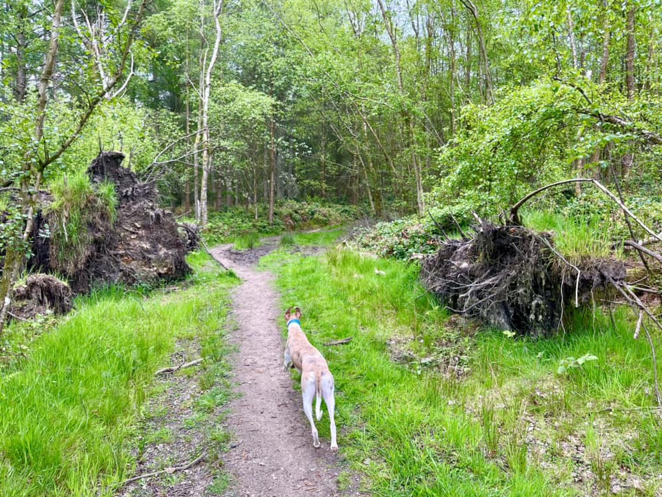
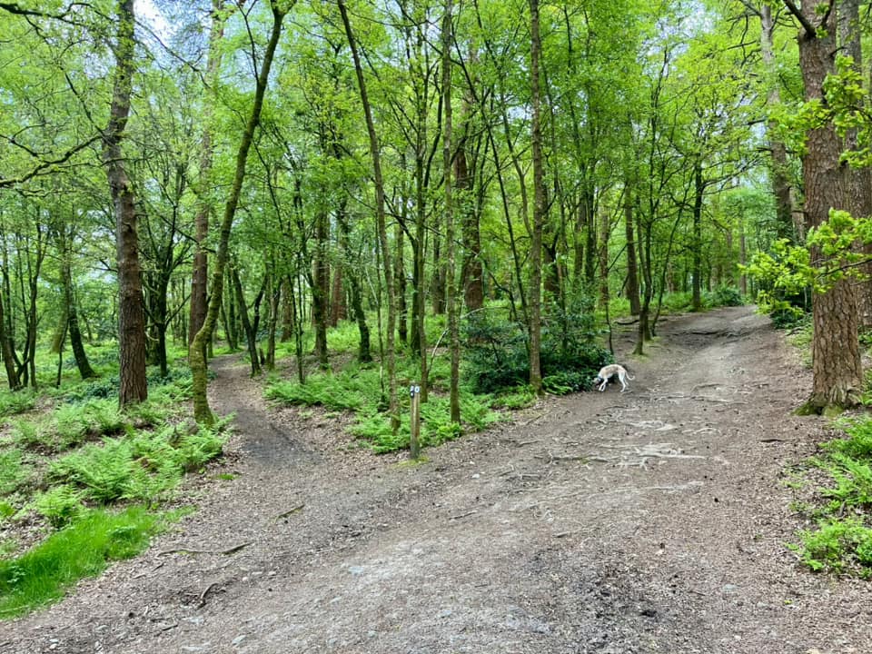
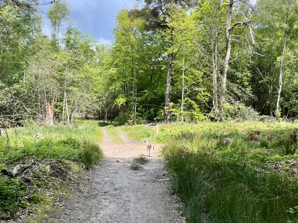
As you reach the brow of the slope, you’ll come to a junction where there is an overgrown triangle of grass. Turn left here off the gravel and walk between two fallen trees.

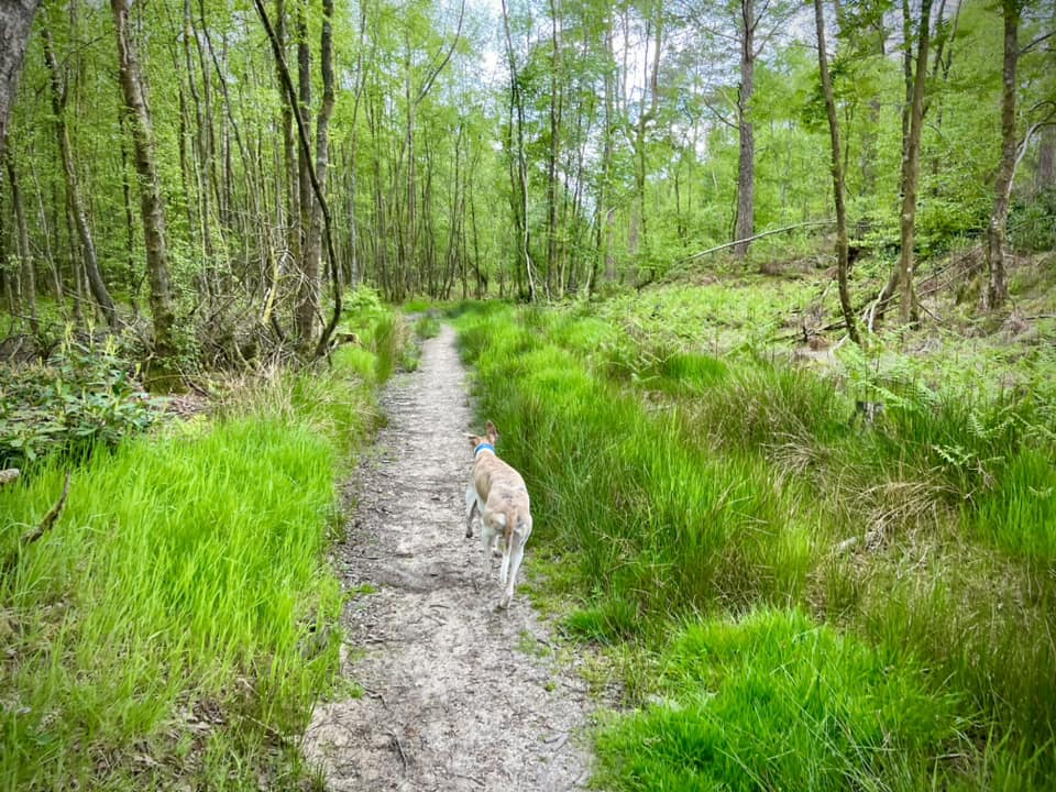
After a short way, there are mounds covered in rhododendrons on your right. You can’t tell but these cover ancient earthworks. Anyway this more sheltered, grassy path makes for a nice contrast to the wide paths you’ve been walking along until now. Ignore any little paths off this “main” one – they are actually tracks made by/for mountain bikers, who plague the Surrey Hills and are almost as prolific as their locust-like cousins, the road cyclists.
Eventually the path comes down a slight slope to a junction of many paths where there’s a marker post with a double arrow. Turn right and head up the sharp slope – follow this path all the way up to the tower.

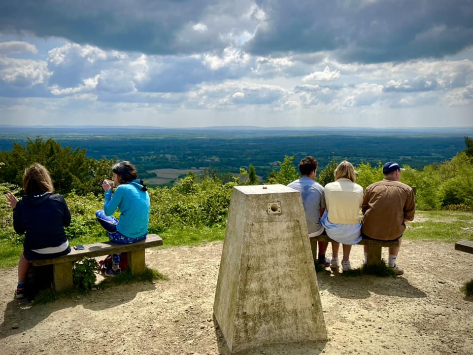
At the tower, enjoy the views, have a sit down, get your breath back, perhaps indulge in a cup of tea or a cold drink at the kiosk/hatch at the base of the building.


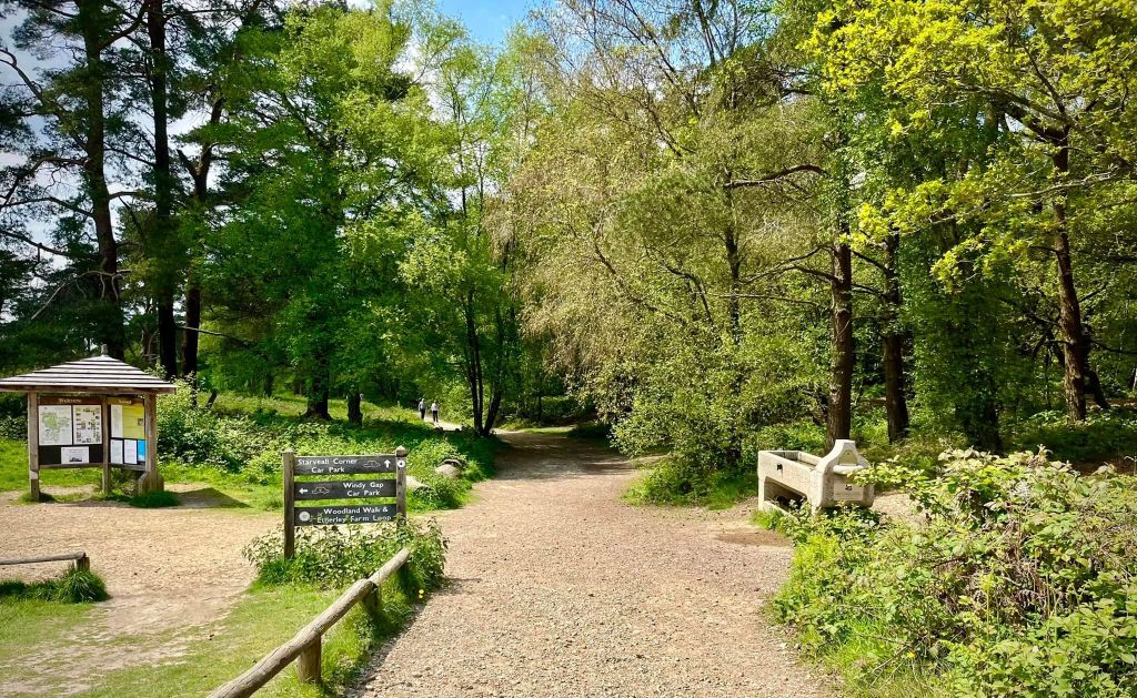
When you’re done, face the view and turn right to take the path away from the tower that heads towards an information point with a roof and, on the opposite side of the path, a large stone water trough. You’ll also pass a sign for Starveall Corner car park.

After a little way, the path splits in two and while it doesn’t matter which side you take, the one on the left has tree roots growing across it so the one on the right is a smoother path. This makes for easier walking but you’re also more likely to experience mountain bikers hurtling down it so choose with care!
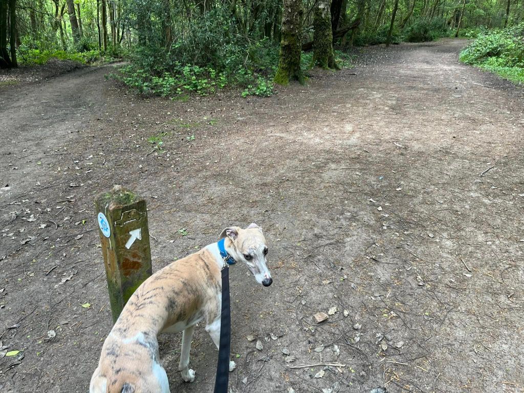
Pass a small orange topped marker post. The path splits again. Take the right hand side this time – and this time it matters for the onward directions!
Pass another orange topped marker and continue towards another marker post you can see ahead. This marker doesn’t have an orange top but it does have a car carved onto it. Of the two paths at this post, take the one on the right and follow this path back to the car park, passing a couple more small markers with cars on the way.