Bushy Park

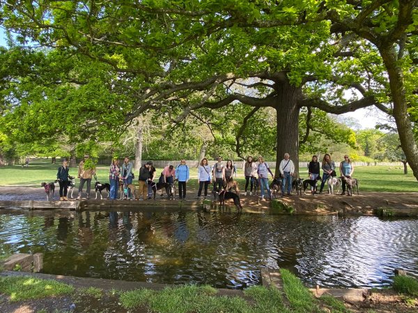
The second largest of London's royal parks (behind Richmond Park), Bushy Park covers approximately 445 hectares. It was one of Henry VIII's favourite hunting grounds and wild herds of red and fallow deer still roam. The park features the Longford River canal, the Diana Fountain, Chestnut Avenue and many ponds.

Epsom Common

The recorded history of Epsom Common, Surrey's largest local nature reserve, goes back to Saxon times, when England was a feudal agricultural society and local people grazed animals on the land. Over the last century, the landscape has changed dramatically due to changing lifestyles and it's now predominantly woodland.

Abinger Roughs

Abinger Roughs, above the village of Abinger Hammer, is a parcel of land that dates to ancient times and Domesday book records state it was woodland and pasture. Today, it comprises grassland and mixed woodland, and is home to several veteran trees, with some of the oaks being over 300 years old.

Lightwater Country Park

Lightwater Country Park is a four times Green Flag accredited park of 59 hectares on the outskirts of Lightwater village next to junction 3 of the M3. It is predominantly heathland habitat, but there are also ponds, woodland, meadows and areas of scrub.

Tilgate Park

Just off the M23 on the southern outskirts of Crawley in West Sussex, Green Flag award winning Tilgate Park boasts stunning lakes, lawns and gardens, and miles of woodland and bridleways for long leisurely walks.

Richmond Park

Richmond Park is the largest of London's eight royal parks. Covering 2,500 acres, it's also the capital's largest Site of Special Scientific Interest and a designated nature reserve that boasts ancient woods, rolling hills and open grasslands.

Horsell Common and Heather Farm wetlands

Horsell Common boasts a wide array of landscapes, including heathland, woodland and meadows. Heather Farm comprises the Mimbridge and Bourne meadows area and a (dog-free) wetlands. It has a large car park and there is a cafe serving food and drinks.

Loxwood – Wey-Arun Canal (westbound)

Known as “London’s lost route to the sea”, the Wey and Arun Canal is a partially open, 18.5 mile (30km) canal running southwards from the River Wey at Shalford in Surrey to the River Arun at Pallingham in West Sussex. This walk takes you west from the canal centre by the Onslow Arms in Loxwood, through the countryside and back along the canal.

Website Powered by WordPress.com.

Up ↑